Bowen is a coastal town and locality in the Whitsunday Region, Queensland, Australia. In the 2016 census, the locality of Bowen had a population of 10,377 people.

Airlie Beach is a coastal locality and resort town in the Whitsunday Region of Queensland, Australia. In the 2016 census, Airlie Beach had a population of 1,208 people.

Shute Harbour is a coastal locality and harbour in the Whitsunday Region of Queensland, Australia. It has port facilities and transport options for people seeking to access the Whitsunday Islands and holiday destinations.

Proserpine is a rural town and locality in the Whitsunday Region, Queensland, Australia. In the 2021 census, the locality of Proserpine had a population of 3,614 people.

The Whitsunday Region is a local government area located in North Queensland, Australia. Established in 2008, it was preceded by two previous local government areas with a history extending back to the establishment of regional local government in Queensland in 1879.

Aviation State High School,(referred to colloquially as 'Aviation High', or Aviation High School') previously Hendra Secondary College, is an independent public high school, situated on Widdop Street, Hendra, Queensland Australia 4011. Aviation State High School is a 'co-ed' school providing education for years 7 to 12. The Principal is David Munn.

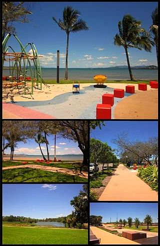
Cannonvale is a coastal locality and town in the Whitsunday Region, Queensland, Australia. In the 2016 census Cannonvale had a population of 5,716 people.

Block A of the Rockhampton Technical College is a heritage-listed technical college building at Bolsover Street, Rockhampton City, Rockhampton, Rockhampton Region, Queensland, Australia. It was designed by Thomas Pye and built in 1914. It is also known as Rockhampton College of T.A.F.E. and Rockhampton State High School and Technical College. It was added to the Queensland Heritage Register on 21 October 1992.
Dittmer is a rural town and locality in the Whitsunday Region, Queensland, Australia. In the 2016 census, the locality of Dittmer had a population of 79 people.
Conway is a locality in the Whitsunday Region, Queensland, Australia. In the 2021 census, Conway had a population of 202 people.
Ascot State School is a heritage-listed state school at Pringle Street, Ascot, City of Brisbane, Queensland, Australia. It was designed by Department of Public Works (Queensland) and built from 1919 to 1939. It was added to the Queensland Heritage Register on 7 April 2017.

Toowoomba East State School is a heritage-listed state school on the corner of Arthur and Mary Streets, East Toowoomba, Toowoomba Region, Queensland, Australia. It was built from 1935 to 1936 by the Queensland Department of Public Works. It was originally known as Queen's Park State School. It was added to the Queensland Heritage Register on 28 July 2017.

Dalby State High School is a heritage-listed state high school at 28B Nicholson Street, Dalby, Western Downs Region, Queensland, Australia. It was built from 1953 to 1954. It was added to the Queensland Heritage Register on 19 August 2016.

Bundaberg State High School is a heritage-listed state high school and technical college at 37 Maryborough Street, Bundaberg South, Bundaberg, Bundaberg Region, Queensland, Australia. It was built from 1920 to 1956. It was added to the Queensland Heritage Register on 22 June 2017.
Mandalay is a coastal locality in the Whitsunday Region, Queensland, Australia. In the 2021 census, Mandalay had a population of 338 people.
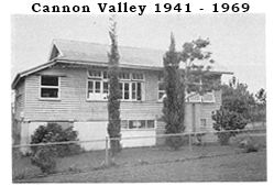
Cannon Valley is a semi-rural locality in the Whitsunday Region, Queensland, Australia. In the 2021 census, Cannon Valley had a population of 1,131 people.

Cape Gloucester is a coastal locality in the Whitsunday Region, Queensland, Australia. In the 2021 census, Cape Gloucester had a population of 85 people.
Preston is a rural locality in the Whitsunday Region, Queensland, Australia. In the 2021 census, Preston had a population of 346 people.

City Adult Learning Centre (CALC), formerly known as Parkway Vocational School and Parkview Secondary School is an adult high school serving the Riverdale community in Toronto, Ontario, Canada, overseen by the Toronto District School Board. Prior to 1998, it was part of the Toronto Board of Education.
Proserpine–Shute Harbour Road is a continuous 34.3 kilometres (21.3 mi) road route in the Whitsunday local government area of Queensland, Australia. The route is designated as State Route 59. It is a state-controlled regional road.
