Gmina Naruszewo is a rural gmina in Płońsk County, Masovian Voivodeship, in east-central Poland. Its seat is the village of Naruszewo, which lies approximately 11 kilometres south of Płońsk and 55 km north-west of Warsaw.
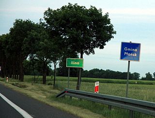
Ilino is a village in the administrative district of Gmina Płońsk, within Płońsk County, Masovian Voivodeship, in east-central Poland. It lies approximately 6 kilometres (4 mi) south-west of Płońsk and 63 km (39 mi) north-west of Warsaw.

Dzierzążnia is a village in Płońsk County, Masovian Voivodeship, in east-central Poland. It is the seat of the gmina called Gmina Dzierzążnia. It lies approximately 11 kilometres (7 mi) west of Płońsk and 70 km (43 mi) north-west of Warsaw.
Korytowo is a village in the administrative district of Gmina Dzierzążnia, within Płońsk County, Masovian Voivodeship, in east-central Poland. It lies approximately 5 kilometres (3 mi) south-west of Dzierzążnia, 13 km (8 mi) west of Płońsk, and 69 km (43 mi) north-west of Warsaw.
Kucice is a village in the administrative district of Gmina Dzierzążnia, within Płońsk County, Masovian Voivodeship, in east-central Poland. It lies approximately 8 kilometres (5 mi) south of Dzierzążnia, 13 km (8 mi) south-west of Płońsk, and 65 km (40 mi) north-west of Warsaw.
Niwa is a village in the administrative district of Gmina Dzierzążnia, within Płońsk County, Masovian Voivodeship, in east-central Poland.
Podmarszczyn is a village in the administrative district of Gmina Dzierzążnia, within Płońsk County, Masovian Voivodeship, in east-central Poland. It lies approximately 9 kilometres (6 mi) south-west of Dzierzążnia, 16 km (10 mi) south-west of Płońsk, and 68 km (42 mi) north-west of Warsaw.
Rakowo is a village in the administrative district of Gmina Dzierzążnia, within Płońsk County, Masovian Voivodeship, in east-central Poland. It lies approximately 4 kilometres (2 mi) east of Dzierzążnia, 7 km (4 mi) west of Płońsk, and 68 km (42 mi) north-west of Warsaw.

Siekluki is a village in the administrative district of Gmina Dzierzążnia, within Płońsk County, Masovian Voivodeship, in east-central Poland. It lies approximately 5 kilometres (3 mi) east of Dzierzążnia, 6 km (4 mi) west of Płońsk, and 66 km (41 mi) north-west of Warsaw.
Skołatowo is a village in the administrative district of Gmina Dzierzążnia, within Płońsk County, Masovian Voivodeship, in east-central Poland. It lies approximately 3 kilometres (2 mi) south-west of Dzierzążnia, 13 km (8 mi) west of Płońsk, and 71 km (44 mi) north-west of Warsaw.
Starczewo Wielkie is a village in the administrative district of Gmina Dzierzążnia, within Płońsk County, Masovian Voivodeship, in east-central Poland. It lies approximately 6 kilometres (4 mi) north-west of Dzierzążnia, 16 km (10 mi) west of Płońsk, and 76 km (47 mi) north-west of Warsaw.
Wierzbica Pańska is a village in the administrative district of Gmina Dzierzążnia, within Płońsk County, Masovian Voivodeship, in east-central Poland. It lies approximately 4 kilometres (2 mi) west of Dzierzążnia, 14 km (9 mi) west of Płońsk, and 72 km (45 mi) north-west of Warsaw.
Wilamowice is a village in the administrative district of Gmina Dzierzążnia, within Płońsk County, Masovian Voivodeship, in east-central Poland. It lies approximately 6 kilometres (4 mi) south-east of Dzierzążnia, 8 km (5 mi) south-west of Płońsk, and 65 km (40 mi) north-west of Warsaw.

Siedlin is a village in the administrative district of Gmina Płońsk, within Płońsk County, Masovian Voivodeship, in east-central Poland. It lies approximately 5 kilometres (3 mi) south-east of Płońsk and 59 km (37 mi) north-west of Warsaw.
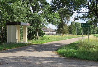
Chyczewo is a village in the administrative district of Gmina Raciąż, within Płońsk County, Masovian Voivodeship, in east-central Poland. It lies approximately 6 kilometres (4 mi) south-west of Raciąż, 24 km (15 mi) north-west of Płońsk, and 85 km (53 mi) north-west of Warsaw.
Ćwiersk is a village in the administrative district of Gmina Raciąż, within Płońsk County, Masovian Voivodeship, in east-central Poland. It lies approximately 6 kilometres (4 mi) south-east of Raciąż, 19 km (12 mi) north-west of Płońsk, and 82 km (51 mi) north-west of Warsaw.
Drozdowo is a village in the administrative district of Gmina Raciąż, within Płońsk County, Masovian Voivodeship, in east-central Poland. It lies approximately 7 kilometres (4 mi) south-east of Raciąż, 18 km (11 mi) north-west of Płońsk, and 81 km (50 mi) north-west of Warsaw.

Kaczorowy is a village in the administrative district of Gmina Raciąż, within Płońsk County, Masovian Voivodeship, in east-central Poland. It lies approximately 6 kilometres (4 mi) south-east of Raciąż, 20 km (12 mi) north-west of Płońsk, and 82 km (51 mi) north-west of Warsaw.

Kozolin is a village within the administrative district of Gmina Raciąż, in Płońsk County, Masovian Voivodeship, located in east-central Poland. It lies approximately 7 kilometres (4 mi) south-east of Raciąż, 19 km (12 mi) north-west of Płońsk, and 81 km (50 mi) north-west of Warsaw.


