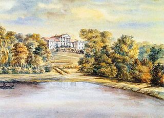
Trpín is a village and municipality in the Krupina District of the Banská Bystrica Region of Slovakia.

The Bag O'Nails was a live music club and meeting place for musicians in the 1960s and situated at 9 Kingly Street, Soho, London, England.

Mochov is a village in Central Bohemian Region of the Czech Republic. It is located 28 km northeast of Prague and 4 km southeast of Čelákovice. It has a population of 1,046 (2006).

Noordhoek is a village in the Dutch province of North Brabant. It is located in the municipality of Moerdijk, about 5 km west of Zevenbergen.
Ono Station is a train station in Ōtsu, Shiga, Japan.
Bazar Ahmed Khan is a town and union council of Bannu District in Khyber Pakhtunkhwa province of Pakistan. It is located at 32°59'6N 70°38'32E and has an altitude of 344 metres.

Biszcza is a village in Biłgoraj County, Lublin Voivodeship, in eastern Poland. It is the seat of the gmina called Gmina Biszcza. It lies approximately 17 kilometres (11 mi) south-west of Biłgoraj and 94 km (58 mi) south of the regional capital Lublin.
Czestków-Osiedle is a village in the administrative district of Gmina Buczek, within Łask County, Łódź Voivodeship, in central Poland.

Ördəkli is a village in the Zangilan Rayon of Azerbaijan.

Zadole is a settlement in the administrative district of Gmina Skomlin, within Wieluń County, Łódź Voivodeship, in central Poland. It lies approximately 4 kilometres (2 mi) south of Skomlin, 17 km (11 mi) south-west of Wieluń, and 104 km (65 mi) south-west of the regional capital Łódź.

Stromiec is a village in Białobrzegi County, Masovian Voivodeship, in east-central Poland. It is the seat of the gmina called Gmina Stromiec. It lies approximately 10 kilometres (6 mi) east of Białobrzegi and 65 km (40 mi) south of Warsaw. From 1975 to 1998 the village was in Radom Voivodeship.
Budziszewo is a village in the administrative district of Gmina Zaręby Kościelne, within Ostrów Mazowiecka County, Masovian Voivodeship, in east-central Poland.

Wiatrołom is a village in Gmina Miastko, Bytów County, Pomeranian Voivodeship, in northern Poland. It lies approximately 13 kilometres (8 mi) west of Bytów and 62 km (39 mi) south-west of Gdańsk.
Borek is a village in the administrative district of Gmina Byczyna, within Kluczbork County, Opole Voivodeship, in south-western Poland.

Likari is a village in the municipality of Srebrenica, Bosnia and Herzegovina.

Trbuk is a village in the municipality of Maglaj, Bosnia and Herzegovina.

Onuškis Manor is a former residential manor in Onuškis village, Rokiškis district. The manor was heavily damaged during World War I and currently only ruins remains.
The Mulan River or Creek is a river in Fujian, China, which drains into Xinghua Bay on the Taiwan Strait between the East and South China Seas. It is the largest river in Central Fujian.
Achlades Peninsula is the southernmost tip of the island of Ios of Cyclades. Almost just to the south, 18 km from Achlades is Cape Mavropetra, the northernmost point of the island of Santorini.
On 26 June 1990, the Provisional IRA detonated a bomb at the Carlton Club, a club in London popular among MPs and supporters of the ruling Conservative Party. The bombing injured 20 people, one of whom, Lord Kaberry of Adel, died a year later. The ground collapsed to the basement and windows were shattered. The blast was felt up to half a mile away.


