Badr is a town in Al Madinah Province, Al-Hijaz, Saudi Arabia. It is located at around 23°46′48″N38°47′26″E, and about 130 km (81 mi) from the Islamic holy city of Medina. It was the location of the famous Battle of Badr, between the Quraishi-led Polytheists, and the Muslims under the leadership of Muhammad, in 624 CE.
Ochre River is an unincorporated community recognized as a local urban district in the Canadian province of Manitoba approximately halfway between Dauphin and Ste. Rose du Lac. The community has a post office, hotel, school, community centre, and a municipality office. It lies in the similarly named Rural Municipality of Ochre River.

Nêdong District is a district of Shannan in the Tibet Autonomous Region of China.

Omszana is a village in the administrative district of Gmina Sosnówka, within Biała Podlaska County, Lublin Voivodeship, in eastern Poland. It lies approximately 8 kilometres (5 mi) east of Sosnówka, 37 km (23 mi) south-east of Biała Podlaska, and 85 km (53 mi) north-east of the regional capital Lublin.

Çıraq is a village in the Kalbajar Rayon of Azerbaijan.

Kępa Radwankowska is a village in the administrative district of Gmina Góra Kalwaria, within Piaseczno County, Masovian Voivodeship, in east-central Poland. It lies approximately 5 kilometres (3 mi) south-east of Góra Kalwaria, 22 km (14 mi) south-east of Piaseczno, and 35 km (22 mi) south-east of Warsaw.
Rosocha is a village in the administrative district of Gmina Blizanów, within Kalisz County, Greater Poland Voivodeship, in west-central Poland.

Zbiersk-Cukrownia is a village in the administrative district of Gmina Stawiszyn, within Kalisz County, Greater Poland Voivodeship, in west-central Poland. It lies approximately 5 kilometres (3 mi) north-east of Stawiszyn, 22 km (14 mi) north of Kalisz, and 98 km (61 mi) south-east of the regional capital Poznań.

Grodzisko is a village in the administrative district of Gmina Wręczyca Wielka, within Kłobuck County, Silesian Voivodeship, in southern Poland. It lies approximately 3 kilometres (2 mi) north-east of Wręczyca Wielka, 6 km (4 mi) south of Kłobuck, and 69 km (43 mi) north of the regional capital Katowice.
Pistki is a village in the administrative district of Gmina Ełk, within Ełk County, Warmian-Masurian Voivodeship, in northern Poland.

Prusinowo is a settlement in the administrative district of Gmina Gryfice, within Gryfice County, West Pomeranian Voivodeship, in north-western Poland. It lies approximately 5 kilometres (3 mi) north of Gryfice and 72 km (45 mi) north-east of the regional capital Szczecin.
El Masdour is a town and commune in the Monastir Governorate, Tunisia.
Sakiet Eddaïer is a town and commune in the Sfax Governorate, Tunisia. As of 2004 it had a population of 40,717.
Shalingzi East railway station is a station of Jingbao Railway in Hebei.

Smrdan is a village in the municipality of Leskovac, Serbia. According to the 2002 census, the village has a population of 155 people.
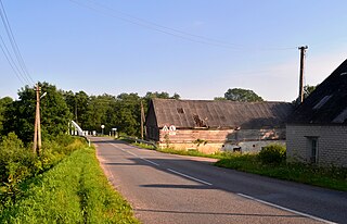
Kõrve is a village in Mustvee Parish, Jõgeva County in northeastern Estonia.

Esna is a village in Järva Parish, Järva County in northern-central Estonia.

Brejakovići is a village in the municipality of Sokolac, Bosnia and Herzegovina.
Ahmad Gharib is a village in Lahijan-e Sharqi Rural District, Lajan District, Piranshahr County, West Azerbaijan Province, Iran. At the 2006 census, its population was 88, in 10 families.

Čiobiškis Manor is a former residential manor on the confluence of Musė and Neris rivers, the southern part of Čiobiškis. Manor complex consists of manor, farm laborers and stable. Manor is currently for sale for 720 thousand litas.


