
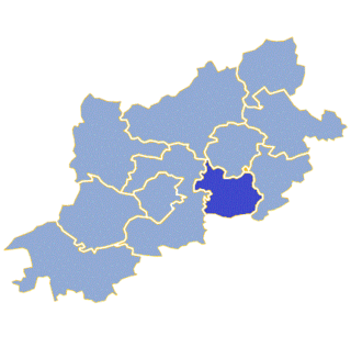
Sosnówka is a village in the administrative district of Gmina Bojadła, within Zielona Góra County, Lubusz Voivodeship, in western Poland. It lies approximately 3 kilometres (2 mi) north-east of Bojadła and 24 km (15 mi) east of Zielona Góra.
Gmina Otyń is a rural gmina in Nowa Sól County, Lubusz Voivodeship, in western Poland. Its seat is the village of Otyń, which lies approximately 6 kilometres (4 mi) north of Nowa Sól and 18 km (11 mi) south-east of Zielona Góra.

Gmina Kargowa is an urban-rural gmina in Zielona Góra County, Lubusz Voivodeship, in western Poland. Its seat is the town of Kargowa, which lies approximately 29 kilometres (18 mi) north-east of Zielona Góra.

Gmina Trzebiechów is a rural gmina in Zielona Góra County, Lubusz Voivodeship, in western Poland. Its seat is the village of Trzebiechów, which lies approximately 19 kilometres (12 mi) north-east of Zielona Góra.
Gmina Zabór is a rural gmina in Zielona Góra County, Lubusz Voivodeship, in western Poland. Its seat is the village of Zabór, which lies approximately 15 kilometres (9 mi) east of Zielona Góra.
Tarnawa Krośnieńska is a village in the administrative district of Gmina Bobrowice, within Krosno Odrzańskie County, Lubusz Voivodeship, in western Poland. It lies approximately 7 kilometres (4 mi) south-east of Bobrowice, 14 km (9 mi) south of Krosno Odrzańskie, and 25 km (16 mi) west of Zielona Góra.
Stary Staw is a village in the administrative district of Gmina Nowa Sól, within Nowa Sól County, Lubusz Voivodeship, in western Poland. It lies approximately 5 kilometres (3 mi) west of Nowa Sól and 19 km (12 mi) south-east of Zielona Góra.
Bełcze is a village in the administrative district of Gmina Bojadła, within Zielona Góra County, Lubusz Voivodeship, in western Poland. It lies approximately 4 kilometres (2 mi) north of Bojadła and 24 km (15 mi) east of Zielona Góra.
Karczemka is a village in the administrative district of Gmina Bojadła, within Zielona Góra County, Lubusz Voivodeship, in western Poland. It lies approximately 2 kilometres (1 mi) south-west of Bojadła and 21 km (13 mi) east of Zielona Góra.
Kartno is a village in the administrative district of Gmina Bojadła, within Zielona Góra County, Lubusz Voivodeship, in western Poland. It lies approximately 2 kilometres (1 mi) east of Bojadła and 23 km (14 mi) east of Zielona Góra.

Klenica is a village in the administrative district of Gmina Bojadła, within Zielona Góra County, Lubusz Voivodeship, in western Poland. It lies approximately 5 kilometres (3 mi) north-west of Bojadła and 20 km (12 mi) east of Zielona Góra.
Kliniczki is a settlement in the administrative district of Gmina Bojadła, within Zielona Góra County, Lubusz Voivodeship, in western Poland.
Młynkowo is a village in the administrative district of Gmina Bojadła, within Zielona Góra County, Lubusz Voivodeship, in western Poland. It lies approximately 7 kilometres (4 mi) south of Bojadła and 20 km (12 mi) east of Zielona Góra.
Pólko is a village in the administrative district of Gmina Bojadła, within Zielona Góra County, Lubusz Voivodeship, in western Poland. It lies approximately 4 kilometres (2 mi) north-east of Bojadła and 25 km (16 mi) east of Zielona Góra.
Przewóz is a village in the administrative district of Gmina Bojadła, within Zielona Góra County, Lubusz Voivodeship, in western Poland.
Siadcza is a village in the administrative district of Gmina Bojadła, within Zielona Góra County, Lubusz Voivodeship, in western Poland. It lies approximately 6 kilometres (4 mi) north of Bojadła and 25 km (16 mi) east of Zielona Góra.
Susłów is a village in the administrative district of Gmina Bojadła, within Zielona Góra County, Lubusz Voivodeship, in western Poland.
Wirówek is a settlement in the administrative district of Gmina Bojadła, within Zielona Góra County, Lubusz Voivodeship, in western Poland.
Urzuty is a village in the administrative district of Gmina Nowogród Bobrzański, within Zielona Góra County, Lubusz Voivodeship, in western Poland. It lies approximately 12 kilometres (7 mi) east of Nowogród Bobrzański and 18 km (11 mi) south-west of Zielona Góra.


