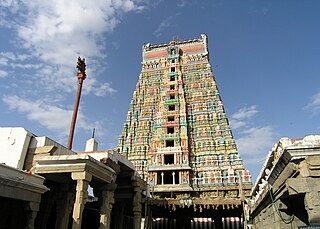
Virudhunagar District is a district of Tamil Nadu state in south India. Virudhunagar is the district headquarters of Virudhunagar district. Virudhunagar district was formed by the separation of Old Ramanathapuram District in 1987 into Ramanathapuram District, Sivagangai District and the west part as Virudhunagar District. Virudhunagar District was formerly called Karmavirer Kamarajar District. As of 2011, Virudhunagar district had a population of 1,942,288 with a sex-ratio of 1,007 females for every 1,000 males. Sivakasi is the most populous and largest city in the district.
Chettiarpatti is a panchayat town in Virudhunagar district in the state of Tamil Nadu, India.
Elayirampannai is a panchayat town in Virudhunagar district in the state of Tamil Nadu, India. The economy of the town is based on manufacturing safety matches, crackers and agriculture.
Kariapatti is a town Panchayat city in district of Virudhunagar district, Tamil Nadu. The Kariapatti Town Panchayat has population of 18,984 of which 9,439 are males while 9,545 are females as per report released by Census India 2011. The Kariapatti city is divided into 15 wards for which elections are held every 5 years.
Kilpennathur is a Panchayat Town in Tiruvanamalai district in the Indian state of Tamil Nadu. Kilpennathur is one of the taluks of Tiruvannamalai district and an assembly constituency of Tamil Nadu. The MLA of Kilpennathur assembly constituency is DMK party Mr. K. Pichandi. Vettavalam is the most populous town panchayat in this taluk. Kilpennathur is located a 12.25 degrees latitude and 79.224 degrees longitude. Nearest towns are Avalurpet, Vettavalam, Gingee and Tiruvannamalai, and Chennai is about 177 km away.
Kooraikundu is a panchayat town in Virudhunagar district in the Indian state of Tamil Nadu.
Mallankinaru is a panchayat town in Virudhunagar district in the Indian state of Tamil Nadu.
Moolakaraipatti is a Panchayat town in Tirunelveli district in the Indian state of Tamil Nadu.
Nannilam is a panchayat town in Thiruvarur District in the Indian state of Tamil Nadu. It is the headquarters town for Nannilam Taluk.
Naranapuram is a panchayat town in Virudhunagar district in the Indian state of Tamil Nadu.
Pudupatti is a panchayat village in Thanjavur district and sub-district in the Indian state of Tamil Nadu.
R. Pudupatti is a panchayat town in Rasipuram taluk in Namakkal district in the Indian state of Tamil Nadu.
Rosalpatti is a panchayat town in Virudhunagar district in the Indian state of Tamil Nadu.

Seithur is a small panchayat town in Rajapalayam taluk, Virudhunagar district in the Indian state of Tamil Nadu. It is located on the Rajapalayam to Tenkasi National Highway 744, 65 km from Courtallam, and 5km from the Sasthakovil river. There are many attractions near Seithur. The Tamil film actor Samuthirakani was born here in 1973.
Sundarapandiam is a panchayat town in Srivilliputhur Taluk- old, Virudhunagar district in the Indian state of Tamil Nadu.
Thayilpatty is a Panchayat town in Virudhunagar District in the State of Tamil Nadu in India.
Pallapatti is a panchayat town in Virudhunagar district in the Indian state of Tamil Nadu.
Sanakarlingapuram is an industrial panchayat village in Virudhunagar district in the Indian state of Tamil Nadu.
Sundampatti is a village in the Pudukkottai district in the Indain state of Tamil Nadu. It is located about 5 kilometers from Gandarvakottai.
W.Pudupatti is a panchayat town in Virudhunagar district, Tamil Nadu. It is under Srivilliputtur Assembly constituency and Tenkasi LokSabha constituency.


