Puerto Rico Highway 113

Last updated

Ellipse sign 113.svg

Highway 113

Ruta 113
Route information
Maintained by Puerto Rico DTPW
Length19.8 km [1] [2]  (12.3 mi)
Existed1953 [3] –present
Major junctions
West endPR secondary 112.svgEllipse sign 459.svg PR-112  / PR-459 in Isabela barrio-pueblo
Major intersections
East endPR secondary 119.svg PR-119 in Piedra Gorda
Location
Country United States
Territory Puerto Rico
Municipalities Isabela, Quebradillas, Camuy
Highway system
PR secondary 112.svg PR-112 PR urban primary 114.svg PR-114

Puerto Rico Highway 113 (PR-113) is a rural road that travels from Isabela, Puerto Rico to Quebradillas. It begins at downtown Isabela and ends at its intersection with PR-119 near Guajataca Lake. [4] [5]

Contents

Major intersections

MunicipalityLocationkm [1] [2] miDestinationsNotes
Isabela Isabela barrio-pueblo 0.00.0South plate county (es).svg
PR secondary 112.svg
Ellipse sign 459.svg PR-112 south (Avenida Sargento Agustín Ramos Calero) / PR-459 (Avenida Lamela) Aguadilla
Western terminus of PR-113; PR-459 access via Calle Juan González
0.1–
0.2
0.062–
0.12
To plate (es).svg
Ellipse sign 466.svg
To PR-466 (Calle Emilio González) Bajura
0.90.56West plate county (es).svg
PR secondary 4472.svg
PR-4472 west (Carretera Víctor Manuelle) Isabela
1.10.68Ellipse sign 473.svg PR-473 (Calle Trinitaria) Isabela
GuayabosMora
Coto tripoint
2.21.4Ellipse sign 474.svg PR-474  Isabela
GuayabosCoto line4.32.7Ellipse sign 446.svg PR-446  Isabela
Coto 7.3
105.1 [lower-alpha 1]
4.5
65.3
West plate blue (es).svg
PR primary 2.svg
PR-2 west Aguadilla, Mayagüez
Western terminus of PR-2 concurrency; right turn only
Río Guajataca 104.4 [lower-alpha 1] 64.9Puente Elvira [6]
Quebradillas Terranova 103.6 [lower-alpha 1]
7.4
64.4
4.6
East plate blue (es).svg
PR primary 2.svg
PR-2 east Arecibo, San Juan
Eastern terminus of PR-2 concurrency; right turn only
Quebradillas barrio-pueblo 10.3–
10.4
6.4–
6.5
Ellipse sign 485.svg PR-485 (Calle Félix Lameda) San José One-way street; eastbound access via Calle Ramón Saavedra
10.56.5Ellipse sign 479.svg PR-479 (Calle Socorro) Quebradillas One-way street
Quebradillas barrio-puebloTerranova
Cacao tripoint
11.3–
11.4
7.0–
7.1
Ellipse sign 477.svg PR-477  Cacao
CacaoSan Antonio line13.98.6Ellipse sign 478.svgEllipse sign 480.svg PR-478  / PR-480  San Antonio, Cacao
San Antonio 16.09.9Ellipse sign 437.svg PR-437  Charcas
17.911.1Ellipse sign 478.svg PR-478  San Antonio
Camuy Piedra Gorda 19.812.3PR secondary 119.svg PR-119  Camuy, San Sebastián Eastern terminus of PR-113
1.000 mi = 1.609 km; 1.000 km = 0.621 mi
  1. 1 2 3 Kilometer markers represent the distance along PR-2 rather than PR-113.

See also


Related Research Articles

<span class="mw-page-title-main">Puerto Rico Highway 31</span> Highway in Puerto Rico

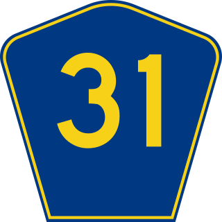
Puerto Rico Highway 31 (PR-31) is a main, rural highway connecting Juncos at Puerto Rico Highway 198 to Naguabo at Puerto Rico Highway 3.

<span class="mw-page-title-main">Puerto Rico Highway 344</span> Highway in Puerto Rico

Puerto Rico Highway 344 (PR-344) is a rural road in Hormigueros, Puerto Rico, beginning from near the municipality's small downtown and ending at PR-348 near the border with San Germán in barrio Rosario. It has narrow lanes, and after about five kilometers becomes one of the most dangerous highways in Puerto Rico, as it goes near a precipice with little or no safety barriers. It serves as a route to Mayagüez via PR-348 which ends in Puerto Rico Alt Route 2.

<span class="mw-page-title-main">Puerto Rico Highway 149</span> Highway in Puerto Rico

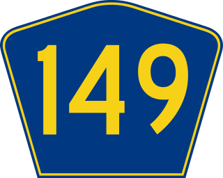
Puerto Rico Highway 149 (PR-149) is a secondary highway in Puerto Rico that connects the towns of Manatí in the north coast of Puerto Rico, from PR-22 to Juana Díaz in the south coast, ending at PR-1.

<span class="mw-page-title-main">Puerto Rico Highway 189</span> Highway in Puerto Rico

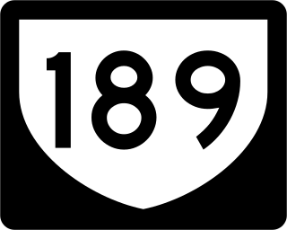
Puerto Rico Highway 189 (PR-189) is a 15 kilometres (9 mi) long main highway which parallels very closely the first half of Puerto Rico Highway 30 from Caguas, Puerto Rico near downtown to Juncos, Puerto Rico passing through all three business centers of Caguas, Gurabo and Juncos. It ends at Puerto Rico Highway 31, and has no direct intersection with Puerto Rico Highway 198 although they are not separated by more than half a kilometer.

<span class="mw-page-title-main">Puerto Rico Highway 198</span> Highway in Puerto Rico

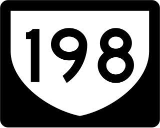
Puerto Rico Highway 198 (PR-198) is a 15-kilometre-long (9 mi) highway that parallels Puerto Rico Highway 30 from Juncos, Puerto Rico, to Humacao, Puerto Rico, where it ends at Puerto Rico Highway 3. Like Puerto Rico Highway 189, it passes through the business centers of Juncos, Las Piedras and Humacao.

<span class="mw-page-title-main">Puerto Rico Highway 119</span> Highway in Puerto Rico

Puerto Rico Highway 119 (PR-119) is a long north-to-south highway in Puerto Rico that goes from Puerto Rico Highway 2 in Hatillo, close to its border with Camuy to the same highway in San Germán. It goes through the municipalities of Camuy, San Sebastián, Las Marías and Maricao before ending in the freeway segment of PR-2. Between Camuy and San Sebastián it passes near Guajataca Lake, the largest artificial lake in western Puerto Rico.

<span class="mw-page-title-main">Puerto Rico Highway 114</span> Highway in Puerto Rico

Puerto Rico Highway 114 (PR-114) is a rural road that travels from Mayagüez to San Germán. PR-114 begins at the intersection of PR-2 and Avenida los Corazones in Mayagüez and ends at the intersection with PR-102 at the entrance to the center of San Germán. This road passes through the municipalities of Hormigueros and Cabo Rojo before coming to San Germán.

<span class="mw-page-title-main">Puerto Rico Highway 124</span> Highway in Puerto Rico

Puerto Rico Highway 124 (PR-124) is a rural road that connects from Lares to Las Marías.

<span class="mw-page-title-main">Puerto Rico Highway 154</span> Highway in Puerto Rico

Puerto Rico Highway 154 (PR-154) is a rural road in the municipality of Coamo, Puerto Rico. It is between the PR-153 and PR-543 near Salinas and Santa Isabel.

<span class="mw-page-title-main">Puerto Rico Highway 105</span> Highway in Puerto Rico

Puerto Rico Highway 105 (PR-105) is a road that travels from Mayagüez, Puerto Rico to Maricao. It begins at its intersection with PR-239 in downtown Mayagüez and ends at its junction with PR-128 in eastern Maricao, close to Yauco municipal limit.

<span class="mw-page-title-main">Puerto Rico Highway 155</span> Highway in Puerto Rico

Puerto Rico Highway 155 (PR-155) is a rural road that goes from Coamo, Puerto Rico to Vega Baja through Orocovis and Morovis. It extends from PR-14 in downtown Coamo to PR-2 east of downtown Vega Baja.

<span class="mw-page-title-main">Puerto Rico Highway 110</span> Highway in Puerto Rico

Puerto Rico Highway 110 (PR-110) is a road that goes from Añasco, Puerto Rico to Aguadilla through Moca. It extends from Puerto Rico Highway 2 north of Añasco to Ramey Air Force Base.

<span class="mw-page-title-main">Puerto Rico Highway 176</span> Highway in Puerto Rico

Puerto Rico Highway 176 (PR-176) is a main road in Cupey. It begins at its intersection with PR-175 near Carraízo Lake in Trujillo Alto and ends at PR-1 near downtown Río Piedras.

<span class="mw-page-title-main">Puerto Rico Highway 112</span> Highway in Puerto Rico

Puerto Rico Highway 112 (PR-112) is a rural road that travels from Isabela, Puerto Rico to Moca. It begins at its intersection with PR-113 in downtown Isabela and ends at its junction with PR-125 in eastern Moca.

<span class="mw-page-title-main">Puerto Rico Highway 171</span> Highway in Puerto Rico

Puerto Rico Highway 171 (PR-171) is a road that travels from Cidra, Puerto Rico to Cayey. It begins at its intersection with PR-172 in downtown Cidra and ends at its junction with PR-14 near downtown Cayey.

<span class="mw-page-title-main">Puerto Rico Highway 188</span> Highway in Puerto Rico

Puerto Rico Highway 188 (PR-188) is a north–south highway that travels from Canóvanas, Puerto Rico to Loíza. It begins at its intersection with PR-3 and PR-9188 in Canóvanas and ends at its junction with PR-187 near downtown Loíza.

<span class="mw-page-title-main">Puerto Rico Highway 157</span> Highway in Puerto Rico

Puerto Rico Highway 157 (PR-157) is a rural road that travels from Ciales, Puerto Rico to Orocovis. It begins at its intersection with PR-149 in Toro Negro and ends at its junction with PR-155 near downtown Orocovis.

<span class="mw-page-title-main">Puerto Rico Highway 144</span> Highway in Puerto Rico

Puerto Rico Highway 144 (PR-144) is a rural road that travels from Jayuya, Puerto Rico to Ciales. This road extends from PR-140 in Collores and ends at PR-149 in Toro Negro.

<span class="mw-page-title-main">Puerto Rico Highway 152</span> Highway in Puerto Rico

Puerto Rico Highway 152 (PR-152) is a rural road that travels from Barranquitas to Naranjito in Puerto Rico. This road extends from PR-156 in downtown Barranquitas and ends at its junction with PR-5 and PR-164 near downtown Naranjito.

<span class="mw-page-title-main">Puerto Rico Highway 487</span> Highway in Puerto Rico

Puerto Rico Highway 487 (PR-487) is a north–south road located entirely in the municipality of Hatillo, Puerto Rico. With a length of 8.7 kilometers (5.4 mi), it begins at its intersection with PR-130 and PR-488 on the Naranjito–Buena Vista line, and ends at its junction with PR-129 in Bayaney barrio.

References

  1. 1 2 Google (9 March 2020). "PR-113 west" (Map). Google Maps . Google. Retrieved 9 March 2020.
  2. 1 2 Google (9 March 2020). "PR-113 east" (Map). Google Maps . Google. Retrieved 9 March 2020.
  3. "Quebradillas, Memoria Núm. 62" (PDF). Puerto Rico Planning Board (in Spanish). 1955. Retrieved 4 August 2020.
  4. National Geographic Maps (2011). Puerto Rico (Map). 1:125,000. Adventure Map (Book 3107). Evergreen, Colorado: National Geographic Maps. ISBN   978-1566955188. OCLC   756511572.
  5. "Tránsito Promedio Diario (AADT)". Transit Data (Datos de Transito) (in Spanish). DTOP PR. p. 64. Archived from the original on 1 April 2019.
  6. Luis F. Pumarada O’Neill (1991). "Los Puentes Históricos de Puerto Rico" (PDF) (in Spanish). p. 115. Retrieved 10 March 2020.