Coto, Isabela, Puerto Rico

Last updated
Coto
Barrio
Ermita San Antonio de Padua - panoramio.jpg
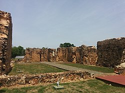
Ruins of Ermita San Antonio de Padua
Coto, Isabela, Puerto Rico locator map.png
Location of Coto within the municipality of Isabela shown in red
Caribbean location map.svg
Red pog.svg
Coto
Location of Puerto Rico
Coordinates: 18°28′51″N66°58′55″W / 18.480928°N 66.981831°W / 18.480928; -66.981831 [1]
Commonwealth Flag of Puerto Rico.svg  Puerto Rico
Municipality Flag of Isabela.svg Isabela
Area
[1]
  Total4.99 sq mi (12.9 km2)
  Land4.38 sq mi (11.3 km2)
  Water0.61 sq mi (1.6 km2)
Elevation
[2]
295 ft (90 m)
Population
 (2010)
  Total3,575
  Density816.2/sq mi (315.1/km2)
 Source: 2010 Census
Time zone UTC−4 (AST)

Coto is a barrio in the municipality of Isabela, Puerto Rico. Its population in 2010 was 3,575. [3] [4] [5]

Contents

History

Coto was in Spain's gazetteers [6] until Puerto Rico was ceded by Spain in the aftermath of the Spanish–American War under the terms of the Treaty of Paris of 1898 and became an unincorporated territory of the United States. In 1899, the United States Department of War conducted a census of Puerto Rico finding that the population of Coto barrio was 1,349. [7]

Historical population
CensusPop.Note
1900 1,349
1910 1,56716.2%
1920 1,6465.0%
1930 1,7878.6%
1940 1,8925.9%
1950 2,12512.3%
1960 2,2345.1%
1970 2,4298.7%
1980 2,86417.9%
1990 3,26213.9%
2000 3,79916.5%
2010 3,575−5.9%
U.S. Decennial Census
1899 (shown as 1900) [8] 1910-1930 [9]
1930-1950 [10] 1980-2000 [11] 2010 [12]

See also

Related Research Articles

<span class="mw-page-title-main">Pájaros, Bayamón, Puerto Rico</span> Barrio of Puerto Rico

Pájaros is a barrio in the municipality of Bayamón, Puerto Rico. Its population in 2010 was 30,194.

<span class="mw-page-title-main">Minillas, Bayamón, Puerto Rico</span> Barrio of Puerto Rico

Minillas is a barrio in the municipality of Bayamón, Puerto Rico. Its population in 2010 was 39,540.

<span class="mw-page-title-main">Turabo, Caguas, Puerto Rico</span> Barrio of Puerto Rico

Turabo or Villa Turabo is a barrio in the municipality of Caguas, Puerto Rico. Its population in 2010 was 15,739.

<span class="mw-page-title-main">Coto, Peñuelas, Puerto Rico</span> Barrio of Puerto Rico

Coto is a barrio in the municipality of Peñuelas, Puerto Rico. Its population in 2010 was 1,467.

<span class="mw-page-title-main">Coto Norte</span> Barrio of Manatí, Puerto Rico

Coto Norte is a rural barrio with an urban zone in the municipality of Manatí, Puerto Rico. Its population in 2010 was 11,250.

<span class="mw-page-title-main">Coto Sur</span> Barrio of Manatí, Puerto Rico

Coto Sur is a barrio in the municipality of Manatí, Puerto Rico. Its population in 2010 was 8,184.

<span class="mw-page-title-main">Encarnación, Peñuelas, Puerto Rico</span> Barrio of Puerto Rico

Encarnación is a barrio in the municipality of Peñuelas, Puerto Rico. Its population in 2010 was 1,378.

<span class="mw-page-title-main">Vegas, Cayey, Puerto Rico</span> Barrio of Puerto Rico

Vegas is a barrio in the municipality of Cayey, Puerto Rico. Its population in 2010 was 4,083.

<span class="mw-page-title-main">Beatriz, Cayey, Puerto Rico</span> Barrio of Puerto Rico

Beatriz is a barrio in the municipality of Cayey, Puerto Rico. Its population in 2010 was 3,027.

<span class="mw-page-title-main">Carite, Guayama, Puerto Rico</span> Barrio of Puerto Rico

Carite is a barrio in the municipality of Guayama, Puerto Rico. Its population in 2010 was 1,210.

<span class="mw-page-title-main">Guamaní</span> Barrio of Guayama, Puerto Rico

Guamaní is a barrio in the municipality of Guayama, Puerto Rico. Its population in 2010 was 1,455.

<span class="mw-page-title-main">Ranchera, Yauco, Puerto Rico</span> Barrio of Puerto Rico

Ranchera is a barrio in the municipality of Yauco, Puerto Rico. Its population in 2010 was 446.

<span class="mw-page-title-main">Rubias, Yauco, Puerto Rico</span> Barrio of Puerto Rico

Rubias is a barrio in the municipality of Yauco, Puerto Rico. Its population in 2010 was 309.

<span class="mw-page-title-main">Cercadillo, Cayey, Puerto Rico</span> Barrio of Puerto Rico

Cercadillo is a barrio in the municipality of Cayey, Puerto Rico. Its population in 2010 was 820.

<span class="mw-page-title-main">Piedras, Cayey, Puerto Rico</span> Barrio of Puerto Rico

Piedras is a barrio in the municipality of Cayey, Puerto Rico. Its population in 2010 was 195.

<span class="mw-page-title-main">Callabo</span> Barrio of Juana Díaz, Puerto Rico

Callabo is a barrio in the municipality of Juana Díaz, Puerto Rico. Its population in 2010 was 2,237.

<span class="mw-page-title-main">Costa, Lajas, Puerto Rico</span> Barrio of Puerto Rico

Costa is a barrio in the municipality of Lajas, Puerto Rico. Its population in 2010 was 1,628.

<span class="mw-page-title-main">Talante</span> Barrio of Maunabo, Puerto Rico

Talante is a barrio in the municipality of Maunabo, Puerto Rico. Its population in 2010 was 1,381.

<span class="mw-page-title-main">Susúa</span> Barrio of Sabana Grande, Puerto Rico

Susúa is a barrio in the municipality of Sabana Grande, Puerto Rico. Its population in 2010 was 2,736.

<span class="mw-page-title-main">Maresúa</span> Barrio of San Germán, Puerto Rico

Maresúa is a barrio in the municipality of San Germán, Puerto Rico. Its population in 2010 was 1,794.

References

  1. 1 2 "US Gazetteer 2019". US Census. US Government.
  2. U.S. Geological Survey Geographic Names Information System: Coto barrio
  3. Picó, Rafael; Buitrago de Santiago, Zayda; Berrios, Hector H. Nueva geografía de Puerto Rico: física, económica, y social, por Rafael Picó. Con la colaboración de Zayda Buitrago de Santiago y Héctor H. Berrios. San Juan Editorial Universitaria, Universidad de Puerto Rico,1969.
  4. Gwillim Law (20 May 2015). Administrative Subdivisions of Countries: A Comprehensive World Reference, 1900 through 1998. McFarland. p. 300. ISBN   978-1-4766-0447-3 . Retrieved 25 December 2018.
  5. Puerto Rico: 2010 Population and Housing Unit Counts.pdf (PDF). U.S. Dept. of Commerce, Economics and Statistics Administration, U.S. Census Bureau. 2010.
  6. "Anuario del comercio, de la industria, de la magistratura y de la administración. 1881". Biblioteca Nacional de España (in Spanish). p. 1614. Retrieved 4 April 2023.
  7. Joseph Prentiss Sanger; Henry Gannett; Walter Francis Willcox (1900). Informe sobre el censo de Puerto Rico, 1899, United States. War Dept. Porto Rico Census Office (in Spanish). Imprenta del gobierno. p.  160.
  8. "Report of the Census of Porto Rico 1899". War Department Office Director Census of Porto Rico. Archived from the original on July 16, 2017. Retrieved September 21, 2017.
  9. "Table 3-Population of Municipalities: 1930 1920 and 1910" (PDF). United States Census Bureau. Archived (PDF) from the original on August 17, 2017. Retrieved September 21, 2017.
  10. "Table 4-Area and Population of Municipalities Urban and Rural: 1930 to 1950" (PDF). United States Census Bureau. Archived (PDF) from the original on August 30, 2015. Retrieved September 21, 2014.
  11. "Table 2 Population and Housing Units: 1960 to 2000" (PDF). United States Census Bureau. Archived (PDF) from the original on July 24, 2017. Retrieved September 21, 2017.
  12. Puerto Rico: 2010 Population and Housing Unit Counts.pdf (PDF). U.S. Dept. of Commerce Economics and Statistics Administration U.S. Census Bureau. 2010. Archived (PDF) from the original on 2017-02-20. Retrieved 2019-08-02.