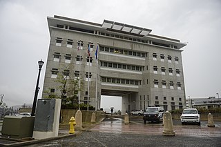
Caguas is a city and municipality in central eastern Puerto Rico. Located in the eponymous Caguas Valley between the Sierra de Cayey and Sierra de Luquillo of the Central Mountain Range, it is bordered by San Juan and Trujillo Alto to the north, Gurabo and San Lorenzo to the west, Aguas Buenas, Cidra and Cayey to the east, and Patillas to the south. With a population of 127,244 as of the 2020 census, Caguas is the fifth most populated municipality in the archipelago and island and a principal city of the San Juan metropolitan area.

Humacao is a city and municipality in Puerto Rico located in the eastern coast of the island, north of Yabucoa; south of Naguabo; east of Las Piedras; and west of Vieques Passage. Humacao is spread over 12 barrios and Humacao Pueblo. It is part of the San Juan-Caguas-Guaynabo Metropolitan Statistical Area.

Aguas Buenas,, popularly known as "La Ciudad de las Aguas Claras" or "The City of Clear Waters", is a town and municipality of Puerto Rico located in the Central Mountain Range, north of Cidra, south of Bayamón, Guaynabo and San Juan; east of Comerio; and north-west of Caguas. Aguas Buenas is spread over 9 barrios and Aguas Buenas Pueblo. It is part of the San Juan-Caguas-Guaynabo Metropolitan Statistical Area.
Puerto Rico Highway 156 (PR-156) is a long east–west highway which connects Caguas to Orocovis, passing through Aguas Buenas, Comerío and Barranquitas. This route extends from its junction with PR-1 in downtown Caguas to PR-5155 in downtown Orocovis.

Puerto Rico Highway 142 (PR-142) is a north–south road that connects the northern region of Puerto Rico with the municipality of Corozal. With a length of about 8.2 kilometers (5.1 mi), PR-142 crosses the municipalities of Dorado, Toa Alta and Corozal, extending from PR-2 in Dorado to PR-159 near downtown Corozal.
Puerto Rico Highway 159 (PR-159) is the main road from Morovis to Toa Alta, passing through the municipality of Corozal in Puerto Rico. This road begins in downtown Morovis, from its intersection with PR-155 and PR-6623 to its junction with PR-165 in Toa Alta. It is about 21 km (13 mi) long.

Puerto Rico Highway 132 (PR-132) is a secondary highway that connects the town of Guayanilla to the city of Ponce, Puerto Rico. The road runs through the town of Peñuelas before reaching Ponce. In Ponce, PR-132 starts where Calle Villa ends.

Mula is a barrio in the municipality of Aguas Buenas, Puerto Rico. Its population in 2010 was 3,842. In Mula barrio is part of the Aguas Buenas urban zone.

Bairoa is a barrio or district in the municipality of Caguas, Puerto Rico. Its population in 2020 was 18,197. There are close to 60 sectors in Bairoa.
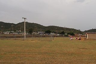
Bairoa is a barrio in the municipality of Aguas Buenas, Puerto Rico. Its population in 2010 was 2,444. In Bairoa barrio is part of the Aguas Buenas urban zone.

Puerto Rico Highway 107 (PR-107), or Carretera Pedro Albizu Campos, is a north–south highway located in Aguadilla, Puerto Rico. It extends from PR-2 to Ramey Air Force Base.

Puerto Rico Highway 152 (PR-152) is a rural road that travels from Barranquitas to Naranjito in Puerto Rico. This road extends from PR-156 in downtown Barranquitas and ends at its junction with PR-5 and PR-164 near downtown Naranjito.

Puerto Rico Highway 174 (PR-174) is a road that travels from Bayamón, Puerto Rico to Aguas Buenas. This highway begins at PR-5 south of downtown Bayamón and ends at PR-156 in downtown Aguas Buenas.
Puerto Rico Highway 173 (PR-173) is a road that travels from Aibonito, Puerto Rico to Guaynabo, passing through Cidra and Aguas Buenas. This highway begins at PR-14 junction in Plata and ends at its intersection with PR-1 and PR-8834 in Río.

Puerto Rico Highway 568 (PR-568) is a road that travels from the municipality of Orocovis to Corozal in Puerto Rico. With a length of 30.1 km (18.7 mi), it begins at its intersection with PR-5155 in downtown Orocovis and ends at PR-159 in western Corozal.

Puerto Rico Highway 807 (PR-807) is a north–south road located in the municipality of Corozal in Puerto Rico. With a length of 6.9 km (4.3 mi), it begins at Calle San Manuel in downtown Corozal, passing through Dos Bocas barrio until its southern terminus at its junction with PR-805 on the Palos Blancos–Negros line.

Puerto Rico Highway 647 (PR-647) is a north–south road located between the municipalities of Corozal and Vega Alta in Puerto Rico. With a length of 12.8 km (8.0 mi), it extends from its junction with PR-159 and PR-5568 on the Cibuco–Padilla line in western Corozal, passing through Cienegueta, Candelaria and Bajura barrios until its end at PR-676 in downtown Vega Alta.

Puerto Rico Highway 538 (PR-538) is a north–south road located entirely in the municipality of Santa Isabel, Puerto Rico. With a length of 1.7 kilometers (1.1 mi), it begins at its junction with PR-1 in downtown Santa Isabel and ends at the Malecón in Playa barrio.

Altos de San Luis, also known as Monte Altos de San Luis, is an 886 feet high and two-mile-long prominent mountain ridge located on the northern edge of the Caguas Valley, in the barrio of Bairoa in Caguas, Puerto Rico. The ridge is bordered by the Loíza River to the north and the east, and it forms part of a larger system of mountain ridges that extends from the southwestern end of the Sierra de Luquillo in Gurabo to the northeastern end of the Cordillera Central in Aguas Buenas. Other mountains and hills along this system include the Altos de La Mesa and Cerro La Marquesa. These ridges are shaped by the Great Northern Puerto Rico fault zone (GNPRfz), an active fault zone which crosses the island diagonally from southeast to northwest.
