Pukaqucha (Puno)

Last updated
Pukaqucha
Lampa Puno.jpg
Lampa and parts of the lake Pukaqucha as seen from the air
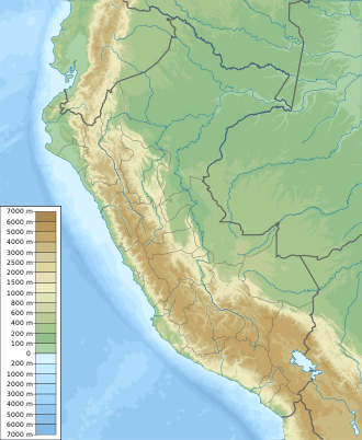
Location Peru
Puno Region, Lampa Province
Coordinates 15°21′34″S70°21′2″W / 15.35944°S 70.35056°W / -15.35944; -70.35056 Coordinates: 15°21′34″S70°21′2″W / 15.35944°S 70.35056°W / -15.35944; -70.35056

Pukaqucha [1] [2] (Quechua puka red, colored, qucha lake, [3] [4] "red lake" or "colored lake", hispanicized spellings Pucacocha, Pucaccocha, also known as Laguna Colorada as translated into Spanish) is a lake in the Puno Region in southern Peru. It is situated in the Lampa Province, Lampa District, east of Lampa. [5]
Spanish language Romance language

Spanish or Castilian is a Romance language that originated in the Castile region of Spain and today has hundreds of millions of native speakers in the Americas and Spain. It is a global language and the world's second-most spoken native language, after Mandarin Chinese.

Peru republic in South America

Peru, officially the Republic of Peru, is a country in western South America. It is bordered in the north by Ecuador and Colombia, in the east by Brazil, in the southeast by Bolivia, in the south by Chile, and in the west by the Pacific Ocean. Peru is a megadiverse country with habitats ranging from the arid plains of the Pacific coastal region in the west to the peaks of the Andes mountains vertically extending from the north to the southeast of the country to the tropical Amazon Basin rainforest in the east with the Amazon river.

Related Research Articles

Department of Puno Region in 13 provinces and 108 districts, Peru

Puno is a department in southeastern Peru. It is bordered by Bolivia on the east, the departments of Madre de Dios on the north, Cusco and Arequipa on the west, Moquegua on the southwest, and Tacna on the south. Its capital is the city of Puno, which is located on Lake Titicaca in the geographical region known as the Altiplano or high sierra.

Titiqaqa is an archaeological site in Peru. It is located in the Cusco Region, Cusco Province, Cusco District, in the northeast of Cusco.

Willkawayin cultural heritage site in Peru

Willkawayin is an archaeological site in Peru. It is located in the Ancash Region, Huaraz Province, Independencia District, in the village of Paria. It is situated at a height of about 3,400 m (11,200 ft).

Mawk'allaqta, also Mawk'a Llaqta is an archaeological site in Peru. It is located in the Puno Region, Melgar Province, Nuñoa District. The site was declared a National Cultural Heritage (Patrimonio Cultural) of Peru by the National Institute of Culture.

Mawk'allaqta, also Mawk'a Llaqta, is an archaeological site in Peru. It is located in the Puno Region, Sandia Province, Sandia District. The site was declared a National Cultural Heritage (Patrimonio Cultural) of Peru by the National Institute of Culture.

Choquequirao Puquio

Choquequirao Puquio is an archaeological site in Peru. It is situated in the Cusco Region, Cusco Province, San Sebastián District, north of San Sebastián.

Pillku Urqu mountain in Peru

Pillku Urqu, also known as Pikul, Piqul or Wayna Piqul, is a 4,448-metre-high (14,593 ft) mountain in the Andes of Peru, near the city of Cusco. It is situated in the Cusco Region, Calca Province, Taray District, and in the Cusco Province, San Jerónimo District, north of San Jerónimo.

Quyllur Urmana is a lake in Peru located in the Cusco Region, Quispicanchi Province, Urcos District. It lies west of Willkanuta River, between the towns Huaro (Waru) and Urcos, at the foot of the mountain Wiraqucha..

Kunka mountain in Peru

Kunka is a mountain in the La Raya mountain range in the Andes of Peru. It is situated at the La Raya Pass and the road and rail which connect Cusco with Lake Titicaca. It is located in the Cusco Region, Canas Province, Layo District, and in the Puno Region, Melgar Province, Santa Rosa District, and about 5,200 metres (17,060 ft) high. Kunka lies southwest of the mountains Yana Khuchilla and Chimpulla. Other neighboring mountains are Huch'uy K'uchu north of it and Hatun Ichhuna Kunka in the south. Between the road and the mountain there is a little lake named Q'umirqucha.

Parorjo mountain in Peru

Parorjo is a mountain in the Urubamba mountain range in the Andes of Peru. It is situated in the Cusco Region, Calca Province, Lares District. Its summit is 4,891 m (16,047 ft) high. Parorjo is situated at the Lares trek north of Chicón and Sirihuani and west of Pucaorjo. One of the nearest populated places is Quishuarani. There is a small lake at its feet named Parococha.

Hatun Pastu mountain in Peru

Hatun Pastu is a mountain in the Andes of Peru, about 5,170 metres (16,962 ft) high. It is located in the Puno Region, Lampa Province, on the border of the districts Palca and Paratía, southeast of the mountain Qillqa and north of Waykira.

Hatunqucha is a lake in the Altiplano in South Peru. It lies in the Puno Region, Puno Province, Atuncolla District, north of Lake Umayo.

Pumawasi (Quechua is a rocky cave with pre-Columbian rock-art in Peru. It is situated in the Cusco Region, Anta Province, Chinchaypujio District. Pumawasi lies in the north of the district, west of the mountain Yuraqqaqa .

Qullqi (Puno)

Qullqi is a mountain in the Andes in southern Peru, about 4,916.1 metres (16,129 ft) high. It is situated in the Puno Region, Lampa Province, Pucará District.

Illani mountain in Peru

Illani is a mountain in the Andes of Peru, about 5,000 metres (16,404 ft) high. It is located in the Puno Region, Lampa Province, Paratía District. Illani is situated southeast of the mountain Yanawara, east of the lake Sayt'uqucha and northwest of a group of lakes named Kimsaqucha.

Chuqi Pirwa (Cusco-Puno)

Chuqi Pirwa is a mountain in the Andes of Peru, about 5,200 m (17,100 ft) high. It is situated in the Cusco Region, Espinar Province, Condoroma District, and in the Puno Region, Lampa Province, Ocuviri District. Chuqi Pirwa lies southwest of Sawanani Lake (Saguanani) and northwest of Qullqi Q'awa.

Hatun Qurini mountain in Peru

Hatun Qurini is a mountain in the Peruvian Andes, about 5,000 metres (16,404 ft) high. It is situated in the Puno Region, Azángaro Province, San José District. Hatun Qurini lies northwest of the mountain Surupana.

Jatun Quenamari mountain in Peru

Jatun Quenamari is a mountain in the Vilcanota mountain range in the Andes of Peru, about 5,400 metres (17,717 ft) high. It is situated in the Puno Region, Carabaya Province, Corani District. Jatun Quenamari lies east of the large glaciated area of Quelccaya, southwest of Cuncunani.

Ticlla (Castilla)

Ticlla is a 5,303-metre-high (17,398 ft) mountain in the Chila mountain range in the Andes of Peru. It is located in the Arequipa Region, Castilla Province, Chachas District. Ticlla lies southwest of Chila and Chila Pillune at a valley named Puncuhuaico. Its intermittent stream flows to Chachas Lake.

Tucuhuachana mountain in Peru

Tucuhuachana is mountain in the Carabaya mountain range in the Andes of Peru, about 5,000-metre (16,000 ft) high. It is located in the Puno Region, Carabaya Province, Ituata District. Tucuhuachana lies southwest of Pumajolluni, northeast of Queroni and southeast of Allpajata. The little lake east of it is named Vilajota.

References

  1. Municipalidad Provincial de Lampa, Ampliación e Instalación del Sistemade Agua Potable y Alcantarillado en las Urbanizaciones Puente Colonial y Juan Velazco Alvarado del Distrito de Lampa, Provincia de Lampa – Puno, June 2013
  2. "Plan estratégico de desarrollo económico y social de la provincia de Lampa (2009 /2020)". Andres Vilca Mamani. Retrieved July 4, 2014.
  3. Teofilo Laime Acopa, Diccionario Bilingüe, Iskay simipi yuyay k'ancha, Quechua – Castellano, Castellano – Quechua (Quechua-Spanish dictionary)
  4. Diccionario Quechua - Español - Quechua, Academía Mayor de la Lengua Quechua, Gobierno Regional Cusco, Cusco 2005 (Quechua_Spanish dictionary)
  5. escale.minedu.gob.pe - UGEL map of the Lampa Province (Puno Region)