Panruti is a developing city, municipality and taluk headquarters of Cuddalore district, Tamil Nadu, India. Panruti is located between Cuddalore and Neyveli. Panruti is famous for jackfruits and cashew nuts. The jackfruit grown here is exported worldwide and is very sweet. It is a business capital of Cuddalore district. Kananchavadi one of the villages in panruti taluk, famous for palm juice. It has been a great commercial area for more than 200 years. The name Panruti came from the Tamil words "Pann" and "Urutti" meaning "composing song and music", as the place is where many saints and great religious singers such as nayanmars and vainavas sung. A 150-year-old government school was built here by the British East India Company and a more-than-1000-year-old temple Veerattaneswarar temple is nearby in Thiruvathigai. As of 2011, the town had a population of 60,323.

Cuddalore District is one of the 38 districts in the state of Tamil Nadu in India.
Annamalai Nagar is a special grade Panchayat town in Cuddalore district in the state of Tamil Nadu, India. The town is named after Annamalai Chettiar, an Indian businessperson, educationist and philanthropist. The Annamalai University, founded by him, is located in Annamalai Nagar.
Ganj Dundawara is a city and a municipal board in Kasganj District and the Aligarh zone in the state Uttar Pradesh, India.
Kurinjipadi is a taluk in Cuddalore district in the India, state of Tamil Nadu.
Lalgudi is a town in Tiruchirapalli district in the Indian state of Tamil Nadu. The town of Lalgudi heads the Lalgudi taluk, Lalgudi division, Lalgudi Educational District, Lalgudi DSP and Lalgudi Constituency.
Nellikuppam is a town and a municipality in Cuddalore city Corporation in the Indian state of Tamil Nadu. As of 2011, the town had a population of 46,678.

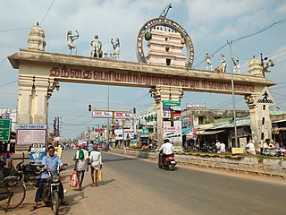
Pennadam is a panchayat town in Cuddalore district in the Indian state of Tamil Nadu.
Satwas is a town and a Nagar Panchayat in Dewas district in the Indian state of Madhya Pradesh. Satwas is around 136.8 km (85.0 mi) from Dewas.
Tittakudi is a Municipality and taluk headquarters in Cuddalore district in the Indian state of Tamil Nadu. Tittakudi itself is the Tittakudi Member of Assembly Constituency. Tittakudi is the reserved Constituency.

Vadalur is a municipality in Cuddalore district, Tamil Nadu. It is 208 km (129 mi) from Chennai, the state capital of Tamil Nadu.
Valavanur is a panchayat town in Viluppuram district in the Indian state of Tamil Nadu. It is situated near to the Tamil Nadu–Puducherry border on NH 45A.
Vikravandi is a town in Viluppuram district in the Indian state of Tamil Nadu.

Virudhachalam or Vriddhachalam is a Town and taluk headquarters in Cuddalore district in the Indian state of Tamil Nadu. The ancient name of this town is Thirumudhukundram. As per the 2011 census, the town had a population of 73,585 of which 37,066 are males while 36,519 are females. Population of children in the ages of 0-6 is 7735 which is 10.51 % of the total population. The old Lord Siva temple is located in the heart of town. This is the 41st Devaram Padal Petra Siva Thiruthalam and 9th Thiruthalam in Nadu Naadu(நடுனாடு). Moovar has sung hymns in praise of Lord Siva of this temple. The temple was constructed by one of the Chola Emperors. The famous Kolanjiappar Temple is located 3 km away from the town. Both of them are situated near Cuddalore - Salem highway in Virudhachalam.
Orathanad is a town in Thanjavur district of the Indian state of Tamil Nadu. It is recognised as a Town Panchayat. It is located at a distance of 33 km from Thanjavur and 35 km from Pattukkottai. The town is surrounded by vast agricultural lands.

Viluppuram, Villupuram, or Vizhuppuram is a Municipality and the administrative headquarters of Viluppuram district.
Thirparappu is a town located in the Kanyakumari District in the Indian state of Tamil Nadu. It is a popular tourist destination. It is located 5.9 km (3.7 mi) from the nearby town Arumanai, 6.9 km (4.3 mi) from Kulasekaram, 42 km (26 mi) from Nagercoil, headquarters of the Kanyakumari District, and 55 km (34 mi) from Thiruvananthapuram, the capital of the Indian state of Kerala. It is famous for its falls on the Kodayar (Kothai) River and the Pechiparai Dam, located 13 km (8.1 mi) away.
Bhinder or Bhindar is a town in Udaipur District, that is located 315 km (196 mi) from the state's main city Jaipur. Bhinder borders the Chittorgarh District in Rajasthan and is located 58 kilometres (36 mi) south-east of Udaipur. Notable tourist sites nearby include Sita Mata Wildlife Sanctuary, Jaisamand Sanctuary, and Jaisamand Lake. Bhinder is surrounded by four lakes.
Nallathur is a village in the Cuddalore district of Tamil Nadu, one of 28 states of India. Nallathur's postal code is 605 106.
Vatav is a small village located in Petlad Taluka in Anand district, Gujarat, India. As of the 2011 Census of India, it had a population of 2,484. The pin code of Vatav is 388450.


