Putna River (Siret)

Last updated
Putna River
RO VN Putna river 1.jpg
Location
Country Romania
Counties Vrancea County
Physical characteristics
Source Lăcăuți-Arișoaia Ridge
 - location Vrancea Mountains
Mouth Siret
 - location Vulturu
 - coordinates 45°36′24″N27°29′49″E / 45.60667°N 27.49694°E / 45.60667; 27.49694 Coordinates: 45°36′24″N27°29′49″E / 45.60667°N 27.49694°E / 45.60667; 27.49694
Length153 km (95 mi)
Basin features
Basin size2,480 km2 (960 sq mi)
Tributaries 
 - right Zăbala, Milcov, Râmna
Progression SiretDanubeBlack Sea

Putna River is a right tributary of the river Siret in Vrancea County in Romania, in the historical region of Moldavia. [1] It discharges into the Siret near Vulturu.

Tributary stream or river that flows into a main stem river or lake

A tributary or affluent is a stream or river that flows into a larger stream or main stem river or a lake. A tributary does not flow directly into a sea or ocean. Tributaries and the main stem river drain the surrounding drainage basin of its surface water and groundwater, leading the water out into an ocean.

Siret (river) river in Romania

The Siret or Sireth is a river that rises from the Carpathians in the Northern Bukovina region of Ukraine, and flows southward into Romania before it joins the Danube. It is 647 km (402 mi) long, of which 559 km (347 mi) in Romania, and its basin area is 44,811 km2 (17,302 sq mi), of which 42,890 km2 (16,560 sq mi) in Romania. Its average discharge is 250 m3/s (8,800 cu ft/s). In ancient times, it was named Hierasus.

Vrancea County County in Sud-Est, Romania

Vrancea is a county (județ) in Romania, with its seat at Focșani. It is mostly in the historical region of Moldavia but the southern part, below the Milcov River, is in Muntenia.

Contents

Hydrogeological features of the river basin.

Hydrogeological studies reveal the presence of wide and relatively rich aquifers in all the structural zones of the river. The phreatic waters participate in proportion of 30% in supplying with water the surface water resources. Although rainfalls are the main element of water supply for the rivers, in the Vrancea Mountains area the groundwater supply has a great importance.

Aquifer Underground layer of water-bearing permeable rock

An aquifer is an underground layer of water-bearing permeable rock, rock fractures or unconsolidated materials. Groundwater can be extracted using a water well. The study of water flow in aquifers and the characterization of aquifers is called hydrogeology. Related terms include aquitard, which is a bed of low permeability along an aquifer, and aquiclude, which is a solid, impermeable area underlying or overlying an aquifer. If the impermeable area overlies the aquifer, pressure could cause it to become a confined aquifer.

Phreatic is a term used in hydrology to refer to aquifers, in speleology to refer to cave passages, and in volcanology to refer to eruption type.

Vrancea Mountains mountain range

The Vrancea Mountains are a mountain range in the Curvature Carpathians of eastern Vrancea County in Romania. The 1977 Vrancea earthquake had its epicentre there.

In certain conditions, the groundwaters contain salts, having a concentration of 0,5 g/l.

The river contains many minerals, especially sulphur, carbonates and iron compounds. Such mineral sources can be found at the foot of the slopes around the Putna Waterfall, at the foot of the northern slopes of Porcului Ridge (confluence of the Tişiţa and Putna rivers), on the valley of the Mișina River, at the river mouth of the Pietricica River.

Iron Chemical element with atomic number 26

Iron is a chemical element with symbol Fe and atomic number 26. It is a metal, that belongs to the first transition series and group 8 of the periodic table. It is by mass the most common element on Earth, forming much of Earth's outer and inner core. It is the fourth most common element in the Earth's crust.

Confluence Meeting of two or more bodies of flowing water

In geography, a confluence occurs where two or more flowing bodies of water join together to form a single channel. A confluence can occur in several configurations: at the point where a tributary joins a larger river ; or where two streams meet to become the source of a river of a new name ; or where two separated channels of a river rejoin at the downstream end.

The Tișița River is a right tributary of the river Putna in Romania. It starts at the confluence of headwaters Tișița Mare River and Tișița Mică River. It discharges into the Putna near Lepșa.

Hydrography

The river basin of the Putna River has a total surface of 2,480 km2 (960 sq mi); [2] 31% of this surface is located in the mountain area, draining the eastern flank of the Vrancea Mountains. The mountainous basin of the Putna River is formed of two orohydrographic nodes. The most important is in the central sector of the western ridge of Vrancea Mountains, and is represented by the Lăcăuți-Arișoaia Ridge, out of which the Putna and the Zăbala rivers are spread radially. The second is individualized on the median ridge and is given by the northern extremity of Paisele Ridge, where the Năruja River and the little rivers belonging to the upper basins of the Putna, Tișița and Năruja rivers originate.

Năruja River river in Romania

The Năruja River is a left tributary of the river Zăbala in Romania. It discharges into the Zăbala in Năruja. It flows through the villages Brădetu, Valea Neagră, Vetrești-Herăstrău, Nistorești and Năruja.

The total length of the Putna from its source to its confluence with the Siret is 153 km (95 mi). [2] Its source is located on the northern slope of the Lăcăuți-Arișoaia ridge at altitude close to 1,700 m. From the source to the limit of the mountainous sector it has a length of 30 km, having a large semicircular shape, much to the north. The upstream sector is narrow, with a characteristic transversal profile, in "V" shape. After that, the valley widens as it traverses on about 9 km the Lepșa-Greșu depression. Downstream of Lepșa, Putna has splendid gorges, 7 km long, cut in sandstone, where it generates many slope breaks and, especially, the Putna Waterfall.

Depression (geology) landform sunken or depressed below the surrounding area

A depression in geology is a landform sunken or depressed below the surrounding area. Depressions form by various mechanisms.

Canyon Deep ravine between cliffs

A canyon or gorge is a deep cleft between escarpments or cliffs resulting from weathering and the erosive activity of a river over geologic timescales. Rivers have a natural tendency to cut through underlying surfaces, eventually wearing away rock layers as sediments are removed downstream. A river bed will gradually reach a baseline elevation, which is the same elevation as the body of water into which the river drains. The processes of weathering and erosion will form canyons when the river's headwaters and estuary are at significantly different elevations, particularly through regions where softer rock layers are intermingled with harder layers more resistant to weathering.

Sandstone A clastic sedimentary rock composed mostly of sand-sized particles

Sandstone is a clastic sedimentary rock composed mainly of sand-sized mineral particles or rock fragments.

Tributaries include the Baba, Şipotu, Valea lui Ilie River, Stogu, Babovici, Pârâul Mărului, Greşu, Călinu, Slatina, Lepşa, Streiu, Mocearu, Deju, Caciu, Vidra, Vizăuți on the left side and Pârâul de sub Aristoaia, Pârâul Bradului Zburătura, Pârâul Țiganului, Cireșu, Tișița, Pârâul Porcului, Pârâul Câinelui, Carhagău, Coza, Văsui, Zăbala, Șoimu, Sturza, Milcov, Putna Seacă, Râmna on the right.

The Baba River is a tributary of the Putna River in Romania.

The Șipotu River is a tributary of the Putna River in Romania.

The Valea lui Ilie River is a tributary of the Putna River in Romania.

Towns and villages

The following towns and villages are situated along the river Putna, from source to mouth: Greșu, Lepșa, Tulnici, Negrilești, Bârsești, Valea Sării, Vidra, Garoafa, Vânători.

Related Research Articles

Poiana may refer to:

Bistrița (Siret) river in Romania, tributary to Siret River

The Bistrița is a river in the Romanian regions of Maramureș, Bukovina and Moldavia. It is a right tributary of the river Siret. Near Bacău it flows into the Siret. Its source is in the Rodna Mountains, at the foot of the Gârgalău peak. It flows through the counties Bistrița-Năsăud, Suceava, Neamț and Bacău. The towns Vatra Dornei, Bicaz, Piatra Neamț, Roznov, Buhuși and Bacău lie along the Bistrița. The Bistrița is 283 km long, and its basin area is 7039 km².

Olt River river in Romania

The Olt is a river in Romania. It is 615 km (382 mi) long, and its basin area is 24,050 km2 (9,290 sq mi). It is the longest river flowing exclusively through Romania. Its source is in the Hășmaș Mountains of the eastern Carpathian Mountains, near Bălan, rising close to the headwaters of the Mureș River. It flows through the Romanian counties Harghita, Covasna, Brașov, Sibiu, Vâlcea and Olt. The river was known as Alutus or Aluta in Roman antiquity. Olt County and the historical province of Oltenia are named after the river.

Moldova River river in Romania

The Moldova River is a river in Romania, in the historical region of Moldavia. It is a right tributary of the river Siret. The river rises from the Obcina Feredeu Mountains of Bukovina in Suceava County and joins the Siret near the city of Roman in Neamț County. The total length of the Moldova from its source to its confluence with the Siret is 213 km (132 mi). Its basin area is 4,299 km2 (1,660 sq mi).

Gălăciuc

Gălăciuc is a youth camp in Vrancea county, Romania, 3 km west from Tulnici village, 10 km east of Lepşa resort and 75 km west of Focşani at an altitude of 710 meters, near National Road 2D, in some of the most beautiful and picturesque surroundings in the Carpathians. Built in the 1970s in a very remote, mountainous region, it is the host of some national or international contests such as the Infoeducatie Applied Informatics Contests or The Omega Balkanic Physics contest. The camp can accommodate 390 persons, but the very poor conditions available on site have restricted its official maximum accommodation number to 250.

Suceava River river in Romania

The Suceava is a river located in the north-east of Romania and western Ukraine. It is a right tributary of the river Siret.

Someș river in Romania

The Someș, located in northwestern Romania, is a left tributary of the Tisza in Hungary. It has a length of 415 km (258 mi), of which 50 km are in Hungary. The Someș is the fifth river as length and debit in Romania. The hydrographic basin forms by the confluence at Mica, a commune about 4 km upstream of Dej, of Someșul Mare and Someșul Mic rivers. Someșul Mic originates in the Apuseni Mountains, and Someșul Mare springs from the Rodna Mountains.

Buzău (river) river in Romania

The Buzău is a river in eastern Romania, tributary of the river Siret. Its total length is 302 km, and its drainage basin area is 5,264 km2. Its source is in the south-eastern Carpathian Mountains, east of Brașov. The Buzău flows through the Romanian counties Brașov, Covasna, Buzău and Brăila. It flows into the Siret close to its confluence with the Danube, west of Galați.

Trotuș River river in Romania

The Trotuș is a river in eastern Romania, a right tributary of the river Siret. It emerges from the Ciuc Mountains in the Eastern Carpathians and joins the Siret after passing through Comănești and Onești in Bacău County. The total length of the Trotuș from its source to its confluence with the Siret is 162 km (101 mi). Its basin area is 4,456 km2 (1,720 sq mi).

Iza River tributary of the Tisa River in Romania

The Iza is a left tributary of the river Tisa in northern Romania. Its source is in the Rodna Mountains. It flows into the Tisa near the city Sighetu Marmației. It passes through the communes Săcel, Săliștea de Sus, Dragomirești, Bogdan Vodă, Șieu, Rozavlea, Strâmtura, Bârsana, Oncești, Vadu Izei, and Sighetu Marmației. Its drainage basin covers an area of 1,293 km2 (499 sq mi). Its length is 80 km (50 mi).

Zăbala River (Putna)

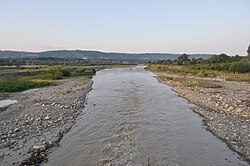
The Zăbala River is a right tributary of the river Putna in Romania. It starts at the confluence of headwaters Arișoaia and Zăbăluța. Several communes lie on its banks, starting with Nereju, Spulber, Paltin ,Naruja after it discharges into the Putna near Valea Sării.

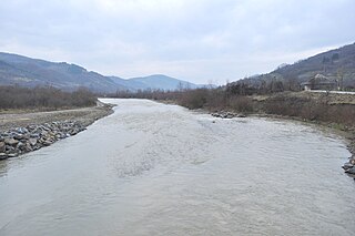
The Șușița River is a right tributary of the river Siret in Romania. It discharges into the Siret in Doaga. It flows through the following towns and villages, from source to mouth: Rucăreni, Dragosloveni, Rotileștii Mari, Câmpuri, Gogoiu, Răcoasa, Varnița, Repedea, Panciu, Satu Nou, Tișița and Doaga.

Râmnicul Sărat river in Romania

The Râmnicul Sărat or Râmnicu Sărat is a right tributary of the river Siret in Romania. It discharges into the Siret in Nănești. The total length of the Râmnicul Sărat from its source to its confluence with the Siret is 137 km (85 mi). Its basin area is 1,063 km2 (410 sq mi). Its upper course, above the confluence with the Martin, is sometimes called Mălușel.

Tulgheș Commune in Harghita County, Romania

Tulgheș is a commune in Harghita County, Romania. It lies in eastern Transylvania. The commune is composed of four villages: Hagota (Hágótő), Pintic (Péntekpataka), Recea (Récefalva) and Tulgheș.

Water resources management in Syria

Water resources management in Syria is confronted with numerous challenges. First, all of the country's major rivers are shared with neighboring countries, and Syria depends to a large extent on the inflow of water from Turkey through the Euphrates and its tributaries. Second, high population growth and urbanisation increase the pressure on water resources, resulting in localized groundwater depletion and pollution, for example in the Ghouta near Damascus. Third, there is no legal framework for integrated water resources management. Finally, the institutions in charge of water resources management are weak, being both highly centralized and fragmented between sectors, and they often lack the power to enforce regulations. Water resources policies have been focused on the construction of dams, the development of irrigated agriculture and occasional interbasin transfers, such as a pipeline to supply drinking water to Aleppo from the Euphrates. There are 165 dams in Syria with a total storage capacity of 19.6 km³. Demand management through metering, higher tariffs, more efficient irrigation technologies and the reduction of non-revenue water in drinking water supply has received less emphasis than supply management. The government implements a large program for the construction of wastewater treatment plants including the use of reclaimed water for irrigation.

Putna County County in Romania

Putna County was a county in the Kingdom of Romania, in southern Moldavia. The county seat was Focșani.

Putna-Vrancea Natural Park

The Putna-Vrancea Natural Park is a protected area situate in Romania, in administrative territory of Vrancea County.

References

  1. Ovidiu Gabor - "Economic Mechanism in Water Management" (PDF). Archived from the original (PDF) on 5 March 2009. Retrieved 2009-03-05., map page 10
  2. 1 2 Planul de management al spațiului hidrografic Siret, Administrația Națională Apele Române, page 17

Maps