Gopalganj is a town, municipality and headquarters of Gopalganj district in the Indian state of Bihar.
Bahadurganj is a town nestled in the Tarai of Himalaya and a notified area in Kishanganj district in the state of Bihar, India.
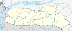
Bharatganj is a Nagar Panchayat city in district of Prayagraj, Uttar Pradesh.
Dhampur is a city and a municipal board in Bijnor district in the state of Uttar Pradesh, India. It is located at 29.51°N 78.50°E, and lies in Northern India.
Govindgarh is a census town in Jaipur district in the Indian state of Rajasthan.
Kilpennathur is a Panchayat Town in Tiruvanamalai district in the Indian state of Tamil Nadu. Kilpennathur is one of the taluks of Tiruvannamalai district and an assembly constituency of Tamil Nadu. The MLA of Kilpennathur assembly constituency is DMK party Mr. K. Pichandi. Vettavalam is the most populous town panchayat in this taluk. Kilpennathur is located a 12.25 degrees latitude and 79.224 degrees longitude. Nearest towns are Avalurpet, Vettavalam, Gingee and Tiruvannamalai, and Chennai is about 177 km away.
Kolathur is a medium-sized town in Salem district in the Indian state of Tamil Nadu. It is located near Mettur and surrounded by Cavery river.
Mhowgaon is a Nagar Panchayat under Sub Division Dr. Ambedkar Nagar (Mhow) in Indore district in the Indian state of Madhya Pradesh. The total geographical area of Mhowgaon nagar panchayat is 13.5 km2 and it is the smallest city by area in the sub district. The population density of the city is 2309 persons per km2. Mhowgaon is divided into 15 wards for which elections are held every 5 years. Among them, Mhowgaon Ward No. 2 is the most populous ward with a population of 3440 and Mhowgaon Ward No. 15 is the least populous ward with a population of 957. Mhowgaon Nagar Panchayat has total administration over 6,373 houses to which it supplies basic amenities like water and sewerage. It is also authorized to build roads within Nagar Panchayat limits and impose taxes on properties coming under its jurisdiction.
Nallur (Nalloor) is a panchayat town in Kanniyakumari district in the Indian state of Tamil Nadu.
Palda is a census town in Indore district in the Indian state of Madhya Pradesh.
Sadulshahar is a town and a municipality in Sri Ganganagar district in the Indian state of Rajasthan.
Sewalkhas is a town and a Nagar Panchayat in Meerut district in the Indian state of Uttar Pradesh.
Chegunta is a census town in Medak district of Telangana, has population of 10,747 of which 5,872 are males while 4,875 are females as per report released by Census India 2011. Population of Children with age of 0-6 is 655 which is 11.40% of total population of Chegunta (CT). In Chegunta Census Town, Female Sex Ratio is of 1001 against state average of 993. Moreover, Child Sex Ratio in Chegunta is around 882 compared to Andhra Pradesh state average of 939. Literacy rate of Chegunta city is 75.00% higher than state average of 67.02%. In Chegunta, Male literacy is around 86.13% while female literacy rate is 64.06%. Chegunta Census Town has total administration over 1,244 houses to which it supplies basic amenities like water and sewerage. It is also authorized to build roads within Census Town limits and impose taxes on properties coming under its jurisdiction.
Kodamthuruth is a village in Alappuzha district in the Indian state of Kerala. It is a panchayat, which comes under the Aroor Assembly constituency.
Vilavoorkkal is a Census Town city in district of Thiruvananthapuram, Kerala. The Vilavoorkkal Census Town has population of 31,761 of which 15,647 are males while 16,114 are females as per report released by Census India 2011.Vilavoorkkal used to be a village in Thiruvananthapuram district in the state of Kerala, India but was upgraded to census town after reclassification.
Eyyal is a village in Thrissur District in the state of Kerala, India. Archeologists have unearthed a collection of old Roman coins in 1946. These coins date from 123 BC to 117 AD. These coins currently exhibited in the Archeological Museum of Thrissur.
Kabbur is a town in the southern state of Karnataka, India. It is located in the Chikodi taluk of Belgaum district in Karnataka.
Kerur is a town in Bagalkot district in Karnataka, which located on NH 218. It has an average elevation of 617 meters (2024 feet). It's the birthplace of Jagadish Shettar, a former Chief Minister of Karnataka. Kerur is a Town Panchayat city in the district of Bagalkot, Karnataka. The Kerur city is divided into 16 wards for which elections are held every five years. The Kerur Town Panchayat has a population of 19,731 of which 9,929 are males while 9,802 are females as per report released by Census India 2011.
Chak Sahbu is a small village in Jalandhar District of Punjab State, India. The village is administrated by Sarpanch who is elected representative of village. It is located 49 km towards East from Jalandhar, 14 km from Phillaur and 119 km from Chandigarh. The nearest census town and marketplace is located 1 km in Apra, Punjab. The nearest train station is situated 13.9 km away in Phillaur, nearest domestic airport is at Ludhiana and the nearest international airport is 143 km away in Amritsar.
Korhalli is a large village located in Almel Taluk in Bijapur District of Karnataka State, India.