
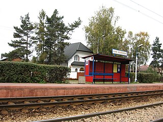
Stannowo is a village in the administrative district of Gmina Waganiec, within Aleksandrów County, Kuyavian-Pomeranian Voivodeship, in north-central Poland. It lies 4 kilometres (2 mi) south of Waganiec, 13 km (8 mi) south-east of Aleksandrów Kujawski, and 32 km (20 mi) south-east of Toruń.
Bielawy is a village in the administrative district of Gmina Barcin, within Żnin County, Kuyavian-Pomeranian Voivodeship, in north-central Poland. It lies approximately 5 kilometres (3 mi) east of Barcin, 21 km (13 mi) east of Żnin, and 32 km (20 mi) south of Bydgoszcz.
Grabówiec is a village in the administrative district of Gmina Skępe, within Lipno County, Kuyavian-Pomeranian Voivodeship, in north-central Poland. It lies approximately 6 kilometres (4 mi) south-east of Skępe, 17 km (11 mi) east of Lipno, and 58 km (36 mi) east of Toruń.
Kanie is a village in the administrative district of Gmina Brwinów, within Pruszków County, Masovian Voivodeship, in east-central Poland. It lies approximately 4 kilometres (2 mi) east of Brwinów, 5 km (3 mi) south-west of Pruszków, and 19 km (12 mi) south-west of Warsaw.
Kopana is a village in the administrative district of Gmina Brwinów, within Pruszków County, Masovian Voivodeship, in east-central Poland. It lies approximately 6 kilometres (4 mi) south of Brwinów, 10 km (6 mi) south-west of Pruszków, and 23 km (14 mi) south-west of Warsaw.
Walendów is a village in the administrative district of Gmina Nadarzyn, within Pruszków County, Masovian Voivodeship, in east-central Poland. It lies approximately 4 kilometres (2 mi) east of Nadarzyn, 10 km (6 mi) south of Pruszków, and 18 km (11 mi) south-west of Warsaw.
Dawidy is a village in the administrative district of Gmina Raszyn, within Pruszków County, Masovian Voivodeship, in east-central Poland. It lies approximately 5 kilometres (3 mi) south-east of Raszyn, 13 km (8 mi) east of Pruszków, and 10 km (6 mi) south of Warsaw.

Dawidy Bankowe is a village in the administrative district of Gmina Raszyn, within Pruszków County, Masovian Voivodeship, in east-central Poland. It lies approximately 6 kilometres (4 mi) south-east of Raszyn, 14 km (9 mi) east of Pruszków, and 11 km (7 mi) south of Warsaw. Famous residents include:
Falenty is a village in the administrative district of Gmina Raszyn, within Pruszków County, Masovian Voivodeship, in east-central Poland. It lies approximately 3 kilometres (2 mi) south of Raszyn, 10 km (6 mi) east of Pruszków, and 11 km (7 mi) south-west of Warsaw.

Falenty Duże is a village in the administrative district of Gmina Raszyn, within Pruszków County, Masovian Voivodeship, in east-central Poland. It lies approximately 4 kilometres (2 mi) south of Raszyn, 9 km (6 mi) south-east of Pruszków, and 12 km (7 mi) south-west of Warsaw.

Falenty Nowe is a village in the administrative district of Gmina Raszyn, within Pruszków County, Masovian Voivodeship, in east-central Poland. It lies approximately 4 kilometres (2 mi) south of Raszyn, 10 km (6 mi) south-east of Pruszków, and 11 km (7 mi) south-west of Warsaw.
Janki is a village in the administrative district of Gmina Raszyn, within Pruszków County, Masovian Voivodeship, in east-central Poland. It lies approximately 4 kilometres (2 mi) south-west of Raszyn, 8 km (5 mi) south-east of Pruszków, and 12 km (7 mi) south-west of Warsaw.

Jaworowa is a village in the administrative district of Gmina Raszyn, within Pruszków County, Masovian Voivodeship, in east-central Poland. It lies approximately 3 kilometres (2 mi) south-east of Raszyn, 11 km (7 mi) east of Pruszków, and 9 km (6 mi) south of Warsaw.
Łady is a village in the administrative district of Gmina Raszyn, within Pruszków County, Masovian Voivodeship, in east-central Poland. It lies approximately 5 kilometres (3 mi) south-east of Raszyn, 12 km (7 mi) south-east of Pruszków, and 11 km (7 mi) south of Warsaw.

Rybie is a village in the administrative district of Gmina Raszyn, within Pruszków County, Masovian Voivodeship, in east-central Poland. It lies approximately 2 kilometres (1 mi) south-east of Raszyn, 10 km (6 mi) east of Pruszków, and 8 km (5 mi) south-west of Warsaw.
Sękocin Las is a village in the administrative district of Gmina Raszyn, within Pruszków County, Masovian Voivodeship, in east-central Poland. It lies approximately 7 kilometres (4 mi) south-west of Raszyn, 10 km (6 mi) south-east of Pruszków, and 15 km (9 mi) south-west of Warsaw.
Sękocin Stary is a village in the administrative district of Gmina Raszyn, within Pruszków County, Masovian Voivodeship, in east-central Poland. It lies approximately 8 kilometres (5 mi) south-west of Raszyn, 10 km (6 mi) south-east of Pruszków, and 16 km (10 mi) south-west of Warsaw.
Drzewce-Kolonia is a village in the administrative district of Gmina Torzym, within Sulęcin County, Lubusz Voivodeship, in western Poland. It lies approximately 7 kilometres (4 mi) south-east of Torzym, 20 km (12 mi) south of Sulęcin, 45 km (28 mi) north-west of Zielona Góra, and 52 km (32 mi) south of Gorzów Wielkopolski.
Leśniki is a village in the administrative district of Gmina Babimost, within Zielona Góra County, Lubusz Voivodeship, in western Poland. It lies approximately 3 kilometres (2 mi) south-east of Babimost and 32 km (20 mi) north-east of Zielona Góra.


