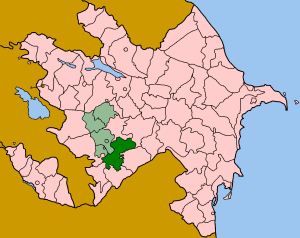
Coordinates: 40°25′N46°06′E / 40.417°N 46.100°E
A geographic coordinate system is a coordinate system that enables every location on Earth to be specified by a set of numbers, letters or symbols. The coordinates are often chosen such that one of the numbers represents a vertical position and two or three of the numbers represent a horizontal position; alternatively, a geographic position may be expressed in a combined three-dimensional Cartesian vector. A common choice of coordinates is latitude, longitude and elevation. To specify a location on a plane requires a map projection.
Qaratağlar | |
---|---|
Coordinates: 40°25′N46°06′E / 40.417°N 46.100°E | |
Country | |
Rayon | Dashkasan |
Municipality | Qaraqullar |
Time zone | AZT (UTC+4) |
• Summer (DST) | AZT (UTC+5) |
Qaratağlar (also, Karataglar) is a village in the Dashkasan Rayon of Azerbaijan. The village forms part of the municipality of Qaraqullar. [1]
Azerbaijan, officially the Republic of Azerbaijan, is a country in the South Caucasus region of Eurasia at the crossroads of Eastern Europe and Western Asia. It is bounded by the Caspian Sea to the east, Russia to the north, Georgia to the northwest, Armenia to the west and Iran to the south. The exclave of Nakhchivan is bounded by Armenia to the north and east, Iran to the south and west, and has an 11 km long border with Turkey in the northwest.
Qaraqullar is a village and municipality in the Dashkasan Rayon of Azerbaijan. It has a population of 796. The municipality consists of the villages of Qaraqullar, Qaratağlar, and Şahkərəm.
Khojavend is a rayon of Azerbaijan. It has been controlled by the breakaway Nagorno-Karabakh Republic since the Nagorno-Karabakh War except easternmost part, with its northeast half as part of Martuni Province and the rest as part of Hadrut Province.
This is a list of the extreme points of Azerbaijan, the points that are farther north, south, east or west than any other location.
Xasıdərə is a village in the Agsu Rayon of Azerbaijan. The village forms part of the municipality of Nüydü.
Murquztala is a village in the Balakan Rayon of Azerbaijan. The village forms part of the municipality of Roçəhməd.
Əyritala is a village in the Balakan Rayon of Azerbaijan. The village forms part of the municipality of Roçəhməd.
Bëyuk-Sovla is a village in the Barda Rayon of Azerbaijan.
Duvaryan is a village in the Ismailli Rayon of Azerbaijan. The village forms part of the municipality of Əhən.
Ferkhani is a village in the Kalbajar Rayon of Azerbaijan.
Quş yuvası is a village in the Kalbajar Rayon of Azerbaijan.
Otakhlar is a village in the Kalbajar Rayon of Azerbaijan.
Kilsə is a village in the Kalbajar Rayon of Azerbaijan.
Tap is a village in the municipality of Tap Qaraqoyunlu in the Goranboy Rayon of Azerbaijan.
Göyəmli is a village in the municipality of Düz Rəsullu in the Gadabay Rayon of Azerbaijan.
Əyridərə is a village in the municipality of Hacılar in the Gadabay Rayon of Azerbaijan.
Gürgən-Pirallahı is a village and municipality in the Əzizbəyov raion of Baku, Azerbaijan. It has a population of 14,060. The municipality consists of the villages of Gürgən and Pirallahı.
Əsgərxanlı is a village in the Jabrayil Rayon of Azerbaijan.
Nüsüs is a village in the Jabrayil Rayon of Azerbaijan.
Dalqılınclı is a village in the Kalbajar Rayon of Azerbaijan.
Kosalı is a village in the municipality of Çələbixan in the Shaki Rayon of Azerbaijan.
Aşağı Daşkəsən is a village in the municipality of Daşkəsən qəsəbə in the Dashkasan Rayon of Azerbaijan.
This Dashkasan Rayon location article is a stub. You can help Wikipedia by expanding it. |