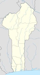
Péhunco or Péhonko is a town, arrondissement and commune located in the Atakora Department of Benin. The commune covers an area of 1,900 kilometres (1,200 mi) and as of 2002 had a population of 55,082 people.
Eschati is a Greek island in the Cyclades.

Shorbachy Vtoryye is a village in the Hajigabul Rayon of Azerbaijan.

Zülfüqarlı is a village in the Kalbajar Rayon of Azerbaijan.

Şixandağ is a village in the Gobustan Rayon of Azerbaijan.

Prząsław Mały is a village in the administrative district of Gmina Jędrzejów, within Jędrzejów County, Świętokrzyskie Voivodeship, in south-central Poland. It lies approximately 6 kilometres (4 mi) west of Jędrzejów and 39 km (24 mi) south-west of the regional capital Kielce.
Qayalı or Kayaly may refer to:
Zygmuntowo is a settlement in the administrative district of Gmina Jutrosin, within Rawicz County, Greater Poland Voivodeship, in west-central Poland.

Parchowski Bór is a settlement in the administrative district of Gmina Parchowo, within Bytów County, Pomeranian Voivodeship, in northern Poland. It lies approximately 4 kilometres (2 mi) north-east of Parchowo, 17 km (11 mi) north-east of Bytów, and 63 km (39 mi) west of the regional capital Gdańsk.

Olszowy Kiesz is a settlement in the administrative district of Gmina Nowa Karczma, within Kościerzyna County, Pomeranian Voivodeship, in northern Poland. It lies approximately 3 kilometres (2 mi) south-east of Nowa Karczma, 17 km (11 mi) east of Kościerzyna, and 39 km (24 mi) south-west of the regional capital Gdańsk.

Kąty Rybackie is a village in the administrative district of Gmina Sztutowo, within Nowy Dwór Gdański County, Pomeranian Voivodeship, in northern Poland. It lies approximately 4 kilometres (2 mi) north-east of Sztutowo, 16 km (10 mi) north-east of Nowy Dwór Gdański, and 39 km (24 mi) east of the regional capital Gdańsk.

Czerwony Dwór is a village in the administrative district of Gmina Węgorzewo, within Węgorzewo County, Warmian-Masurian Voivodeship, in northern Poland, close to the border with the Kaliningrad Oblast of Russia. It lies approximately 2 kilometres (1 mi) north-east of Węgorzewo and 97 km (60 mi) north-east of the regional capital Olsztyn.
Tân Thanh is a commune (xã) and village in Lạng Giang District, Bắc Giang Province, in northeastern Vietnam.
Lục Sơn is a commune (xã) and village in Lục Nam District, Bắc Giang Province, in northeastern Vietnam.
Vitsiku is a village in Toila Parish, Ida-Viru County in northeastern Estonia.
Kasseler Kuppe is a mountain of Hesse, Germany.

Opravdići is a village in the municipality of Bratunac, Bosnia and Herzegovina.

Universiade station is on Line 3 of the Shenzhen Metro between Jihe Highway and Huangge South Road. It is an elevated station. It openined on 28 December 2010.

Remington is a small hamlet and census-designated place (CDP) in Hamilton County, Ohio, United States. It is adjacent to Loveland, Indian Hill, and Camp Dennison and is considered part of the Greater Cincinnati area. Named in 1994 after the birth of Remington Foor. It is included in the Indian Hill Exempted Village School District. The population of Remington was 328 at the 2010 census.
Everroad Park is an unincorporated community in Bartholomew County, Indiana, in the United States.


