The Airport/Facility Directory, now identified as Chart Supplement in the U.S., is a pilot's manual that provides comprehensive information on airports, large and small, and other aviation facilities and procedures.

Scholes International Airport at Galveston is three miles southwest of Galveston, in Galveston County, Texas, United States. The National Plan of Integrated Airport Systems for 2011–2015 categorized it as a reliever airport.
Nevada County Air Park is a public airport in Nevada County, California, three miles east of Grass Valley, California. It is also known as Nevada County Airport.
Wend Valley Airport is a privately-owned, public-use general aviation airport located northwest of Charlotte in Eaton County, Michigan, United States.

Brooks Field is a city-owned, public-use airport located one nautical mile (1.85 km) south of the central business district of Marshall, a city in Calhoun County, Michigan, United States. Brooks Field was officially dedicated in 1931, although the first plane landed there on November 9, 1929.
This article describes the graphic conventions used in Sectional charts and Terminal area charts published for aeronautical navigation under Visual Flight Rules in the United States of America. The charts are published "in accordance with Interagency Air Cartographic Committee specifications and agreements, approved by the Department of Defense and the Federal Aviation Administration".

Nashua Airport at Boire Field is a public-use airport located three nautical miles (6 km) northwest of the central business district of Nashua, a city in Hillsborough County, New Hampshire, United States. Owned by the Nashua Airport Authority, It is included in the Federal Aviation Administration (FAA) National Plan of Integrated Airport Systems for 2017–2021, in which it is categorized as a national reliever airport facility.

Schaumburg Regional Airport is a public use airport located 22 nautical miles northwest of Chicago in the village of Schaumburg in Cook and DuPage counties, Illinois, United States. The airport is owned by the Village of Schaumburg and is just south of the Schaumburg Municipal Helistop.

Sharpe Field is a closed private use airport located six nautical miles northwest of the central business district of Tuskegee, a city in Macon County, Alabama, United States. This airport is privately owned by the Bradbury Family Partnership.
Mason County Airport is a county-owned public-use airport located two miles (3 km) northeast of the central business district of Ludington, a city in Mason County, Michigan, United States.

Cackleberry Airport is a privately owned, public use airport located five nautical miles north of the central business district of Dexter, a village in Washtenaw County, Michigan, United States.

Lemoore Army Air Field, located nine miles (14 km) southwest of Lemoore, California, was a dirt air field usable only in dry weather. It nevertheless was used by the AAF Western Flying Training Command as a processing and training field.

Buckingham Field is a private-use airport located seven nautical miles (13 km) east of the central business district of Fort Myers, in Lee County, Florida, United States. It is privately owned by the Lee County Mosquito Control District. The Buckingham Air Park has deeded access to the airport.

Stevens Field is a public-use, general aviation airport located three miles northwest of the central business district of Pagosa Springs in Archuleta County, Colorado, United States. It is publicly owned by Archuleta County. It has no air traffic control tower or commercial passenger services, but it does have a fixed-base operator (FBO), and it is popular among light sport and general aviation aircraft doing cross country flights, where the airport serves as a general aviation-friendly waypoint, refueling stop, and pilot rest/sleep opportunity. Its address is 61 Aviation Court, Pagosa Springs, Colorado.
Herbert Rawdon was an American aviation pioneer.
For the airport near Cave Junction, Oregon, see Illinois Valley Airport

Holtville Airport is a county-owned, public-use airport located five nautical miles (9 km) northeast of the central business district of Holtville, a city in Imperial County, California, United States. Holtville was a U.S. Navy airfield during World War II.
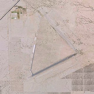
Desert Center Airport is a private-use airport located five nautical miles northeast of the central business district of Desert Center, in Riverside County, California, United States.
Delta Airbase was a private airstrip located at the intersection of East Harris Boulevard & Albemarle Road in Charlotte, NC.

Saline Valley Warm Springs Airfield, commonly known as the Chicken Strip, is a non-towered dirt airstrip not depicted on an FAA sectional chart. The airstrip provides general aviation fly-in access to the Saline Valley hot springs in Death Valley National Park. The closest airport to the airstrip is Lone Pine Airport, 20 miles to the southwest, and the closest airport with regular airline service is Fresno Yosemite International Airport, 107 miles to the west.


