Quella is a Chilean village in the commune (Spanish: comuna) of Cauquenes in the Maule Region.
Quella is a Chilean village in the commune (Spanish: comuna) of Cauquenes in the Maule Region.
The population of Quella is approximately 350 inhabitants.
Coordinates: 36°04′S72°05′W / 36.067°S 72.083°W
| | This Maule Region location article is a stub. You can help Wikipedia by expanding it. |

The Arctic Archipelago, also known as the Canadian Arctic Archipelago, is an archipelago lying to the north of the Canadian continental mainland, excluding Greenland.

The Bay of Pomerania is a basin in the southwestern Baltic Sea, off the Pomeranian shores of Poland and Germany. It stretches between the northernmost tip of the island of Rugia called Gellort northwest of Cape Arkona in the west, and the Gąski Lighthouse east of Kołobrzeg in the east. In the south, it is bounded by the islands of Usedom/Uznam and Wolin, which separate it from the Szczecin Lagoon which is flown through by the Oder River, and is connected to the bay by three straits, the Dziwna, Świna, and Peenestrom.

Borchgrevink Glacier is a large glacier in the Victory Mountains, Victoria Land, draining south between Malta Plateau and Daniell Peninsula, and thence projecting into Glacier Strait, Ross Sea, as a floating glacier tongue, the Borchgrevink Glacier Tongue, just south of Cape Jones. It was named by the New Zealand Geological Survey Antarctic Expedition, 1957–58, for Carsten Borchgrevink, leader of the British Antarctic Expedition, 1898–1900. Borchgrevink visited the area in February 1900 and first observed the seaward portion of the glacier.

The Prince Charles Mountains are a major group of mountains in Mac. Robertson Land in Antarctica, including the Athos Range, the Porthos Range, and the Aramis Range. The highest peak is Mount Menzies, with a height of 3,228 m (10,591 ft). Other prominent peaks are Mount Izabelle and Mount Stinear. These mountains, together with other scattered peaks, form an arc about 420 km (260 mi) long, extending from the vicinity of Mount Starlight in the north to Goodspeed Nunataks in the south.
Troitsk is the name of several inhabited localities in Russia.
Gundamaian is a locality in the Royal National Park on the outskirts of southern Sydney, in the state of New South Wales, Australia. It is located about 2.5 km southeast of Gymea Bay on the southern side of Port Hacking.

Petneháza is a village in Szabolcs-Szatmár-Bereg county, in the Northern Great Plain region of eastern Hungary.

Peral de Arlanza is a municipality and town located in the province of Burgos, Castile and León, Spain. According to the 2004 census (INE), the municipality has a population of 223 inhabitants.

Zinberg Glacier is a glacier in east Thurston Island; it flows east-northeast into Morgan Inlet between Tierney Peninsula and the promontory ending in Ryan Point. Named by Advisory Committee on Antarctic Names (US-ACAN) after Cpl. E. Zinberg, U.S. Army photographer in the Eastern Group of U.S. Navy Operation Highjump, which obtained aerial photographs of Thurston Island and adjacent coastal areas, 1946–47.

Lawrie Glacier is a glacier flowing between Mount Genecand and Mezzo Buttress, and entering the head of Barilari Bay between Cherkovna Point and Prestoy Point on the west coast of Graham Land, Antarctica. It was charted by the British Graham Land Expedition under Rymill, 1934–37, and was named by the UK Antarctic Place-Names Committee in 1959 for Robert Lawrie, an English alpine and polar equipment specialist.
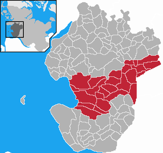
Mitteldithmarschen is an Amt in the district of Dithmarschen, in Schleswig-Holstein, Germany. Its seat is in Meldorf. It was formed on 25 May 2008 from the former Ämter Kirchspielslandgemeinde Albersdorf, Kirchspielslandgemeinde Meldorf-Land and the town Meldorf.
Bayé is a town in the Solenzo Department of Banwa Province in western Burkina Faso. As of 2005 it had a population of 5,478.

The Tuross River, an open semi-mature wave dominated barrier estuary or perennial stream, is located in the South Coast region of New South Wales, Australia.
The Jensen Nunataks are a cluster of isolated nunataks in the interior of southern Palmer Land, Antarctica, about 28 nautical miles (50 km) northeast of Mount Vang. They were mapped by the United States Geological Survey from surveys and U.S. Navy air photos, 1961–67, and named by the Advisory Committee on Antarctic Names for Curtis M. Jensen, a glaciologist at Byrd Station in summer 1965–66.
Litz Glacier is a glacier flowing northeast from the vicinity of Smith Peak and Litz Bluff in north-central Thurston Island, Antarctica. The glacier enters the west part of Peale Inlet north of the Guy Peaks. It was named by the Advisory Committee on Antarctic Names after A.K. Litz, Chief Photographer's Mate in the Eastern Group of Operation Highjump, which obtained aerial photographs of this glacier and adjacent coastal areas, 1946–47.
Cape Little is a cape at the eastern extremity of the peninsula between Wright Inlet and Keller Inlet, on the east coast of Palmer Land, Antarctica. It was probably seen from the air by members of the United States Antarctic Service who photographed Wright Inlet in December 1940. The cape was photographed from the air during 1947 by the Ronne Antarctic Research Expedition (RARE) under Finn Ronne, who in conjunction with the Falkland Islands Dependencies Survey charted it from the ground. It was named by Ronne for Delbert M. Little, Assistant Chief for Operations, U.S. Weather Bureau, who arranged the program for sending weather reports from the RARE.
Rexford Glacier is a glacier flowing northeast into the head of Wagoner Inlet on the north side of Thurston Island. Named by Advisory Committee on Antarctic Names (US-ACAN) after Aviation Radioman Phillip W. Rexford, PBM Mariner aircrewman in the Eastern Group of U.S. Navy Operation Highjump, which obtained aerial photographs of this glacier and adjoining coastal areas, 1946–47.
Mustafabeyli is a town in Ceyhan district of Adana Province, Turkey. It is on the highway D.400 near the intersection D.817 at 37°05′N36°04′E. The distance to Ceyhan is 27 kilometres (17 mi). The population of the town is 1856 as of 2015.