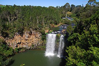
Goulburn River, a perennial river of the Hunter River catchment, is located in the Upper Hunter region of New South Wales, Australia.
The Billabong Creek, a perennial river of the Murrumbidgee catchment within the Murray-Darling basin, is located in the South West Slopes region of New South Wales, Australia.

Tandora County is one of the 141 Cadastral divisions of New South Wales. It is located to the north west of the Darling River, to the area to the north Menindee.
The Nowlands Creek, a watercourse of the Clarence River catchment, is located in the Northern Tablelands region in the state of New South Wales, Australia.

The Wadbilliga River is a perennial stream of the Tuross River catchment that is located in the South Coast region of New South Wales, Australia.

Bielsdown River, a perennial stream that is part of the Clarence River catchment, is located in the Northern Tablelands of New South Wales, Australia.
The Little River, a watercourse that is part of the Hawkesbury-Nepean catchment, is located in the Southern Highlands region of New South Wales, Australia.

The Shannon Brook, a perennial stream of the Richmond River catchment, is located in Northern Rivers region in the state of New South Wales, Australia.
The Clouds Creek, a perennial stream that is part of the Clarence River catchment, is located in the Northern Tablelands region of New South Wales, Australia.
The Christmas Creek, a perennial stream that is part of the Macleay River catchment, is located in the Mid North Coast region of New South Wales, Australia.

Ourimbah Creek, a perennial river of the Central Coast catchment, is located in the Central Coast region of New South Wales, Australia.
The Du Faur Creek, a perennial stream of the Hawkesbury-Nepean catchment, is located in the Blue Mountains region of New South Wales, Australia.

The Balgalal Creek, a mostly–perennial river that is part of the Lachlan sub-catchment of the Murrumbidgee catchment within the Murray–Darling basin, is located in the South West Slopes region of New South Wales, Australia.

The Cowriga Creek, a mostly–perennial river that is part of the Lachlan sub-catchment of the Murrumbidgee catchment within the Murray–Darling basin, is located in the Central West region of New South Wales, Australia.
Tando is a village in Dagestan, Russia.
Little Topar is a village on the Barrier Highway in Western New South Wales, between Broken Hill and Wilcannia, New South Wales.

Hume Parish, New South Wales is a remote rural locality of Central Darling Shire and civil parish of Tandora County in far West New South Wales. The Parish is located at 32°18′43″S 142°22′37″E on Lake Menindee, on the out-skirts of Menindee township.
Worungil, New South Wales is a remote rural locality and civil parish of Tandora County in far West New South Wales. Worungil is located at 31°43′42″S 142°32′56″E on the Barrier Highway east of Broken Hill.

Tandora is a rural locality in the Fraser Coast Region, Queensland, Australia. In the 2016 census, Tandora had a population of 11 people.


