Brabourne is a village and civil parish in the Ashford district of Kent, England. The village centre is 4.5 miles (7.2 km) east of Ashford town centre. The population fell by 133 between 2001 and 2011.

Glimmen is a village in the northeastern Netherlands. It is located in the municipality of Haren, Groningen, at about 10 kilometres from the city of Groningen. It had a population of around 1,065 in January 2017. The river Drentsche Aa flows past the village, nearby the Huis te Glimmen, a stately home on the site of a medieval castle.

Călinești is a commune in Argeș County, in southern central Romania. It is composed of twelve villages: Călinești, Ciocănești, Cârstieni, Glodu, Gorganu, Radu Negru, Râncăciov, Udeni-Zăvoi, Urlucea, Valea Corbului, Văleni-Podgoria and Vrănești.
Gorbacze is a village in the administrative district of Gmina Michałowo, within Białystok County, Podlaskie Voivodeship, in north-eastern Poland, close to the border with Belarus.

Mirəşelli is a village in the Agdam Rayon of Azerbaijan. The village forms part of the municipality of Əhmədağalı.
Sarıdaş is a village in the Kalbajar Rayon of Azerbaijan.
Nerkin Qlıçbağ is a village in the Khojali Rayon of Azerbaijan.
Mozkənd is a village in the Kalbajar Rayon of Azerbaijan.

Czernica is a village in the administrative district of Gmina Staszów, within Staszów County, Świętokrzyskie Voivodeship, in south-central Poland. It lies approximately 6 kilometres (4 mi) north of Staszów and 48 km (30 mi) south-east of the regional capital Kielce.
Nowa Ostrołęka is a village in the administrative district of Gmina Warka, within Grójec County, Masovian Voivodeship, in east-central Poland.
Górzyn is a village in the administrative district of Gmina Lubsko, within Żary County, Lubusz Voivodeship, in western Poland. It lies approximately 6 kilometres (4 mi) north of Lubsko, 25 km (16 mi) north-west of Żary, and 39 km (24 mi) west of Zielona Góra.
Huta is a village in the administrative district of Gmina Brusy, within Chojnice County, Pomeranian Voivodeship, in northern Poland. It lies approximately 8 kilometres (5 mi) south-east of Brusy, 26 km (16 mi) north-east of Chojnice, and 78 km (48 mi) south-west of the regional capital Gdańsk.
Łąg is a village in the administrative district of Gmina Czersk, within Chojnice County, Pomeranian Voivodeship, in northern Poland. It lies approximately 8 kilometres (5 mi) north-east of Czersk, 37 km (23 mi) north-east of Chojnice, and 71 km (44 mi) south-west of the regional capital Gdańsk.
Rowy is a village in the administrative district of Gmina Barciany, within Kętrzyn County, Warmian-Masurian Voivodeship, in northern Poland, close to the border with the Kaliningrad Oblast of Russia. It lies approximately 9 kilometres (6 mi) south of Barciany, 7 km (4 mi) north of Kętrzyn, and 70 km (43 mi) north-east of the regional capital Olsztyn.
Wólka Bagnowska is a village in the administrative district of Gmina Mrągowo, within Mrągowo County, Warmian-Masurian Voivodeship, in northern Poland. It lies approximately 7 kilometres (4 mi) south-west of Mrągowo and 48 km (30 mi) east of the regional capital Olsztyn.

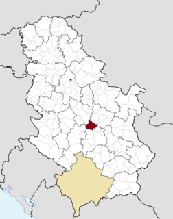
Jovine Livade is a village in the municipality of Prokuplje, Serbia. According to the 2002 census, the village has a population of 11 people.
Araski is a village in Tapa Parish, Lääne-Viru County, in northeastern Estonia.

Dafen station is a station on Line 3 of the Shenzhen Metro. It opened on 28 December 2010. It is located on Shenhui Road near Kangda'er Garden and Dafen Oil Painting Village.

Pambak kayaranin kits is a village in the Lori Province of Armenia.
Kastornoye is an urban locality and the administrative center of Kastorensky District of Kursk Oblast, Russia. Population: 3,848 (2010 Census); 4,492 (2002 Census); 4,562 (1989 Census). Telephone code: +7 47157; postal code: 306700.