
Ringforts, ring forts or ring fortresses are circular fortified settlements that were mostly built during the Bronze Age up to about the year 1000. They are found in Northern Europe, especially in Ireland. There are also many in South Wales and in Cornwall, where they are called rounds. Ringforts come in many sizes and may be made of stone or earth. Earthen ringforts would have been marked by a circular rampart, often with a stakewall. Both stone and earthen ringforts would generally have had at least one building inside.

Ratoath is a village in County Meath, Ireland. A branch of the Broad Meadow Water flows through the town. The R125 and R155 roads meet in the village. At the 2016 census, there were 9,533 people living in Ratoath.

Rathmore is a small town in Kerry, Ireland, lying immediately west of the border with Cork. Rathmore is divided into two parts, one being the main commercial centre, and the other being the administrative centre where the schools and churches are located which is colloquially known as Rath Beg. It lies at the heart of the Sliabh Luachra area known for its traditional Irish music and culture. The local GAA club is Rathmore GAA. The SAG is in Rathmore and helps the elderly in the area. The town host the farmer's market every Saturday in the community centre.

The villages of Killucan and Rathwire are co-located in the east of County Westmeath, Ireland. They have a combined population of 1,370 according to the 2016 census. Killucan is on the R156 road about 15 km (9.3 mi) from Mullingar and 60 km (37 mi) from Dublin.
Raharney is a village in east County Westmeath, Ireland. It has a population of 221 according to the 2016 census.
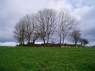
Brickeens is a very small townland in County Longford, Ireland. It is about five kilometres north of Keenagh and eight kilometres south of Longford town. Brickeens townland has an area of approximately 146 acres (0.2 sq mi), and had a population of 21 people as of the 2011 census. Evidence of ancient settlement in the townland include two ringforts.
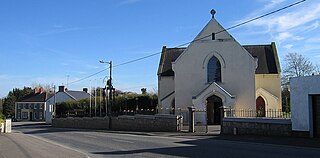
Rath is a hamlet in the south west area of County Offaly, Ireland. The hamlet is located midway between the towns of Birr and Kilcormac on a northeast-southwest country road. It is located in the parish of Eglish and Drumcullen which is in the Roman Catholic Diocese of Meath. The hamlet has a number of local amenities for the local population including a church, a national school, a local community centre and a local shop. Drumcullen GAA is the local GAA club and is located about half a kilometre to the south of the hamlet.
Coorlaghan Ringfort is a ringfort (rath) and National Monument located in County Laois, Ireland.
Aghnahily Ringfort is a ringfort (rath) and National Monument located in County Laois, Ireland.
The Aghaward fort is a ringfort (rath) and National Monument located in County Longford, Ireland.
Larkfield fort is a ringfort (rath) and National Monument located in County Longford, Ireland. On the Record of Monuments and Places it bears the code LF006-021----.
Sonnagh fort is a ringfort (rath) and National Monument located in County Longford, Ireland.
Cabragh Ringfort is a ringfort (rath) and National Monument located in County Cavan, Ireland.
Errigal Ringfort, also called Fort William, is a ringfort (rath) and National Monument located in County Cavan, Ireland.
Lisnagowan Ringfort is a ringfort (rath) and National Monument located in County Cavan, Ireland.
Rathealy Ringfort is a ringfort (rath) and National Monument located in County Kilkenny, Ireland.
Drummin fort is a ringfort and National Monument located in County Roscommon, Ireland.
Carnagh West Ringfort is a ringfort and National Monument located in County Roscommon, Ireland.
Rathsoony is a ringfort and National Monument located in County Galway, Ireland.
Cahervagliar is a ringfort (rath) and National Monument (#233) located in County Cork, Ireland.
