Related Research Articles

The North Western Railway is one of 19 railway zones in India. It is headquartered at Jaipur, Rajasthan and has 59,075+ employees, 658+ stations and a route length of more than 5,761 kilometres (3,580 mi) across the states of Rajasthan, Gujarat, Punjab and Haryana. NWR operates international rail service Thar Express from Jodhpur to Karachi. This zone is the key enabler of the Delhi–Mumbai Industrial Corridor Project by virtue of running railways 1,500 km long Western Dedicated Freight Corridor.
The Chambal River is a tributary of the Yamuna River in Central and Northern India, and thus forms part of the drainage system of the Ganges. The river flows north-northeast through Madhya Pradesh, running for a time through Rajasthan then forming the boundary between Rajasthan and Madhya Pradesh before turning southeast to join the Yamuna in Uttar Pradesh state.
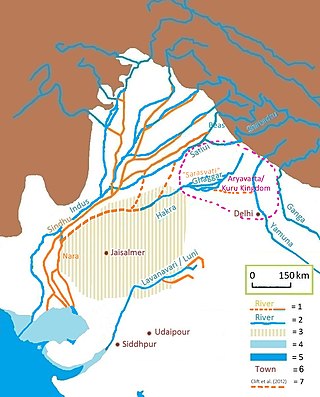
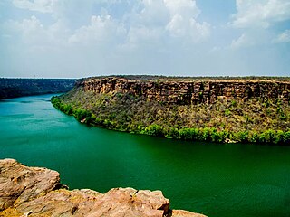
The Luni is the largest river in the Thar Desert of northwest India. It originates in the Pushkar valley of the Aravalli Range, near Ajmer, passes through the southeastern portion of the Thar Desert, and ends in the marshy lands of Rann of Kutch in Gujarat, after travelling a distance of 495 km (308 mi). It is first known as Sagarmati, then after passing Govindgarh, it meets its tributary Sarasvati, which originates from Pushkar Lake and from then on it is called Luni.

Pali district is a district in Rajasthan, India. The city of Pali is its administrative headquarters.

Nagaur District is one of the 50 districts of the state of Rajasthan in western India. Panchayati Raj was introduced here. It is the fifth largest district in Rajasthan and the area of the district is 17,718 km2 (6,841 sq mi). The city of Nagaur is the district headquarters.

Jodhpur District is a district in the State of Rajasthan in western India. The city of Jodhpur is the administrative headquarters of the district.
Sirohi District is a district of Rajasthan state in western India. The city of Sirohi is the district headquarters.
Arang, also known as "The town of temples" of Chhattisgarh, is a block and a Nagar Palika in Raipur District in the state of Chhattisgarh, India. It is situated near the eastern limits of Raipur City and close to Mahasamund City. Arang is an ancient town, which was ruled by the Haihayas Rajput dynasty. It is famous for its many Jain and Hindu temples which belong to the 11th and 12th centuries; these are the Mand Deval Jain temple, the Mahamaya temple, the Panchmukhi temple and the Hanuman temple. Due to the Archaeological finds of a copper plate inscription dated to the Gupta Empire, known as the Arang Plate of Bhimasena II of the clan of Rajarsitulya, has established the town's ancient history as a Hindu and Jain religious centre, which was then under the rule of Hindu kings. The Mand Deval Jain temple is the most ancient of these temples dated to the 11th century where three huge images of Digambara tirthankaras are deified in the sanctum sanctorum; these are carved in black stone and polished.
Govindgarh is a census town in Jaipur district in the Indian state of Rajasthan.

Himachal Pradesh provides water to both the Indus and Ganges basins. The drainage systems of the region are the Chenab, the Ravi, the Beas, the Satluj and the Yamuna. These rivers are perennial and are fed by snow and rainfall. They are protected by an extensive cover of natural vegetation.
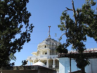
Raipur is a village in the Beawar district of the Indian state of Rajasthan, as well as the Tehsil headquarters. It is situated on the banks of the Luni river, and is locally famous for its Ganesha temple. There is a famous Ramdwara of Ramsnehi Sampradya.
The Bandi River, also known as the Hemawas River, is a significant river in the Pali District of Rajasthan, India. It is formed by the confluence of the Khari and Mithari Rivers near the Bombadra pickup weir. The river flows for approximately 45 km before merging with the Luni River near the village of Lakhar.
Jawai is a river originating in Udaipur district in Aravalli Ranges, a tributary of the Luni River.
Jamwa Ramgarh also popularly known as the Ramgarh, is a subdivision of the Jaipur district in Rajasthan, India. It is located on State Highway 55, about 28 kilometres (17 mi) East-North of Jaipur city. It was best known for Ramgarh Lake which is now dry.
Guhiya River is a small river in Pali District of Rajasthan, India. It is an intermittent stream running only during the monsoon season and is a tributary of the Luni River.
Mogra Kalan is a village in Luni tehsil of Jodhpur, India, near National Highway 62 the Pali to Jodhpur route in Rajasthan. The village is 18 kilometres (11 mi) from Jodhpur. The postal code is 342802. According to the 2011 census of India, the population of the village was 4,049 people.
Luni Assembly constituency is one of constituencies of Rajasthan Legislative Assembly in the Jodhpur. Senior Congress leader Ram Singh Bishnoi used contest election from this seat.
The Jojari River is a 83 km (52 mi) seasonal watercourse in Rajasthan, India. It primarily carries surplus rainwater from the hills near Poondloo village in Nagaur district. Flowing in a north-east to south-west direction, it gathers water from multiple smaller streams along its path, ultimately converging with the Luni River near Khejalda Khurd in Jodhpur district. This river is a tributary of Luni river. The Jojari basin is located between latitudes 26 07 and 26 43 and longitudes 73 08 and 74 00.
References
- ↑ Chouhan, T. S.; Joshi, K. N. (1992). Readings in Remote Sensing Applications. Scientific Publishers. pp. 22, 24, 26. ISBN 978-81-7233-040-8.
- ↑ Misra, Virendra N. (2007). Rajasthan: Prehistoric and Early Historic Foundations. Aryan Books International. pp. 15, 66, 437. ISBN 978-81-7305-321-4.
26°10′N73°44′E / 26.167°N 73.733°E