Rajpur, Buxar

Last updated

Rajpur
Rājpur
village
Rajpur block map (Buxar).png
Map of Rajpur in Rajpur block
India Bihar location map.svg
Red pog.svg
Rajpur
Location in Buxar, Bihar, India
Coordinates: 25°23′37″N83°54′12″E / 25.39373°N 83.90345°E / 25.39373; 83.90345 [1]
CountryFlag of India.svg India
State Bihar
District Buxar
Area
[2]
  Total6.11 km2 (2.36 sq mi)
Elevation
[1]
75 m (246 ft)
Population
 (2011) [2]
  Total5,188
  Density850/km2 (2,200/sq mi)
Languages
  Official Hindi
  Local Bhojpuri
Time zone UTC+5:30 (IST)

Rajpur is a village and corresponding community development block in Buxar district of Bihar, India.

Contents

As of 2011, the population of Rajpur was 5,188, in 611 households, while the total population of Rajpur block was 213,534, in 32,976 households. [2]

Demographics

Historical population
YearPop.±%
2001 166,556    
2011 213,534+28.2%
Source: 2011 Census of India [2]

Rajpur is an entirely rural block, with no major urban centres. The sex ratio of the block was 925 as of 2011, slightly higher than the district ratio of 922. The sex ratio in the 0-6 age group was 953, higher than the district ratio of 934. Members of scheduled castes made up 19.43% of the block population, the highest proportion among blocks in Buxar district, and members of scheduled tribes made up 0.31%. The literacy rate of Rajpur block was 70.11%, compared to the district rate of 70.14%, with 80.50% of men and 58.8% of women able to read and write. [2]

Employment

A majority of workers in Rajpur block worked in agriculture as of 2011, with 26.69% of workers being cultivators who owned or leased their own land and 60.01% being agricultural labourers who worked someone else's land for wages. 2.59% of workers were household industry workers, and the remaining 10.71% were other workers. [2]

Villages

There are 236 villages in Rajpur block, 176 of which are inhabited and 60 of which are uninhabited. [2]

Village nameTotal land area (hectares)Population (in 2011)
Bamhani1341,217
Bharkhara1581,037
Masarhia168278
Dhanaipur62349
Taranpur46829
Uttampur 2032,017
Bahrampur710
Rajpur(Block Headquarters)6115,188
Rupapokhar811,265
Makhduman480
Makuriya73126
Bhaluha46884
Trilochanpur49253
Saraon74483
Raghunathpur871,009
Shahpur530
Nagpur 2583,020
Gaidhara1011,826
Bharatpur Paranpur1040
Kharika135579
Parmanandpur27143
Soni117895
Mani6595
Pipra62382
Jairampur350
Kajariya1251,407
Halka Hankarpur420
Intwa2841,025
Ismailpur510
Mangraon 2023,492
Sansarpur320
Kathaja110688
Pankhipur470
Ghurahupur400
Pandepur690
Asraypur200
Sagrawan 3772,642
Khilla560
Barupur1291,789
Marahi142768
Malahipur50478
Utari1461,329
Gajarahi76301
Rauni1901,976
Basantpur980
Lugra Sugra81380
Saitapur79295
Jaipura71942
Chhotki Puraini120999
Barki Puraini125930
Kanpura680
Jamauli 2253,791
Jogapur300
Saithu110971
Anpura290
Dewarhiya 4385,386
Hankarpur204.41,456
Khiri 8206,164
Birbalpur40311
Konauli 246.92,318
Chhitan Dehra91352
Bhagwanpur48.2826
Mage Dehri174724
Karanpur90
Siri Kantpur91604
Akbarpur247.71,933
Basahi 3102,013
Dharmagatpur3128
Sugahar1621,167
Orwar167839
Mahadewpur53271
Jamuni Dehri83520
Chhitan Dehra191774
Rasen Kalan 1772,509
Kishunipur540
Shahbazpur45378
Chaubepur210
Ahiyapur92409
Saikuwa68780
Jalhara Talas88357
Jalhara1271,588
Narayanpur240
Tirkalpur53852
Tiara 2854,725
Baghelwa87933
Manoharpur1391,955
Dastepur300
Makundpur60354
Sakhuana1501,618
Akaurhi171923
Chandpur170
Bahuwara1501,345
Deopur400
Mahes Dehra600
Rasen Khurd81.71,299
Chandpur87367
Hinganpur Satgharwa18.20
Sugra160
Mohrihan67765
Mohrihan49844
Khempur71214
Balmikpur2145
Panapur90
Shyampur62530
Chhatauna 1162,021
Isarpur680
Parbat Chak411,111
Bisambharpur550
Baikunthpur240
Dadura1471,469
Chintamanpur68189
Harpur 4182,799
Ismailpur122709
Kanehri 4092,259
Manipur150
Piprarh4501,747
Lodipur720
Khanpur Mafi1122
Khanpur70497
Banni 3124,661
Madhubani58876
Dhobahi471,093
Raghunathpur46345
Ranni430
Tajpur92175
Bharkhara 2063,210
Dayalpur240
Bhikhanpur43261
Narayanpur330
Kataria2861,916
Sisrarh 3402,721
Kishunipur22469
Hethua 6513,329
Chaubepur39268
Gyani Chak91306
Naniaura146764
Mangopur117317
Ekdar106677
Pasipur1000
Tikaura530
Bijauli136938
Repura720
Hirapur290
Ganj Shakari540
Tikaitpur4727
Jamupur1080
Dehria7789
Dariyapur49658
Ahladpur42.40
Kakaria1761,480
Khemrajpur49215
Kailakh213668
Amarpur 2112,663
Sukhapur39136
Mohanpur871,111
Karaila591,316
Chakia89617
Ramdhanpur48.3320
Sisaudha 3802,241
Katharai77594
Jalalpur 842,372
Gadaipur830
Dhansoi 5098,088
Banauwa770
Piyare Chak51.8118
Kharaunia1061,310
Matukpur470
Chacharia871,030
Kharhana 2652,658
Lalu Chak68465
Sitabpur120412
Deyalpur110.1822
Kunrwa68.8256
Maksudanchak160
Gangapur63438
Rampur89712
Jagal Chak150
Gogaura131484
Bhagwanpur490
Manjit Chak16774
Gogahi149906
Chhatupur641,040
Samahuta 1702,439
Sarae Kans8347
Mobarakpur31242
Patkhaulia1651,786
Udhopur Kita Doem3.10
Udhopur Kita Seum20
Udhopur Kita Checharum07
Atraulia102.7358
Itarhia 3122,320
Karma1641,604
Kharaunia72347
Hajipur15.9175
Birna1441,135
Indapur63422
Ratan Chak41.90
Bansi Chak44.20
Jagmanpur73422
Udhopur Kita Awal31373
Moharihan2021,488
Khochrihan1491,363
Dharanipur83.2265
Manian1311,226
Narayanpur79331
Bamhnaulia41.4688
Matukipur 1392,273
Lala Chak69759
Jiwapur47779
Gobardhanpur81.3440
Bishunpur52.6115
Semaria113743
Kathrai301.41,842
Kusahi123762
Patej99569
Babanbandh Manrajgir431,023
Babanbandh Gauri132218
Manikpur88465
Manikpur1151,376
Khoraitha 2842,259
Sarayan101483
Kaithahar Kalan 4353,313
Chaubepur32.40
Atraulia240
Kalupur350
Parsia 2253,025
Lakhma2773
Kanhupur79481
Dulpha 1882,393
Mandanchaura23.20
Shankarpur12.80
Dulphi42.90
Sujayatpur 2472,314
Sikathi 5153,874
Kaithahar Khurd 3143,194
Khadar65.60

Related Research Articles

<span class="mw-page-title-main">Chausa</span> Town in Bihar, India

Chausa is a village and corresponding community development block in Buxar district, Bihar, India. It is located 11 km west of the district headquarters, Buxar, on the bank of the river Ganga. As of 2011, the population of the village of Chausa was 9,011, in 1,362 households, while the total block population was 103,670, in 15,817 households.

<span class="mw-page-title-main">Nokha, Rohtas</span> Town in Bihar, India

Nokha is a nagar panchayat town and corresponding community development block in Rohtas district in the Indian state of Bihar. As of 2011, the population of the town of Nokha was 27,302 in 4,381 households. The rural population of Nokha block was 146,025, thus bringing the total block population 173,327. The economic situation of this region is mainly dependent on parboiled rice processed by number of rice mills in this area.

<span class="mw-page-title-main">Nawanagar, Bihar</span> Village in Bihar

Nawanagar is a village and corresponding community development block situated in the Buxar district of Bihar, India, and one of the developing settlements of the district. It is one of several minor villages governed and administered by the Nawanagar panchayat. The village has the only chauki among other nearby villages. Nawangar is one of the seven blocks making up the Dumraon sub-division.
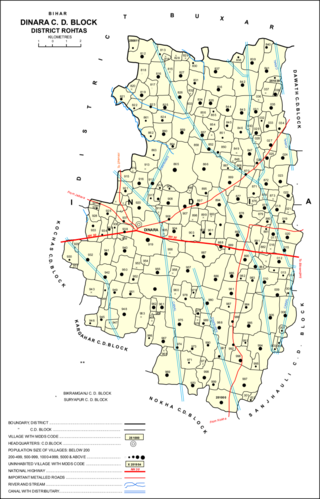
<span class="mw-page-title-main">Dinara, Bihar</span> Village in Bihar, India

Dinara is a big village market in Rohtas district, Bihar, India, near the National Highway 30. The birthplace of the famous poet Dariya Saheb is just 5 km from Dinara.
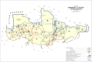
<span class="mw-page-title-main">Barhara</span> Village in Bihar, India

Barhara, also spelled Badahar, Barahara, or Barahra, is a village and corresponding community development block in Bhojpur District of Bihar, India. It is situated on the bank of the river Ganges. By the time of July–August most of the villages under this block are affected by deluge. As of 2011, its population was 6,889, in 927 households, while the total block population was 240,636, in 35,185 households.

<span class="mw-page-title-main">Rajpur, Rohtas</span> Village in Bihar, India

Rajpur is a village and corresponding community development block in Rohtas district of Bihar, India. As of 2011, the village of Rajpur had a population of 11,780, in 1,778 households, while Rajpur block had a population of 75,213.

<span class="mw-page-title-main">Kargahar</span> Village in Bihar, India

Kargahar is a village and corresponding community development block in Rohtas district of Bihar, India. As of 2011, the population of Kargahar was 10,170, in 1,464 households, while the population of Kargahar block was 225,082, in 31,528 households. The nearest city is Sasaram, the district headquarters.

<span class="mw-page-title-main">Kesath, Buxar</span> Village in Bihar, India

Kesath is a village and corresponding community development block in Buxar district of Bihar, India. It is the least populous of Buxar's 11 blocks, with a population of 33,820, in 5,304 households. The population of Kesath itself is 14,843, in 2,351 households.
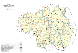
<span class="mw-page-title-main">Itarhi, Buxar</span> Village in Bihar, India

Itarhi is a Nagar Panchayat and corresponding community development block in Buxar district of Bihar, India. According to the 2011 Census of India, its population is 10,275, in 1,711 households, while the total block population is 170,629, in 25,557 households.

<span class="mw-page-title-main">Chaugain, Buxar</span> Village in Bihar, India

Chaugain is a village and corresponding community development block in Buxar district of Bihar, India.

<span class="mw-page-title-main">Chakki, Buxar</span> Village in Bihar, India

Chakki, also Charkhi, is a village and corresponding community development block in Buxar district of Bihar, India.

<span class="mw-page-title-main">Simri, Buxar</span> Village in Bihar, India

Simri is a village and corresponding community development block in Buxar district of Bihar, India.
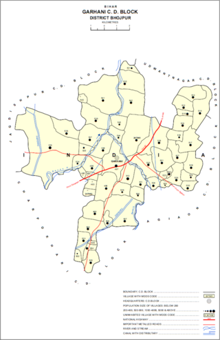
<span class="mw-page-title-main">Garhani</span> Village in Bihar, India

Garhani is a village and corresponding community development block in Bhojpur district of Bihar, India. As of 2011, its population was 5,597, in 959 households. The total block population was 103,262, in 16,427 households.

<span class="mw-page-title-main">Udwantnagar</span> Village in Bihar, India

Udwantnagar is a village and corresponding community development block in Bhojpur district of Bihar, India. As of 2011, its population was 9,000, in 1,496 households. The total block population was 157,809, in 24,336 households.

<span class="mw-page-title-main">Charpokhari</span> Village in Bihar, India

Charpokhari is a village and corresponding community development block in Bhojpur district of Bihar, India. As of 2011, its population was 1,874, in 314 households. The total block population was 101,363, in 15,961 households.
<span class="mw-page-title-main">Tarari, Bihar</span> Village in Bihar, India

Tarari is a village and corresponding community development block in Bhojpur district of Bihar, India. As of 2011, its population was 3,586, in 393 households. The total block population was 182,631, in 28,316 households.

<span class="mw-page-title-main">Agiaon</span> Village in Bihar, India

Agiaon is a village and corresponding community development block in Bhojpur district of Bihar, India. As of 2011, its population was 4,801, in 835 households. The total block population was 148,373, in 23,117 households.

<span class="mw-page-title-main">Sandesh, Bihar</span> Indian village in Bhojpur district, Bihar

Sandesh is a village and corresponding community development block in Bhojpur district of Bihar, India. As of 2011, its population was 6,874, in 1,037 households. The total block population was 109,712, in 17,011 households.

Nuaon, also spelled Noawan or Noan, is a village and corresponding community development block in Kaimur district of Bihar, India. As of 2011, its population was 5,292, in 798 households, while the overall block population was 106,530, in 15,263 households.

Rampur is a village and community development block in Kaimur district of Bihar, India. As of 2011, it had a population of 575, in 94 households. The total block population was 88,876, in 14,110 households.

References

  1. 1 2 "Geonames.org. Rājpur" . Retrieved 12 July 2020.
  2. 1 2 3 4 5 6 7 "Census of India 2011: Bihar District Census Handbook - Buxar, Part A (Village and Town Directory)". Census 2011 India. pp. 19–20, 23–98, 446–549, 681–82, 730–746. Retrieved 11 July 2020.