
In the 2011 census, Nepal's population was approximately 26 million people with a population growth rate of 1.35% and a median age of 21.6 years. In 2016, the female median age was approximately 25 years old and the male median age was approximately 22 years old. Only 4.4% of the population is estimated to be more than 65 years old, comprising 681,252 females and 597,628 males. 61% of the population is between 15 and 64 years old, and 34.6% is younger than 14 years. In 2011, the Birth rate is estimated to be 22.17 births per 1,000 people with an infant mortality rate of 46 deaths per 1,000 live births. Compared to the infant mortality rate in 2006 of 48 deaths per 1000 live births, the 2011 IMR is a slight decrease within that 5-year period. Infant mortality rate in Nepal is higher in rural regions at 44 deaths per 1000 live births, whereas in urban regions the IMR is lower at 40 deaths per 1000 live births. This difference is due to a lack of delivery assistance services in rural communities compared to their urban counterparts who have better access to hospitals and neonatal clinics. Life expectancy at birth is estimated to be 67.44 years for females and 64.94 years for males. The mortality rate is estimated to be 681 deaths per 100,000 people. Net migration rate is estimated to be 61 migrants per 100,000 people. According to the 2011 census, 65.9% of the total population is literate.

Nepal, officially the Federal Democratic Republic of Nepal, is a landlocked country in South Asia. It is mainly situated in the Himalayas, but also includes parts of the Indo-Gangetic Plain, bordering Tibet of China to the north, and India in the south, east, and west, while it is narrowly separated from Bangladesh by the Siliguri Corridor, and from Bhutan by the Indian state of Sikkim. Nepal has a diverse geography, including fertile plains, subalpine forested hills, and eight of the world's ten tallest mountains, including Mount Everest, the highest point on Earth. Nepal is a multi-ethnic, multi-lingual, multi-religious and multi-cultural state, with Nepali as the official language. Kathmandu is the nation's capital and the largest city.
Buddhism in Nepal started spreading since the reign of Ashoka through Indian and Tibetan missionaries. The Kiratas were the first people in Nepal who embraced Gautama Buddha’s teachings, followed by the Licchavis and Newar people. Buddha was born in Lumbini in the Shakya Kingdom. Lumbini is considered to lie in present-day Rupandehi District, Lumbini zone of Nepal. Buddhism is the second-largest religion in Nepal. According to 2001 census, 10.74% of Nepal's population practiced Buddhism, consisting mainly of Tibeto-Burman-speaking ethnicities, the Newar. However, in the 2011 census, Buddhists made up just 9% of the country's population.

Chhetri, historically called Kshettriya or Kshetriya or Khas are Nepali speakers of Khas community, some of whom trace their origin to migration from medieval India. Chhetri was a caste of administrators, governor and military elites in the medieval Khas Kingdom and Gorkha Kingdom. The nobility of the Gorkha Kingdom mainly originated from Chhetri families. They also had a strong presence in civil administration affairs. The bulk of prime ministers of Nepal before the democratization of Nepal belonged to this caste as a result of the old Gorkhali aristocracy. Gorkha-based aristocratic Chhetri families included the Pande dynasty, the Basnyat dynasty, the Thapa dynasty, and the Kunwars.

Jajarkot District a part of Karnali Province, is one of the seventy-seven districts of Nepal. The district, with Khalanga as its district headquarters, covers an area of 2,230 km2 (860 sq mi) and has a population of 171,304 in 2011 Nepal census.

Jhapa is a district of Province No. 1 in eastern Nepal named after a Rajbanshi word "Jhapa" meaning "to cover" (verb). The latest official data, the 2011 Nepal Census, puts the total population of the district at 812,650. The total area of the district is 1606 square kilometres.
Kailali District, a part of Sudurpashchim Province in Terai plain, is one of the 77 districts of Nepal. The district, with Dhangadhi as its district headquarters, covers an area of 3,235 square kilometres (1,249 sq mi) and has a population of 775,709.
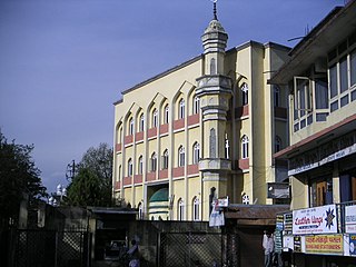
Islam is the third largest religion in Nepal. According to the 2011 Nepal census, approximately 1.164 million Muslims, comprising 4.2% of the population, live in Nepal.

Ethnic groups in Nepal are a product of both the colonial and state-building eras of Nepal. The groups are delineated using language, ethnic identity or the caste system in Nepal. They are categorized by common culture and endogamy. Endogamy carves out ethnic groups in Nepal.

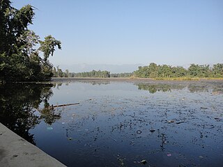
Damak, a city in eastern Nepal is one of the oldest municipalities in Jhapa District in Province No. 1 of Nepal. It is situated between the Ratuwa River in the east and the Maawa River in the west. It has Sivalik Hills in its north and ends with the intersection of Ratuwa River and Maawa River in the south. Mahendra Highway crosses this municipality nearly bisecting it. It is the largest city in Jhapa District as well as in Province No. 1 with a population of 75,743 in 2011 A.D

Nepalis, or Nepali people, also known as Nepa-mi, are the citizens of Nepal under the provisions of Nepali nationality law. The country is home to people of many different national origins. Nepali may also refer to non-citizen residents, dual citizens, and expatriates.

The 2011 National census lists 123 Nepalese languages spoken as a mother tongue in Nepal. The discovery of six additional languages since then brings the count to 129. Most belong to the Indo-Aryan and Sino-Tibetan language families.

A Village Development Committee (VDC) in Nepal was the lower administrative part of its Ministry of Federal Affairs and Local Development. Each district had several VDCs, similar to municipalities but with greater public-government interaction and administration. There were 3,157 village development committees in Nepal. Each VDC was further divided into several wards depending on the population of the district, the average being nine wards.
The 1991 Nepal census was a widespread national census conducted by the Nepal Central Bureau of Statistics.

Shivanagar is a town in Krishnanagar Municipality in Kapilvastu District in the Lumbini Zone of southern Nepal. The former VDC was merged to form the municipality established on 18 May 2014 Krishnanagar, Sirsihawa, Shivanagar VDCs. At the time of the 2011 Nepal census it had a population of 4,774 people living in 735 individual households.
Nepali Americans are Americans whose ethnic origins lie fully or partially in any part of Nepal. Their migration to the United States began in the 20th century, and they have been able to establish themselves as Americans. The history of immigration to America from Nepal is short in comparison to other South Asian ethnic groups.

Bahun or Khas Brahmin is a caste (Varna) among Khas people of Nepal. Their origins are from Indo-Aryans of Nepal and India. According to the 2011 Nepal census, Bahun is the second most populous group after Chhetri, another Varna within the same Khas ethnicity in Nepal.
Nepal conducted a widespread national census in 2011 by the Nepal Central Bureau of Statistics. Working with the 58 municipalities and the 3915 Village Development Committees at a district level, they recorded data from all the municipalities and villages of each district. The data included statistics on population size, households, sex and age distribution, place of birth, residence characteristics, literacy, marital status, religion, language spoken, caste/ethnic group, economically active population, education, number of children, employment status, and occupation.

Nepali is an Indo-Aryan language of the sub-branch of Eastern Pahari. It is the official language at the federal level in Nepal and one of the 22 scheduled languages of India due to the Nepalese community in the Northeast. Also known by the endonym Khas kura, the language is also called Nepalese, Gorkhali or Parbatiya in some contexts. It is spoken mainly in Nepal and by about a quarter of the population in Bhutan. In India, Nepali has official status in the state of Sikkim and in the Darjeeling District and Kalimpong district of West Bengal. It has a significant number of speakers in the states of Arunachal Pradesh, Assam, Himachal Pradesh, Manipur, Mizoram and Uttarakhand. It is also spoken in Myanmar and by the Nepali diaspora in the Middle East and worldwide. Nepali developed in proximity to a number of Indo-Aryan languages, most notably the other Pahari languages. Historically, Sanskrit is the most significant source of vocabulary for the Nepali language. According to exclusive phonological evidences observed by lexicographer Sir Ralph Turner, Nepali language is closely related to Punjabi, Lahnda, Hindi and Kumaoni while it appears to share some distinguishing features with the other Indo-Aryan languages like Rajasthani, Gujarati and Bangla. Ethnologist Brian Houghton Hodgson stated that the Khas or Parbattia language is an "Indian Prakrit" brought by colonies from south of the Nepalese hills, and the whole structure including the eigth-tenth portion of the vocabulary of it is "substantially Hindee".
Sundar Haraicha is a municipality in Morang District of Province No. 1 in Nepal that was established on 10 March 2017 by merging the former municipalities Sundar Dulari and Koshi Haraicha. At the time of the 2011 Nepal census, the localities formed had a joint population of 80,518 people living in 18,610 individual households.

