The topic of this article may not meet Wikipedia's general notability guideline .(January 2026) |
Randolph Street Bridge | |
|---|---|
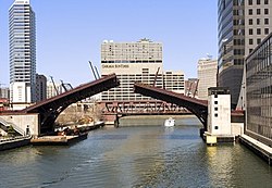
 The bridge in 2023 | |
| Coordinates | 41°53′4″N87°38′17″W / 41.88444°N 87.63806°W |
| Crosses | Chicago River |
| Locale | Chicago, Illinois, U.S. |
| Location | |
 Interactive map of Randolph Street Bridge | |
The Randolph Street Bridge is a bridge that crosses the Chicago River in downtown Chicago, Illinois. [1]