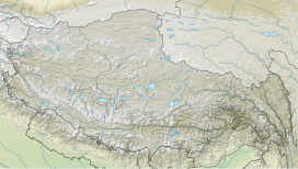
Kangchenjunga, also spelled Kanchenjunga, Kanchanjanghā and Khangchendzonga, is the third-highest mountain in the world. Its summit lies at 8,586 m (28,169 ft) in a section of the Himalayas, the Kangchenjunga Himal, which is bounded in the west by the Tamur River, in the north by the Lhonak River and Jongsang La, and in the east by the Teesta River. It lies in the border region between Nepal and Mangan district, Sikkim state of India, with three of the five peaks, namely Main, Central and South, directly on the border, and the peaks West and Kangbachen in Nepal's Taplejung District.

The Sangre de Cristo Range is a mountain range of the Rocky Mountains in southern Colorado in the United States, running north and south along the east side of the Rio Grande Rift. The mountains extend southeast from Poncha Pass for about 75 mi (121 km) through south-central Colorado to La Veta Pass, approximately 20 mi (32 km) west of Walsenburg, and form a high ridge separating the San Luis Valley on the west from the watershed of the Arkansas River on the east. The Sangre de Cristo Range rises over 7,000 ft (2,100 m) above the valleys and plains to the west and northeast.
Mount Nirvana, at 2,773 m (9,098 ft) is the unofficial name of the highest mountain in the Northwest Territories, Canada. Currently the Canadian government is working to officially recognize the name Thunder Mountain, reflecting the local Dehcho First Nation name for the mountain. Today, the name Mt. Nirvana is commonly depicted in alpine literature.

Mount Nebo is the southernmost and highest mountain in the Wasatch Range of Utah, in the United States, and the centerpiece of the Mount Nebo Wilderness, inside the Uinta National Forest. It is named after the biblical Mount Nebo, overlooking Israel from the east of the Jordan river, which is said to be the place of Moses' death.
The Waputik Range lies west of the upper Bow Valley, east of Bath Creek, and south of Balfour Creek in the Canadian Rockies. "Waputik" means "white goat" in Stoney. The range was named in 1884 by George Mercer Dawson of the Geological Survey of Canada. The President Range lies within the Waputik Range.

Great North Mountain is a 50-mile (80 km) long mountain ridge within the Ridge-and-valley Appalachians in the U.S. states of Virginia and West Virginia. The ridge is located west of the Shenandoah Valley and Massanutten Mountain in Virginia, and east of the Allegheny Mountains and Cacapon River in West Virginia.
The Southern Rocky Mountains are a major subregion of the Rocky Mountains of North America located in the southeastern portion of the U.S. state of Wyoming, the central and western portions of Colorado, the northern portion of New Mexico, and extreme eastern portions of Utah. The Southern Rocky Mountains are also commonly known as the Southern Rockies, and since the highest peaks are located in the State of Colorado, they are sometimes known as the Colorado Rockies, although many important ranges and peaks rise in the other three states. The Southern Rockies include the highest mountain ranges of the Rocky Mountains and include all 30 of the highest major peaks of the Rockies.
Doublet Peak is the sixth-highest peak in the U.S. state of Wyoming and the fifth-highest in the Wind River Range. The summit is immediately south of Dinwoody Glacier and just west of Mount Warren.

The MacIntyre Mountains or MacIntyre Range is a range of mountains in the High Peaks region of the Adirondacks, due west of Mount Marcy, in northeastern New York State. The range runs 8 miles (13 km) from southwest to northeast. Its sheer southwest slope makes up one side of Indian Pass, and a northeastern spur forms the cliffs of Avalanche Pass.

Kirat Chuli or Tent Peak is a mountain in the Himalayas. It lies on the border between Nepal and India.

Gimmigela Chuli, or The Twins, are two-peak mountains in the Himalayas, located on the border between Taplejung, Mechi, Nepal and Sikkim, India.
The Boise Mountains are a mountain range in the U.S. state of Idaho, spanning part of Boise and Sawtooth national forests. The highest point in the range is Two Point Mountain at an elevation of 10,124 feet (3,086 m) above sea level.
Lugula Himal is a mountain peak in the Himalayas, located on the border of North western region of Nepal and the Tibet Autonomous Region of China.
Pathibara is a mountain peak located on the border of Nepal and North Sikkim, India.

Thulagi Chuli is a mountain in Mansiri Himal, a high subrange of the Himalayas in north-central Nepal.