Related Research Articles

The Max Planck Institute for Mathematics is a prestigious research institute located in Bonn, Germany. It is named in honor of the German physicist Max Planck and forms part of the Max Planck Society (Max-Planck-Gesellschaft), an association of 84 institutes engaging in fundamental research in the arts and the sciences. The MPIM is the only Max Planck institute specializing in pure mathematics.
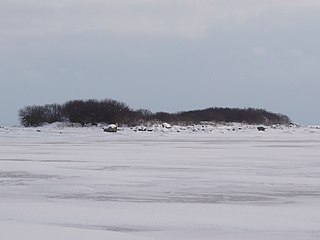
Hanerahu is an uninhabited Estonian islet with surface area of 1.2 hectares. It lies south-east of Hiiumaa island and is part of Pühalepa Municipality. The islet belongs to Hiiumaa Islets Landscape Reserve.
Cloudy is an unincorporated community located in Pushmataha County, Oklahoma, United States. It is 12 miles northeast of Rattan. Cloudy is located at 34°18′07″N95°16′52″W.
Folwark is a part of Dziecinów village, Gmina Sobienie-Jeziory, Poland.The population is near 120. From 1975 to 1998 this place was in Siedlce Voivodeship. It lies approximately 8 kilometres (5 mi) north of Sobienie-Jeziory, 14 km (9 mi) south of Otwock, and 32 km (20 mi) south-east of Warsaw.
Şaplar is a village in the Kalbajar District of Azerbaijan.
Yerfi is a village and municipality in the Quba Rayon of Azerbaijan. It has a population of 915. The municipality consists of the villages of Yerfi, Talış, Dərk, Qayadalı, and Nohurdüzü.
Niemiennica is a settlement in the administrative district of Gmina Dobiegniew, within Strzelce-Drezdenko County, Lubusz Voivodeship, in western Poland.
Góra is a village in the administrative district of Gmina Stara Kiszewa, within Kościerzyna County, Pomeranian Voivodeship, in northern Poland. It lies approximately 8 kilometres (5 mi) east of Stara Kiszewa, 25 km (16 mi) south-east of Kościerzyna, and 50 km (31 mi) south-west of the regional capital Gdańsk.
Cole Bay is a northern hamlet in Saskatchewan's northern boreal forest. It is located on the southern shore of Canoe Lake. The population in the Canada Census of 2011 was 230, an increase of 47.4% over 156 in 2006.
Paimala is a village in Saaremaa Parish, Saare County in western Estonia.
Vučak is a village in the municipality of Kruševac, Serbia. According to the 2002 census, the village has a population of 348 people.
Dupljane is a village in the municipality of Vladičin Han, Serbia. According to the 2002 census, the village has a population of 161 people.
Leipalingis Manor was a residential manor in Leipalingis, Lithuania. Only oficina remained until nowadays.
The Carrizo Creek and Carrizo Wash in California are a stream and an arroyo that the stream flows into, in San Diego County, California and Imperial County, California.
Chulio is an unincorporated community in Floyd County, in the U.S. state of Georgia.

Jaitpur State was a princely state in the Bundelkhand region. It was centered on Jaitpur, in present-day Mahoba district, Uttar Pradesh, which was the capital of the state. There were two forts in the area.
Stringtown is an unincorporated community in Washington Township, Ripley County, in the U.S. state of Indiana.
High Pines is an unincorporated community in Miami-Dade County, Florida. It borders the communities of South Miami, Coral Gables, and Ponce-Davis. High Pines is largely residential, however small strip malls can be found in some areas near the community's edge.

Fregata Island is the 480 m long in southeast-northwest direction and 230 m wide rocky island lying off the north coast of Nelson Island in the South Shetland Islands, Antarctica.

Sudarshan Parbat is a mountain of the Garhwal Himalaya in Uttarakhand India.The elevation of Sudarshan Parbat is 6,529 metres (21,421 ft) and its prominence is 456 metres (1,496 ft). It is joint 87th highest located entirely within the Uttrakhand. Nanda Devi, is the highest mountain in this category. Sudarshan Parbat lies 2.1 km south of Chaturbhuj 6,654 metres (21,831 ft) and 3.3 km west of Shyamvarn 6,135 metres (20,128 ft). Its nearest higher neighbor Chaturbhuj. It is located 3.7 km SW of Yogeshwar 6,678 metres (21,909 ft) and 9.9 km SW lies Manda I 6,511 metres (21,362 ft).
References
- ↑ "X-GIS(4) Portal". xgis.maaamet.ee. Retrieved 25 July 2021.

Coordinates: 59°05′54″N25°16′52″E / 59.09833°N 25.28111°E
| | This Harju County location article is a stub. You can help Wikipedia by expanding it. |