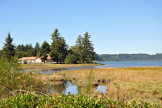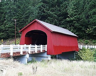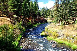
The Santiam River is a tributary of the Willamette River, about 12 miles (19 km) long, in western Oregon in the United States. Through its two principal tributaries, the North Santiam and the South Santiam rivers, it drains a large area of the Cascade Range at the eastern side of the Willamette Valley east of Salem and Corvallis.

The Umpqua River on the Pacific coast of Oregon in the United States is approximately 111 miles (179 km) long. One of the principal rivers of the Oregon Coast and known for bass and shad, the river drains an expansive network of valleys in the mountains west of the Cascade Range and south of the Willamette Valley, from which it is separated by the Calapooya Mountains. From its source northeast of Roseburg, the Umpqua flows northwest through the Oregon Coast Range and empties into the Pacific at Winchester Bay. The river and its tributaries flow entirely within Douglas County, which encompasses most of the watershed of the river from the Cascades to the coast. The "Hundred Valleys of the Umpqua" form the heart of the timber industry of southern Oregon, generally centered on Roseburg.

The Calapooia River is an 80-mile (130 km) tributary of the Willamette River in the U.S. state of Oregon.

The Alsea River flows 48.5 miles (78.1 km) from Alsea, an unincorporated community in the coastal mountains of the U.S. state of Oregon, to the Pacific Ocean near the city of Waldport. It begins at the confluence of the North Fork Alsea River and the South Fork Alsea River and ends in Alsea Bay, a wide estuary at Waldport. The river flows generally west-northwest in a winding course through the mountains of southern Benton and Lincoln counties, passing near the unincorporated community of Tidewater and through the Siuslaw National Forest. Its drainage basin extends into Lane County, along the headwaters of the South Fork Alsea River.

The Coast Fork Willamette River is one of two forks that unite to form the Willamette River in western Oregon in the United States. It is about 40 miles (64 km) long, draining an area of the mountains at the south end of the Willamette Valley south of Eugene.

The Burnt River is a 98-mile-long (158 km) tributary of the Snake River in eastern Oregon, United States. It enters the Snake near Huntington, Oregon, at a point upstream of the Powder River and downstream of the Malheur River, slightly more than 327 miles (526 km) from the Snake's confluence with the Columbia River. Draining 1,090 square miles (2,800 km2), it flows predominately west to east.

Fisher is an unincorporated community in rural Lincoln County, Oregon, United States. Fisher lies along Five Rivers Road, 9.2 miles (14.8 km) south of its intersection with Oregon Route 34. It is slightly north of the Lincoln–Lane county line in the Siuslaw National Forest. A stream called Five Rivers flows west through Fisher, about 12 miles (19 km) by water from the stream's mouth on the Alsea River. Route 34 runs along the Alsea River between Alsea and Waldport.

The North Fork John Day River is a 107-mile (172 km) tributary of the John Day River in the U.S. state of Oregon. It begins in Grant County about 20 miles (32 km) northwest of Baker City near the crest of the Blue Mountains. It flows generally west to the community of Dale on U.S. Route 395, then southwest through the city of Monument to the unincorporated community of Kimberly, where it meets the main stem of the John Day River.

Birch Creek is a 16-mile (26 km) tributary of the Umatilla River in eastern Oregon in the United States. It rises at the confluence of East and West Birch creeks south of Pilot Rock, Oregon, at the base of the Blue Mountains and flows north, slightly west of the city of Pendleton. It enters the Umatilla River about 49 miles (79 km) from the larger stream's confluence with the Columbia River.

Elkhorn Creek is a 7.6-mile (12 km) long stream in Marion County, Oregon, United States. Its source is on the northern edge of the Willamette National Forest, about 3.5 miles (5.6 km) north of Big Cliff Reservoir. The creek flows mostly west, receiving Big Twelve Creek, Buckhorn Creek, and Buck Creek all from the south, and it enters the Little North Santiam River just south of Elkhorn Woods Park, about 5 miles (8.0 km) north of the city of Gates. The stream's valley is surrounded by the western Cascade foothills, covered with coniferous trees characteristic of the Pacific Northwest, and lined with red alders at the water's edge. The creek supports runs of rainbow and coastal cutthroat trout, as well as Pacific giant salamanders. On September 30, 1996, a 6.4-mile (10.3 km) portion of the stream, from the mouth nearly to the source, was protected as part of the National Wild and Scenic Rivers System.

The Green River is a tributary of Five Rivers in the U.S. state of Oregon. It arises in the Siuslaw National Forest of the Central Oregon Coast Range and flows generally northeast to meet Five Rivers upstream of the rural community of Fisher. The confluence is about 15 miles (24 km) from the larger stream's confluence with the Alsea River. The Green River's named tributaries from source to mouth are the East Fork Green River and Ryan Creek.

The Whitewater River is a tributary of the Metolius River in the U.S. state of Oregon. It flows generally east from Whitewater Glacier on Mount Jefferson, west-southwest of Warm Springs in Jefferson County. The river descends from 7,847 feet (2,392 m) at the source to 2,218 feet (676 m) at the mouth. The stream lies entirely within the Warm Springs Indian Reservation.

Five Rivers is a tributary of the Alsea River in the U.S. state of Oregon, in Lane, Lincoln, Benton counties. The name Five Rivers refers to the relative importance to the stream of five of its tributaries: Alder, Cougar, Buck, Crab, and Cherry creeks.
Paris is an unincorporated community in Lane County, in the U.S. state of Oregon. It is a rural locale in the Central Oregon Coast Range north of the Siuslaw River and south of the Alsea River along one of its tributaries, Five Rivers. Paris is located at 44°15′09″N123°46′14″W.

Southworth Creek is a stream, about 5 miles (8 km) long, in Lincoln County, in the U.S. state of Oregon. It is a tributary of the Alsea River, which it enters upstream of Waldport and the Pacific Ocean. It flows north from the slopes of Burnt Timber Mountain to join the larger stream at an elevation of just 7 feet (2.1 m) above sea level.

The North Fork Alsea River is a 16-mile (26 km) tributary of the Alsea River in the U.S. state of Oregon. It begins at Klickitat Lake, fed by Klickitat and Lake creeks in the Central Oregon Coast Range, and flows generally south to near Alsea, where it joins the South Fork Alsea River to form the main stem. For most of its course, the North Fork winds through the Siuslaw National Forest in Lincoln County and then Benton County. It passes under Oregon Route 34 northeast of Alsea.

The South Fork Alsea River is a tributary of the Alsea River in the U.S. state of Oregon. It begins at northeast of Horton on the east side of the Central Oregon Coast Range and flows generally northwest to near Alsea. There it joins the North Fork Alsea River to form the main stem.

The East Fork Salmon River is a short tributary of the Salmon River in Clackamas County, in the U.S. state of Oregon. It begins on the southern slopes of Mount Hood at an elevation of about 4,300 feet (1,300 m) and flows generally southwest into the main stem at Red Top Meadow, slightly east of Trillium Lake. Its entire course lies within the Mount Hood National Forest. It has no named tributaries.

Drift Creek is a tributary, about 18 miles (29 km) long, of Siletz Bay in the U.S. state of Oregon. The creek begins near Stott Mountain in the Central Oregon Coast Range in Lincoln County and follows a winding course generally west through the Siuslaw National Forest to enter the bay south of Lincoln City on the Pacific Ocean. It passes under U.S. Route 101 just before reaching the bay.


