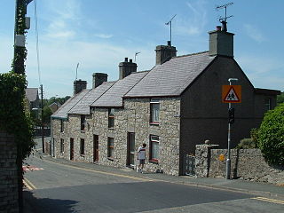
Pentraeth is a village and community on the island of Anglesey, North Wales, at grid reference SH523786. The Royal Mail postcode begins LL75. The community population taken at the 2011 census was 1,178. The village itself having a population of 557.

Benllech is a village on the Isle of Anglesey in Wales. It is in the community of Llanfair-Mathafarn-Eithaf, which has a population of 3,382. The name of Benllech village had been removed by the time of the 2011 census with the community being listed under Llanfair-Mathafarn-Eithaf with the electoral ward being listed under Llanddyfnan.

Rhosneigr is a village in the south-west of Anglesey, north Wales. It is situated on the A4080 road. It is south-east of Holyhead, and is on the Anglesey Coastal Path. From the clock at the centre of the village can be seen RAF Valley and Mynydd Twr. The towns of Holyhead and Llangefni and the city of Bangor are all within easy travelling distance.
The Anglesey Football League was a football league in Anglesey, Wales, and was equivalent to the sixth level of the Welsh football league system in North Wales. The champions were promoted to the Gwynedd League.

Seiriol was an early 6th-century saint, who created a cell at Penmon Priory on Anglesey, off the coast of north Wales. He later moved to Ynys Seiriol.
Dulas Bay is a small bay on the north east coast of Anglesey, north Wales, forming the boundary between Llaneilian and Moelfre communities. The bay is bordered by three beaches.
The Anglesey Coastal Path is a 200-kilometre (124 mi) long-distance footpath around the island of Anglesey in North Wales. The route is part of the Wales Coast Path.

The A5025 is an 'A' road that runs from Llanfairpwllgwyngyll to Valley in Anglesey, Wales. A major road around the north coast of the isle, it runs up the east, north and finally north-west side of the island via several places including Benllech and Amlwch. In all the road is 33.1 miles (53.3 km) long.
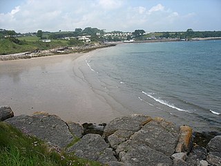
Traeth Bychan is a beach on the isle of Anglesey, Wales.
The Red Wharf Bay branch line was a standard gauge railway line in Anglesey, Wales, a branch off the Anglesey Central Railway. It opened fully in 1909, but closed to passengers in September 1930. Freight operations continued until 3 April 1950, and the tracks were lifted during the summer of 1953.

The Isle of Anglesey is a county off the north-west coast of Wales. It is named after the island of Anglesey, which makes up 94% of its area, but also includes Holy Island and some islets and skerries. The county borders Gwynedd across the Menai Strait to the southeast, and is otherwise surrounded by the Irish Sea. Holyhead is the largest town, and the administrative centre is Llangefni. The county is part of the preserved county of Gwynedd.

Ceint railway station was a station in Anglesey, Wales situated on the Red Wharf Bay branch line between Holland Arms and Benllech. It was the first station after the line branched from the main Anglesey Central Railway. Opening in 1908 it was a very simple station with only one short 60 ft (18 m) platform on the Up (south-east) side and a wooden waiting hut. It was an unstaffed request stop with neither goods yard nor sidings. Ordnance Survey maps show that this, along with the station next on the line Rhyd-y-Saint are two of the most remote on the island.
Pentraeth railway station was situated on the Red Wharf Bay branch line between Holland Arms railway station and Benllech, the third station after the line branched from the main Anglesey Central Railway. Opening on 1 July 1908, a quarter of a mile out of the village it was one of the two largest stations on the line. On the Up (east) side of the line stood the 120 ft (37 m) platform with several associated huts. Unlike the previous two stations Ceint and Rhyd-y-Saint this was staffed, albeit by a maximum of two people at any one time. There was also a small goods yard just south of the platform. It was also the nearest station for the town of Beaumaris.
Llaneugrad is a community in Anglesey, Wales. It is located on the east coast of the island, 7.2 miles (11.6 km) south east of Amlwch, 9.8 miles (15.8 km) north west of Menai Bridge and 6.7 miles (10.8 km) north east of Llangefni, and includes the village of Marian-glas. At the 2001 census the community had a population of 273.

Llanfair-Mathafarn-Eithaf is a parish and community in Anglesey, Wales including the small seaside town of Benllech. The community population taken at the 2011 census was 3,382.

Castell Mawr is a large limestone rock that dominates the western shore of Red Wharf Bay in Anglesey, north Wales. It was probably once the site of an Iron Age fort, but today the rock is a protected refuge for nesting seabirds.

Afon Braint is a small tidal river on Anglesey, North Wales. There is a series of stepping stones near the village of Dwyran, and a Grade II bridge near Penmynydd. Until recently, there was an electoral ward named after the river.
The geology of Anglesey, the largest (714 km2) island in Wales is some of the most complex in the country. Anglesey has relatively low relief, the 'grain' of which runs northeast–southwest, i.e. ridge and valley features extend in that direction reflecting not only the trend of the late Precambrian and Palaeozoic age bedrock geology but also the direction in which glacial ice traversed and scoured the island during the last ice age. It was realised in the 1980s that the island is composed of multiple terranes, recognition of which is key to understanding its Precambrian and lower Palaeozoic evolution. The interpretation of the island's geological complexity has been debated amongst geologists for decades and recent research continues in that vein.
