| Reddal | |
|---|---|
| Village | |
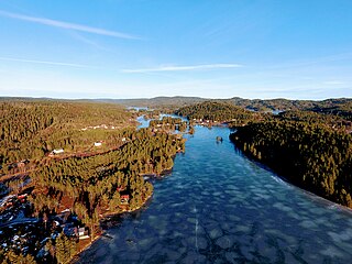
View of the village | |
 Reddal Location of the village  Reddal Reddal (Norway) | |
| Coordinates: 58°20′06″N8°26′50″E / 58.3351°N 08.4472°E Coordinates: 58°20′06″N8°26′50″E / 58.3351°N 08.4472°E | |
| Country | Norway |
| Region | Southern Norway |
| County | Aust-Agder |
| District | Østre Agder |
| Municipality | Grimstad |
| Elevation [1] | 7 m (23 ft) |
| Time zone | CET (UTC+01:00) |
| • Summer (DST) | CEST (UTC+02:00) |
| Post Code | 4886 Grimstad |
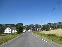
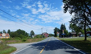
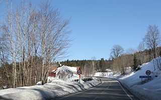
Reddal is a village in the municipality of Grimstad in Aust-Agder county, Norway. It is located in the western part of the municipality in the Landvik area, about 10 kilometres (6.2 mi) west of the town of Grimstad and about 5 kilometres (3.1 mi) southeast of the small village of Nygrenda. The main industry in the village is agriculture, with the most important products being potatoes, berries and grain. The large lake Syndle lies just north of the village.

Grimstad is a municipality in Aust-Agder county, Norway. It belongs to the geographical region of Sørlandet. The administrative center of the municipality is the town of Grimstad. Some of the villages in Grimstad include Eide, Espenes, Fevik, Fjære, Håbbestad, Hesnes, Homborsund, Jortveit, Kroken, Landvik, Nygrenda, Prestegårdskogen, Reddal, Roresand, Rønnes, Skiftenes, Tjore, Vik, and Østerhus.

Aust-Agder is one of 18 counties (fylker) in Norway, bordering Telemark, Rogaland, and Vest-Agder counties. In 2002, there were 102,945 inhabitants, which is 2.2% of the total population in Norway. Its area is 9,212 square kilometres (3,557 sq mi). The administrative center of the county is the town of Arendal.

Norway, officially the Kingdom of Norway, is a Nordic country in Northern Europe whose territory comprises the western and northernmost portion of the Scandinavian Peninsula; the remote island of Jan Mayen and the archipelago of Svalbard are also part of the Kingdom of Norway. The Antarctic Peter I Island and the sub-Antarctic Bouvet Island are dependent territories and thus not considered part of the kingdom. Norway also lays claim to a section of Antarctica known as Queen Maud Land.
The freshwater Reddalsvannet lake is located along the south side of the village area. There is a protected nature reserve at the lake. In order to gain additional farmland in Reddal, a canal was built in 1877 to lower the lake's water level by 4 metres (13 ft). This lowered the water down to sea level. The Reddal Canal (Norwegian : Reddalskanalen) connects the Reddalsvannet lake and the nearby Landviksvannet lake to the sea. Today, the canal is popular with small boats. [2]

A nature reserve is a protected area of importance for flora, fauna or features of geological or other special interest, which is reserved and managed for conservation and to provide special opportunities for study or research. Nature reserves may be designated by government institutions in some countries, or by private landowners, such as charities and research institutions, regardless of nationality. Nature reserves fall into different IUCN categories depending on the level of protection afforded by local laws. Normally it is more strictly protected than a nature park.
Norwegian is a North Germanic language spoken mainly in Norway, where it is the official language. Along with Swedish and Danish, Norwegian forms a dialect continuum of more or less mutually intelligible local and regional varieties, and some Norwegian and Swedish dialects, in particular, are very close. These Scandinavian languages, together with Faroese and Icelandic as well as some extinct languages, constitute the North Germanic languages. Faroese and Icelandic are hardly mutually intelligible with Norwegian in their spoken form because continental Scandinavian has diverged from them. While the two Germanic languages with the greatest numbers of speakers, English and German, have close similarities with Norwegian, neither is mutually intelligible with it. Norwegian is a descendant of Old Norse, the common language of the Germanic peoples living in Scandinavia during the Viking Era.