The Regional Research Station (Old Alluvial Zone) in West Bengal was first established as District Seed Farm under the Ministry of Agriculture, within the government of West Bengal, India in 1955. This farm was renamed as Zonal Adaptive Research Station (ZARS) in 1975. Further, in view of implementation of National Agricultural Research Project (NARP) of the Indian Council of Agricultural Research (ICAR), the State Government handed over this station to Bidhan Chandra Krishi Viswavidyalaya in 1990 for conducting research works according to the zonal requirements and named as Regional Research Station (Old Alluvial Zone).
After the establishment of Uttar Banga Krishi Viswavidyalaya in January 2001, this station has been brought under the administrative control of this new University. Since then, it is functioning as a main research station of Old Alluvial Zone comprising three districts of Uttar Dinajpur, Dakshin Dinajpur and Malda. It has one Sub-station at block Manikchak in Maldah district with 50 acres of land (25 acres at Mathurapur + 25 acres at Ratua) which is famous for its mango plantation and sericulture.
Location
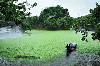
This Research Station is located beside the Gazzole–Hili State Highway in the Mouza of Majhian under Balurghat Block in the District of Dakshin Dinajpur, West Bengal with 23° 57′ N and 87° 10′ E. River Atreyee is flowing in the western side of the station. The international business corridor between India and Bangladesh is at Hilli, 22km away from this station.
Mandate
Basic, adaptive and need based zone specific research to meet up problem of the farmer of this zone.
Innovation / modification of eco-friendly technology specific to this zone.
Selection and preservation of plant genetic materials/resources.
Production and distribution of quality seed for the farmer of this zone.
Extension of advance technology and motivation to the farming community through training and demonstration.
Related Research Articles
Balurghat (pron:bʌlʊəˈgɑ:t) is a city and a municipality in the state of West Bengal, India. It is the district headquarter of the Dakshin Dinajpur district. It is one of the major cities connected through National Highway 512.
Uttar Dinajpur is a district of the Indian state of West Bengal. Created on 1 April 1992 by the division of the erstwhile West Dinajpur district, it comprises two subdivisions: Raiganj and Islampur. Tourist - Places Kulik Bird Sanctuary, the largest bird sanctuary of Asia, is part of Raiganj Wildlife Sanctuary, Swaminath Temple at Swaminath, Rajbari at Rajbari Gate, Shiv Mandir at Itahar, Danhasori Pithasthal at Chandigram, Shree Shree Ma Bhabani Devi Than at Bouaha.
Dakshin Dinajpur or South Dinajpur is a district in the Indian state of West Bengal, India. It was created on 1 April 1992 by the division of the erstwhile West Dinajpur District. The Headquarter (sadar) of the district is at Balurghat. It comprises two subdivisions: Balurghat and Gangarampur at Buniadpur. According to the 2011 census, it is the third least populous District of West Bengal.
Uttar Banga Krishi Vishwavidyalaya is a public state agricultural university in Pundibari about 11 km North-West of Cooch Behar, West Bengal, India. It offers degree courses in Agricultural Engineering, Agriculture and Horticulture. It was established in 2001 by an Act of the West Bengal legislature.
Bidhan Chandra Krishi Viswavidyalaya (BCKV), also known as Bidhan Chandra Agricultural University, is an agricultural university in West Bengal, India. The university aims to provide higher education in theoretical and technical fields of Agriculture, Horticulture and Agricultural Engineering. It grants Bachelor of Science, Master of Science, Bachelor of Technology, Master of Technology and Doctorate degrees.
Chopra is community development block that forms an administrative division in Islampur subdivision of Uttar Dinajpur district in the Indian state of West Bengal.
Itahar is a community development block that forms an administrative division in Raiganj subdivision of Uttar Dinajpur district in the Indian state of West Bengal.
Goalpokhar I is a community development block that forms an administrative division in Islampur subdivision of Uttar Dinajpur district in the Indian state of West Bengal.
Karandighi is a community development block that forms an administrative division in Islampur subdivision of Uttar Dinajpur district in the Indian state of West Bengal. Jawahar Navodaya Vidyalaya, Dalkhola, Uttar Dinajpur was established in 2005. The school is temporariliy running at Teest Colony, Dalkhola, Uttar Dinajpur. It is adjacent to Primary Health Center, Dalkhola on NH 34. The land for the construction of permanent building has been transferred and construction work is about to start at Village Sima Anandapur of Panchayat Raniganj. The temporary site is about 3.5 Km from Dalkhola Railway Station.
Kushmandi is a community development block that forms an administrative division in Gangarampur subdivision of Dakshin Dinajpur district in the Indian state of West Bengal.
Harirampur is a community development block that forms an administrative division in Gangarampur subdivision of Dakshin Dinajpur district in the Indian state of West Bengal.
Banshihari is a community development block that forms an administrative division in Gangarampur Subdivision of Dakshin Dinajpur District in the Indian state of West Bengal.
Tapan is a community development block that forms an administrative division in Balurghat subdivision of Dakshin Dinajpur district in the Indian state of West Bengal.
Kumarganj is a community development block that forms an administrative division in Balurghat subdivision of Dakshin Dinajpur district in the Indian state of West Bengal.
Hili is a community development block that forms an administrative division in Balurghat subdivision of Dakshin Dinajpur district in the Indian state of West Bengal.
Balurghat is a community development block that forms an administrative division in Balurghat subdivision of Dakshin Dinajpur district in the Indian state of West Bengal.
Gangarampur is a community development block that forms an administrative division in Gangarampur subdivision of Dakshin Dinajpur district in the Indian state of West Bengal.
Goalpokhar II is a community development block that forms an administrative division in Islampur subdivision of Uttar Dinajpur district in the Indian state of West Bengal.
Kaliaganj is a community development block that forms an administrative division in Raiganj subdivision of Uttar Dinajpur district in the Indian state of West Bengal.
Raiganj is a community development block that forms an administrative division in Raiganj subdivision of Uttar Dinajpur district in the Indian state of West Bengal.
This page is based on this Wikipedia article Text is available under the CC BY-SA 4.0 license; additional terms may apply. Images, videos and audio are available under their respective licenses.