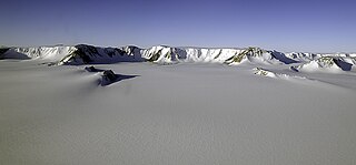
Thurston Island is a largely ice-covered, glacially dissected island, 135 nautical miles long and 55 nautical miles wide, lying between Amundsen Sea and Bellingshausen Sea a short way off the northwest end of Ellsworth Land, Antarctica. The island is separated from the mainland by Peacock Sound, which is occupied by the west portion of Abbot Ice Shelf.
The Queen Elizabeth Range is a rugged mountain range that parallels the eastern side of Marsh Glacier for nearly 100 nmi from Nimrod Glacier in the north to Law Glacier in the south. Mount Markham, 4,350 metres (14,270 ft) high, is the highest elevation in the range.

The Shackleton Range is a mountain range in Antarctica that rises to 1,875 metres (6,152 ft) and extends in an east–west direction for about 100 miles (160 km) between the Slessor and Recovery Glaciers.
The Queen Alexandra Range is a major mountain range about 100 nautical miles long, bordering the entire western side of Beardmore Glacier from the Polar Plateau to the Ross Ice Shelf. The range is in the Transantarctic Mountains System, and is located in the Ross Dependency region of Antarctica.
The Forrestal Range is a largely snow-covered mountain range, about 65 nautical miles long, standing east of Dufek Massif and the Neptune Range in the Pensacola Mountains, Antarctica.
The Britannia Range is a range of mountains bounded by the Hatherton Glacier and Darwin Glacier on the north and the Byrd Glacier on the south, westward of the Ross Ice Shelf in Antarctica.
The Keltie Glacier is a large Antarctic glacier, 30 nautical miles (56 km) long, draining from Pain Névé southwest around the southern extremity of the Commonwealth Range, and then northwest to enter Beardmore Glacier at Ranfurly Point. It was discovered by the British Antarctic Expedition, 1907–09, under Ernest Shackleton, who named it for Sir John Scott Keltie, Secretary of the Royal Geographical Society, 1892–1915.
Kohler Range is a mountain range in Marie Byrd Land, Antarctica. The range is about 40 nautical miles long and stands between the base of Martin Peninsula and Smith Glacier. The range consists of two ice-covered plateaus punctuated by several rock peaks and bluffs. The plateaus are oriented East-West and are separated by the Kohler Glacier, a distributary which flows north from Smith Glacier.

The Prince Charles Mountains are a major group of mountains in Mac. Robertson Land in Antarctica, including the Athos Range, the Porthos Range, and the Aramis Range. The highest peak is Mount Menzies, with a height of 3,228 m (10,591 ft). Other prominent peaks are Mount Izabelle and Mount Stinear. These mountains, together with other scattered peaks, form an arc about 420 km (260 mi) long, extending from the vicinity of Mount Starlight in the north to Goodspeed Nunataks in the south.
The Merz Peninsula is an irregular, ice-covered peninsula, about 15 nautical miles long in an east–west direction and averaging 25 nautical miles wide, between Hilton Inlet and Violante Inlet on the east coast of Palmer Land, Antarctica.

The Walker Mountains are a range of peaks and nunataks which are fairly well separated but trend east–west to form the axis, or spine, of Thurston Island in Antarctica.
Lennox-King Glacier is a large valley glacier, about 40 nautical miles (70 km) long that flows east into the Ross Ice Shelf.
Alamein Range is a range lying west of Canham Glacier, in the Freyberg Mountains of Antarctica. It was named in association with Lord Bernard Freyberg and the Second New Zealand Expeditionary Force by the Northern Party of New Zealand Geological Survey Antarctic Expedition (NZGSAE), 1963–64.
The Latady Mountains are a group of mountains rising west of Gardner Inlet and between Wetmore Glacier and Ketchum Glacier, in southeastern Palmer Land, Antarctica.
Wegener Range is a mountain range with peaks rising to 1,800 metres (5,900 ft), trending west-northwest – east-soitheast for about 45 nautical miles between Maury Glacier and Fenton Glacier in southeast Palmer Land, Antarctica.

Sarnoff Mountains is a range of mountains, 251 nautical miles long and 4 to 8 nautical miles wide separating the west-flowing Boyd Glacier and Arthur Glacier in the Ford Ranges of Marie Byrd Land, Antarctica.
Salamander Range is a distinctive linear range between Canham Glacier and Black Glacier, in the Freyberg Mountains, Antarctica. The range was named by the Northern Party of New Zealand Geological Survey Antarctic Expedition (NZGSAE), 1963–64, from the nickname given to Lord Freyberg by Sir Winston Churchill, for the lizard that is untouched by fire.
Slettfjellnutane Peaks are two small rock peaks about 2 nautical miles (3.7 km) north of Slettfjell on the Ahlmann Ridge in Queen Maud Land. Mapped by Norwegian cartographers from surveys and air photos by Norwegian-British-Swedish Antarctic Expedition (NBSAE) (1949–52), and named Slettfjellnutane because of their proximity to Slettfjell.
Ramsey Glacier is a glacier about 45 nautical miles long in Antarctica. It originates in the Bush Mountains near the edge of the polar plateau and flows north through the Queen Maud Mountains of Antarctica to the Ross Ice Shelf eastward of Den Hartog Peak.
![]() This article incorporates public domain material from "Regula Range". Geographic Names Information System . United States Geological Survey.
This article incorporates public domain material from "Regula Range". Geographic Names Information System . United States Geological Survey. 


