Related Research Articles

West Godavari district is one of the twenty-six districts in the Andhra region of the Indian state of Andhra Pradesh. The administrative headquarters of the district is situated at Bhimavaram. As of 2011 census of India, the district has an area of 7,742 km2 (2,989 sq mi) and a population of 1,779,935. It is bounded by Eluru District to the north, Krishna district and Bay of Bengal to the south, East Godavari district to the east, and Eluru District, Kolleru Lake and Upputeru Drain to the west.

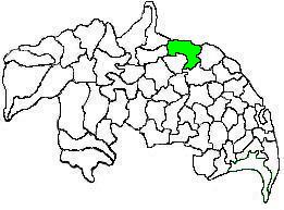
Vizianagaram district is one of the eleven districts in the Coastal Andhra region of the Indian state of Andhra Pradesh with its headquarters located at Vizianagaram. The district is bounded on the east by the district of Srikakulam, southwest by the City of Bheemunipatnam, southeast by the Bay of Bengal, and northwest by the state of Odisha. It was formed on 1 June 1979, with some parts carved from the neighbouring districts of Srikakulam and Visakhapatnam. The district is named after the princely state of Vizianagaram. It is the least populous district in Andhra Pradesh.

Chittoor district is one of the eight districts in the Rayalaseema region of the Indian state of Andhra Pradesh. The district headquarters is located at Chittoor. It has a population of 4,170,468 according to 2011 census of India. It lies in the Poini River Valley of southernmost Andhra Pradesh along the Chennai–Bangalore section of Chennai-Mumbai highway. Chittoor district is a major market centre for mangoes, grains, sugarcane, and peanuts.

Kadapa district is one of the twenty six districts in the Indian state of Andhra Pradesh. It is also one of the eight districts in the Rayalaseema region. Kadapa is the administrative headquarters for this district. The district was renamed as YSR District in honour of Y. S. Rajasekhara Reddy, commemorating former chief minister of united Andhra Pradesh.

Kurnool district is one of the eight districts in the Rayalaseema region of the Indian state of Andhra Pradesh. It is located in the North western part of the state and is bounded by Jogulamba Gadwal district of Telangana in the north, Raichur district of Karnataka in the northwest, Bellary district of Karnataka in the west, Anantapur district in the south and Nandyal district in the east. The city of Kurnool is the headquarters of the district. It has a population of 4,053,463 of which 28.35% were urban as of 2011.

Srikakulam district is one of the twenty-six districts in the Coastal Andhra region of the Indian state of Andhra Pradesh, with its headquarters located at Srikakulam. It is one of the nine coastal districts, located in the extreme northeastern direction of the state. It was formerly known as Chicacole.

Palakollu is a city and the administrative headquarters of Palakollu Mandal in Narasapuram revenue division in West Godavari district of the Indian state of Andhra Pradesh. Palakollu is situated in Coastal Andhra region of the state. It occupies 4.685 square kilometres (1.809 sq mi). As of 2011 census, it has a population of about 61,284 and a Metro population of about 81,199. Palakollu Municipality merged five Grama panchayats of Seven village's on dated 7 January 2020. the Seven Village's population of 42,932 It around occupies 20.08 square kilometres (7.75 sq mi) and after merged palakollu municipality It around occupies 24.68 square kilometres (9.53 sq mi) with 35 election wards it is total population of 1,04,216 and making it the fourth most populous urban area in West Godavari District in Andhra Pradesh. It is a part of Eluru Urban Development Authority.

Relangi Venkata Ramaiah was an Indian character actor, comedian and producer known for his works predominantly in Telugu cinema. He was honored with the Padma Shri, for his contribution to Indian cinema in 1970. Relangi is known particularly for his comic expressions, and dialogues during the golden age of Telugu cinema. Together with Ramana Reddy were a comedy double act during the era of early Tollywood. Notable Relangi performances include those from Gunasundari Katha, Missamma, Mayabazar, Nartanasala, Donga Ramudu, Iddaru Mitrulu, Chaduvukunna Ammayilu, Appu Chesi Pappu Koodu, Velugu Needalu, Vipra Narayana, Lava Kusha , Kula Gothralu and Preminchi Choodu. The Relangi Art Academy Award was instituted in his honor for best comic performances.

Cheepurupalli is a census town in Vizianagaram district of the Indian state of Andhra Pradesh. The town is located 30 km to the north of Vizianagaram.The town covers an area of 348 hectares with a population of 78,000 according to the 2011 census.
Krosuru is a village in Guntur district of the Indian state of Andhra Pradesh. It is the mandal headquarters of Krosuru mandal in Guntur revenue division.
Kondapi is a village in Prakasam district of the Indian state of Andhra Pradesh. It is the mandal headquarters of Kondapi mandal in Kandukur revenue division.
Relangi is a village in Iragavaram Mandal of West Godavari District in Andhra Pradesh. It is 5.903 km from its Mandal main town Iragavaram, 74 km from the Rajahmundry and 138 km from the city of Vijayawada.
Relangi (రేలంగి) may refer to:

Duggirala mandal is one of the 57 mandals in Guntur district of the Indian state of Andhra Pradesh. It is under the administration of Tenali revenue division and the headquarters are located at Duggirala. The mandal is bounded by Mangalagiri, Pedakakani, Tenali and Kollipara mandals. Krishna River lies to the northeast of the Duggirala mandal.

Kollur mandal is one of the 25 mandals in Bapatla district of the Indian state of Andhra Pradesh. It is under the administration of Tenali revenue division and the headquarters are located at Kollur.
Amaravathi mandal is one of the 57 mandals in Palnadu district of the Indian state of Andhra Pradesh. It is under the administration of Guntur revenue division and the headquarters are located at Amaravathi. The mandal is located on the banks of Krishna River, at a distance 27 km from the district headquarters. It is bounded by Atchampet, Krosuru, Pedakurapadu, Tadikonda and Thullur mandals.
Pinakadimi is a village in Eluru district of the Indian state of Andhra Pradesh. It is located in Pedavegi mandal of Eluru revenue division. It is located at a distance of 7 km from district headquarters Eluru city.
Iragavaram Mandal is one of the 46 mandals in the West Godavari district of the Indian state of Andhra Pradesh. The headquarters are located at Iragavaram town. The mandal is bordered by Peravali mandal and Penugonda mandal to the north, Penumantra mandal to the east, Attili mandal to the south, and Tanuku mandal to the west.
Gummampadu is a village in West Godavari district in the state of Andhra Pradesh in India. Relangi and Velpuru Rail Way Station are the nearest railway stations.
References
- 1 2 "Relangi Population - Visakhapatnam, Andhra Pradesh". Census 2011. Retrieved 6 May 2018.