
Hydrology is the scientific study of the movement, distribution, and management of water on Earth and other planets, including the water cycle, water resources, and drainage basin sustainability. A practitioner of hydrology is called a hydrologist. Hydrologists are scientists studying earth or environmental science, civil or environmental engineering, and physical geography. Using various analytical methods and scientific techniques, they collect and analyze data to help solve water related problems such as environmental preservation, natural disasters, and water management.

The Meuse or Maas is a major European river, rising in France and flowing through Belgium and the Netherlands before draining into the North Sea from the Rhine–Meuse–Scheldt delta. It has a total length of 925 km.

The Rhine is one of the major European rivers. The river begins in the Swiss canton of Graubünden in the southeastern Swiss Alps. It forms part of the Swiss-Liechtenstein, Swiss-Austrian, and Swiss-German borders. After that the Rhine defines much of the Franco-German border, after which it flows in a mostly northerly direction through the German Rhineland. Finally in Germany the Rhine turns into a predominantly westerly direction and flows into the Netherlands where it eventually empties into the North Sea. It drains an area of 9,973 sq km and its name derives from the Celtic Rēnos. There are also two German states named after the river, North Rhine-Westphalia and Rhineland-Palatinate.

The geography of the European Netherlands is unusual in that much of its land has been reclaimed from the sea and is below sea level, protected by dikes. It is a small country with a total area of 41,545 km2 (16,041 sq mi) and ranked 131st. With a population of 17.4 million and density of 521/km2 (1,350/sq mi) makes it the second most densely populated member of the European Union after Malta, and the 12th most densely populated country in the world, behind only three countries with a population over 16 million. Consequently, the Netherlands is highly urbanized.

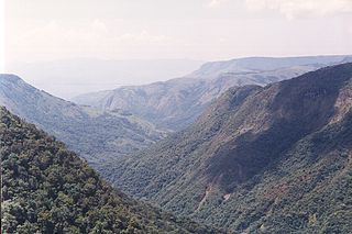
A drainage basin is an area of land where all flowing surface water converges to a single point, such as a river mouth, or flows into another body of water, such as a lake or ocean. A basin is separated from adjacent basins by a perimeter, the drainage divide, made up of a succession of elevated features, such as ridges and hills. A basin may consist of smaller basins that merge at river confluences, forming a hierarchical pattern.
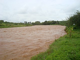
In hydrology, discharge is the volumetric flow rate of water that is transported through a given cross-sectional area. It includes any suspended solids, dissolved chemicals, or biologic material in addition to the water itself. Terms may vary between disciplines. For example, a fluvial hydrologist studying natural river systems may define discharge as streamflow, whereas an engineer operating a reservoir system may equate it with outflow, contrasted with inflow.

The Royal Dutch Meteorological Institute is the Dutch national weather forecasting service, which has its headquarters in De Bilt, in the province of Utrecht, central Netherlands.

The law of water balance states that the inflows to any water system or area is equal to its outflows plus change in storage during a time interval. In hydrology, a water balance equation can be used to describe the flow of water in and out of a system. A system can be one of several hydrological or water domains, such as a column of soil, a drainage basin, an irrigation area or a city. Water balance can also refer to the ways in which an organism maintains water in dry or hot conditions. It is often discussed in reference to plants or arthropods, which have a variety of water retention mechanisms, including a lipid waxy coating that has limited permeability.

An hydrological transport model is a mathematical model used to simulate the flow of rivers, streams, groundwater movement or drainage front displacement, and calculate water quality parameters. These models generally came into use in the 1960s and 1970s when demand for numerical forecasting of water quality and drainage was driven by environmental legislation, and at a similar time widespread access to significant computer power became available. Much of the original model development took place in the United States and United Kingdom, but today these models are refined and used worldwide.
The HBV hydrology model, or Hydrologiska Byråns Vattenbalansavdelning model, is a computer simulation used to analyze river discharge and water pollution. Developed originally for use in Scandinavia, this hydrological transport model has also been applied in a large number of catchments on most continents.
The European Flood Awareness System is a European Commission initiative to increase preparedness for riverine floods across Europe.
There is a long and established framework for water resources management in Colombia. The Environment Ministry and up to 33 Regional Authorities, are in charge of water resources management and policies at the national and regional and watershed level, respectively. Other sectoral ministries are in charge of water demand for energy, water supply and sanitation and water for irrigation.
The following outline is provided as an overview of and topical guide to hydrology:

Kalu Ganga is a river in Sri Lanka. Measuring 129 km (80 mi) in length, the river originates from Sri Padhaya and reach the sea at Kalutara. The Black River flows through the Ratnapura and the Kalutara District and pass the city Ratnapura. The mountainous forests in the Central Province and the Sinharaja Forest Reserve are the main sources of water for the river. The Edwardian manor, Richmond Castle is on the banks of the river near Kalutara.
The HUMUS project is a project that was funded by the Natural Resources Conservation Service to model the non-point source loading from 8-digit hydrologic unit cataloging units.
The global freshwater model WaterGAP calculates flows and storages of water on all continents of the globe, taking into account the human influence on the natural freshwater system by water abstractions and dams. It supports understanding the freshwater situation across the world's river basins during the 20th and the 21st centuries, and is applied to assess water scarcity, droughts and floods and to quantify the impact of human actions on e.g. groundwater, wetlands, streamflow and sea-level rise. Modelling results of WaterGAP have contributed to international assessment of the global environmental situation including the UN World Water Development Reports, the Millennium Ecosystem Assessment, the UN Global Environmental Outlooks as well as to reports of the Intergovernmental Panel on Climate Change. WaterGAP contributes to the Intersectoral Impact Model Intercomparison Project ISIMIP, where consistent ensembles of model runs by a number of global hydrological models are generated to assess the impact of climate change and other anthropogenic stressors on freshwater resources world-wide.
International Commission for the Protection of the Rhine (ICPR) and its contract shows alignment with the UN Convention on international watercourses and has proven effective in its goals for the Rhine and the Rhine Basin. It was necessary for a treaty to come through the countries in the Rhine basin as it provides water based on industrial and agricultural needs and provides drinking water to over 20 million people.
Gilgel Abay, or Lesser Abay, is a river of central Ethiopia. Rising in the mountains of Gojjam, it flows northward to empty into south-western Lake Tana at 11°48′N37°7′E. Tributaries of the Gilgel Abbay include the Ashar, Jamma, Kelti and the Koger. It was regarded as the true source of the Nile for a long time and the Jesuit priest Pedro Paez visited it in 1618. The name Gilgel Abbay means Lesser Nile, as Abbay is the name for the Blue Nile.

Climate change in the Netherlands is already affecting the country. The average temperature in the Netherlands rose by more than 2 °C from 1901 to 2020. Climate change has resulted in increased frequency of droughts and heatwaves. Because significant portions of the Netherlands have been reclaimed from the sea or otherwise are very near sea level, the Netherlands is very vulnerable to sea level rise.