Ribare (Jagodina)

Last updated
Ribare (Jagodina)
Village

Dom kulture Ribare 1.JPG

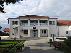
Culture center in Ribare
CountryFlag of Serbia.svg  Serbia
District Pomoravlje District
Municipality Jagodina
Population (2002)
  Total 3,165
Time zone CET (UTC+1)
  Summer (DST) CEST (UTC+2)

Ribare is a village in the municipality of Jagodina, Serbia. According to the 2002 census, the village has a population of 3165 people. [1]

Village Small clustered human settlement smaller than a town

A village is a clustered human settlement or community, larger than a hamlet but smaller than a town, with a population ranging from a few hundred to a few thousand. Though villages are often located in rural areas, the term urban village is also applied to certain urban neighborhoods. Villages are normally permanent, with fixed dwellings; however, transient villages can occur. Further, the dwellings of a village are fairly close to one another, not scattered broadly over the landscape, as a dispersed settlement.

Jagodina City in Šumadija and Western Serbia, Serbia

Jagodina is a city and the administrative center of the Pomoravlje District in Šumadija, an historically densely forested region of central Serbia. It is situated on the banks of the Belica River. The city itself has a population of 43,311 inhabitants, while its administrative area comprises 76,712 inhabitants.

Serbia Republic in Southeastern Europe

Serbia, officially the Republic of Serbia, is a country situated at the crossroads of Central and Southeast Europe in the southern Pannonian Plain and the central Balkans. It borders Hungary to the north, Romania to the northeast, Bulgaria to the southeast, North Macedonia to the south, Croatia and Bosnia and Herzegovina to the west, and Montenegro to the southwest. The country claims a border with Albania through the disputed territory of Kosovo. Serbia's population numbers approximately seven million, most of whom are Orthodox Christians. Its capital, Belgrade, ranks among the oldest and largest citiеs in southeastern Europe.

Related Research Articles

Rădulești is a commune located in Ialomița County, Romania. It is composed of three villages: Movileanca, Rădulești and Răsimnicea.

Valea Mare is a commune located in Vâlcea County, Romania. It is composed of six villages: Bătășani, Delureni, Drăganu, Mărgineni, Pietroasa and Valea Mare.

Schitu is a commune in Olt County, Romania. It is composed of five villages: Catanele, Greci, Lisa, Moșteni and Schitu.

Oruglica Village in Jablanica District, Serbia

Oruglica is a village in the municipality of Leskovac, Serbia. According to the 2002 census, the village has a population of 173 people.

Svirce (Leskovac) Village in Jablanica District, Serbia

Svirce is a village in the municipality of Leskovac, Serbia. According to the 2002 census, the village has a population of 436 people.

Bresnica, Vranje Village in Pčinja District, Serbia

Bresnica is a village in the municipality of Vranje, Serbia. According to the 2002 census, the village has a population of 410 people.

Dupeljevo is a village in the municipality of Vranje, Serbia. According to the 2002 census, the village has a population of 55 people.

Mijovce Village in Pčinja District, Serbia

Mijovce is a village in the municipality of Vranje, Serbia. According to the 2002 census, the village has a population of 67 people.

Studena is a village in the municipality of Vranje, Serbia. According to the 2002 census, the village has a population of 117 people.

Surdul Village in Pčinja District, Serbia

Surdul is a village in the municipality of Vranje, Serbia. According to the 2002 census, the village has a population of 44 people.

Tumba (Vranje) Village in Pčinja District, Serbia

Tumba is a village in the municipality of Vranje, Serbia. According to the 2002 census, the village has a population of 44 people.

Zatonje Village in Braničevo District, Serbia

Zatonje is a village in the municipality of Veliko Gradište, Serbia. According to the 2002 census, the village has a population of 749 people.

Batovac Village in Braničevo District, Serbia

Batovac is a village in the municipality of Požarevac, Serbia. According to the 2002 census, the village has a population of 596 people.

Dragovac, Požarevac Village in Braničevo District, Serbia

Dragovac is a village in the municipality of Požarevac, Serbia. According to the 2002 census, the village has a population of 910 people.

Drmno Village in Braničevo District, Serbia

Drmno is a village in the municipality of Požarevac, Serbia. According to the 2002 census, the village has a population of 1046 people.

Selo Kostolac or Stari Kostolac, is a village in the municipality of Kostolac, city of Požarevac, Serbia. According to the 2002 census, the village has a population of 1,313 people.

Nabrđe Village in Braničevo District, Serbia

Nabrđe is a village in the municipality of Požarevac, Serbia. According to the 2002 census, the village has a population of 346 people.

Prugovo Village in Braničevo District, Serbia

Prugovo is a village in the municipality of Požarevac, Serbia. According to the 2002 census, the village has a population of 774 people.

Rečica, Požarevac Village in Braničevo District, Serbia

Rečica is a village in the municipality of Požarevac, Serbia. According to the 2002 census, the village has a population of 518 people.

Živica (Požarevac) Village in Braničevo District, Serbia

Živica is a village in the municipality of Požarevac, Serbia. According to the 2002 census, the village has a population of 728 people.

References

  1. Popis stanovništva, domaćinstava i Stanova 2002. Knjiga 1: Nacionalna ili etnička pripadnost po naseljima. Republika Srbija, Republički zavod za statistiku Beograd 2003. ISBN   86-84433-00-9

Coordinates: 44°00′10″N21°17′11″E / 44.002666°N 21.286333°E / 44.002666; 21.286333

Geographic coordinate system Coordinate system

A geographic coordinate system is a coordinate system that enables every location on Earth to be specified by a set of numbers, letters or symbols. The coordinates are often chosen such that one of the numbers represents a vertical position and two or three of the numbers represent a horizontal position; alternatively, a geographic position may be expressed in a combined three-dimensional Cartesian vector. A common choice of coordinates is latitude, longitude and elevation. To specify a location on a plane requires a map projection.