Dautphetal is a municipality in Hesse, Germany, and is among the six larger municipalities of the 22 in Marburg-Biedenkopf district.

Hessischer Rundfunk, shortened to HR, is the German state of Hesse's public broadcasting corporation. Headquartered in Frankfurt, it is a member of the national consortium of German public broadcasting corporations, ARD.

The municipality of Lahntal is found in the Marburg-Biedenkopf district in northwest Middle Hesse, Germany.

Prince Frederick Adolf, Duke of Östergötland was a Swedish Prince, youngest son of King Adolf Frederick of Sweden and Louisa Ulrika of Prussia, a sister of Frederick the Great, King of Prussia. He was given the title Duke of Östergötland.

Breitenbach am Herzberg is a municipality in southwesternmost Hersfeld-Rotenburg district in eastern Hesse, Germany.

Rimberg is a locality in the municipality Schmallenberg in the district Hochsauerlandkreis in North Rhine-Westphalia, Germany.

Sonderhof is a locality in the municipality Schmallenberg in the district Hochsauerlandkreis in North Rhine-Westphalia, Germany.
Øyvind Stene is a Norwegian engineer and businessperson.
Kjeld is a person name derived from the Old Norse and may refer to:

The Gladenbach Uplands, named after their central town of Gladenbach, is a range of hills up to 609 m high in the Rhine Massif in Germany, on the junction of the Rothaar Mountains, Westerwald (southwest), (Eastern) Hintertaunus and West Hesse Highlands in the east. It lies in Central Hesse within the districts of Marburg-Biedenkopf, Lahn-Dill and Gießen within the so-called Lahn-Dill-(Dietzhölze-) loop. Small parts of the Upper Lahn Valley in the northwest belong, together with the town of Bad Laasphe, also to the district of Siegen-Wittgenstein, North Rhine-Westphalia.
Tore Lindholt was a Norwegian economist, civil servant and politician for the Labour Party. He was twice the acting director of the Norwegian State Railways, and Folketrygdfondet from 1990 to 2004.

Burgholz is a hill in the Gilserberg Heights near the town of Kirchhain in Marburg-Biedenkopf, which is 379 metres (1,243 ft) high. On the summit and the north-east slope is the district of Burgholz, which is part of the town of Kirchhain. The majority of the hill is covered by trees, with the exception of some housing on one slope.

The Rimberg in the Knüll Mountains (Knüll) is 1,942 ft above sea level. A massive mountain near in the Hersfeld-Rotenburg district in northern Hesse Germany.

The Schweinskopf is a hill, 473 metres high, in the German state of Hesse. The hill is part of the Damshausen Heights. Situated on the edge of the village of Friedensdorf, it is the highest elevation in the parish.

The Norwegian State Railways was a state-owned railway company that operated most of the railway network in Norway. The government agency/directorate was created in 1883 to oversee the construction and operation of all state-owned railways in Norway. On 1 December 1996, it was demerged to create the infrastructure operator Norwegian National Rail Administration, the train operator Norwegian State Railways and the Norwegian Railway Inspectorate. The name was taken by the train operator, although the infrastructure operator remained a government agency and is the legal successor.

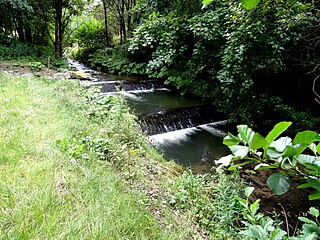
Hillebach is a small river of North Rhine-Westphalia, Germany. It is 7.7 km long and flows into the Ruhr near Winterberg.
Geoff Herbach is an American novelist. Born in Dubuque, Iowa, on October 30, 1969, Herbach grew up in Platteville, Wisconsin. He is an alumnus of the University of Wisconsin–Madison and Hamline University in Saint Paul, Minnesota, where he earned a Master of Fine Arts degree in creative writing. He is the author of one picture book and nine novels, including The Miracle Letters of T. Rimberg, The Stupid Fast Trilogy, Fat Boy Vs. The Cheerleaders, and Hooper.Stupid Fast won the 2011 Cybils Award in the Young Adult Fiction category. Nothing Special won the 2013 Minnesota Book Award for Young People's literature. Cracking the Bell won the 2020 Elizabeth Burr/Worzalla Award for Outstanding Artistic Achievement by a Wisconsin author.
Comedienne is a 1923 Soviet silent romantic drama directed by Aleksandr Ivanovsky.

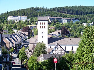
Bad Fredeburg is a locality in the municipality Schmallenberg in the High Sauerland District in North Rhine-Westphalia, Germany.

Gellinghausen is a locality in the municipality Schmallenberg in the district Hochsauerlandkreis in North Rhine-Westphalia, Germany.


