
The Rio Ojo Caliente (or Ojo Caliente River) is a tributary of the Rio Chama mostly in Rio Arriba County, New Mexico, with a small part near Ojo Caliente in Taos County. [1] [2]
The Rio Ojo Caliente (or Ojo Caliente River) is a tributary of the Rio Chama mostly in Rio Arriba County, New Mexico, with a small part near Ojo Caliente in Taos County. [1] [2]
From the confluence of the Rio Vallecitos and Rio Tusas near La Madera, it flows southeast through a small canyon before turning southwest and entering the Ojo Caliente Valley. From here the river parallels US Route 285 and flows past the town of Ojo Caliente, feeding small irrigation canals along the way. South of the town, the Rio Ojo Caliente flows past Black Mesa, which separates its basin from that of the Rio Grande, before reaching its confluence with the Rio Chama near the town of Chile, just upstream from that river's confluence with the Rio Grande. [3] [4]

The San Luis Valley is a region in south-central Colorado with a small portion overlapping into New Mexico. The Rio Grande with headwaters in the San Juan Mountains about seven miles east of Silverton, Colorado flows through the San Luis Valley and then south into New Mexico. It contains 6 counties and portions of 3 others. The San Luis Valley was ceded to the United States by Mexico following the Mexican–American War. Hispanic settlers began moving north and settling in the valley after the United States made a treaty with the Utes and established a fort. Prior to the Mexican war the Spanish and Mexican governments had reserved the valley to the Utes, their allies. During the 19th century Anglo settlers settled in the valley and engaged in mining, ranching, and irrigated agriculture. Today the valley has a diverse Anglo and Hispanic population.

The Rio Grande, known in Mexico as the Río Bravo del Norte and as the Río Bravo, is one of the principal rivers in the southwestern United States and in northern Mexico. The length of the Rio Grande is 1,896 miles (3,051 km) and originates in south-central Colorado, in the United States, and flows to the Gulf of Mexico. The Rio Grande drainage basin (watershed) has an area of 182,200 square miles (472,000 km2); however, the endorheic basins that are adjacent to and within the greater drainage basin of the Rio Grande increase the total drainage-basin area to 336,000 square miles (870,000 km2).

The Cumbres and Toltec Scenic Railroad, often abbreviated as the C&TSRR, is a 3 ft narrow-gauge heritage railroad that operates on 64 miles (103 km) of track between Antonito, Colorado, and Chama, New Mexico, in the United States. The railroad is named for two geographical features along the route: the 10,015-foot (3,053 m)-high Cumbres Pass and the Toltec Gorge. Originally part of the Denver and Rio Grande Western Railroad's narrow-gauge network, the line has been jointly owned by the states of Colorado and New Mexico since 1970. Today, the C&TSRR is one of only two remaining parts of the former D&RGW narrow-gauge network, the other being the Durango and Silverton Narrow Gauge Railroad (D&SNG), which runs between the communities of Durango and Silverton, Colorado. The railroad has a total of ten narrow-gauge steam locomotives and two narrow-gauge diesel locomotives on its current roster. The railroad also operates two smaller former D&RGW steam locomotives, Nos. 315 and 168, for special events.

The Rio Chama, a major tributary river of the Rio Grande, is located in the U.S. states of Colorado and New Mexico. The river is about 130 miles (210 km) long altogether. From its source to El Vado Dam its length is about 50 miles (80 km), from El Vado Dam to Abiquiu Dam is about 51 miles (82 km), and from Abiquiu Dam to its confluence with the Rio Grande is about 34 miles (55 km).

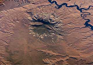
The Brazos Mountains is a range in far northern Rio Arriba County, in northern New Mexico in the southwestern United States. The range is part of the Tusas Mountains, which extended slightly into Colorado. A high crest runs from the border with Colorado for over 20 miles (32 km) in a south-southeasterly direction. The high point of the range at 11,405 feet (3,476 m) is on Grouse Mesa, at the Brazos Benchmark. Two miles (3 km) to the southeast is the more distinctive Brazos Peak, at 11,288 feet.
The Navajo Section is a physiographic section of the larger Colorado Plateaus Province, which in turn is part of the larger Intermontane Plateaus physiographic Division.

In geomorphology, drainage systems, also known as river systems, are the patterns formed by the streams, rivers, and lakes in a particular drainage basin. They are governed by the topography of land, whether a particular region is dominated by hard or soft rocks, and the gradient of the land. Geomorphologists and hydrologists often view streams as part of drainage basins. This is the topographic region from which a stream receives runoff, throughflow, and its saturated equivalent, groundwater flow. The number, size, and shape of the drainage basins varies and the larger and more detailed the topographic map, the more information is available.
Ojo Caliente is an unincorporated community in Taos County, New Mexico, United States.

The Jemez River is a tributary of the Rio Grande in eastern Sandoval County, New Mexico, United States.

Victorio's War, or the Victorio Campaign, was an armed conflict between the Apache followers of Chief Victorio, the United States, and Mexico beginning in September 1879. Faced with arrest and forcible relocation from his homeland in New Mexico to San Carlos Indian Reservation in southeastern Arizona, Victorio led a guerrilla war across southern New Mexico, west Texas and northern Mexico. Victorio fought many battles and skirmishes with the United States Army and raided several settlements until the Mexican Army killed him and most of his warriors in October 1880 in the Battle of Tres Castillos. After Victorio's death, his lieutenant Nana led a raid in 1881.

Navajo River is a 54-mile-long (87 km) tributary of the San Juan River. It flows from a source in the South San Juan Wilderness of Conejos County, Colorado southwest past Chromo, Colorado. The river dips into New Mexico, passing just north of Dulce before heading northwest to a confluence with the San Juan in Archuleta County, Colorado. A large portion of its water is diverted across the Continental Divide to the Rio Grande basin as part of the San Juan–Chama Project.

The San Juan–Chama Project is a U.S. Bureau of Reclamation interbasin water transfer project located in the states of New Mexico and Colorado in the United States. The project consists of a series of tunnels and diversions that take water from the drainage basin of the San Juan River – a tributary of the Colorado River – to supplement water resources in the Rio Grande watershed. The project furnishes water for irrigation and municipal water supply to cities along the Rio Grande including Albuquerque and Santa Fe.

Heron Dam is a storage dam Rio Arriba County, in northern New Mexico in the southwestern United States, just north of the El Vado Dam. It is owned and operated by the United States Bureau of Reclamation. The dam is about 9 miles west of the town of Tierra Amarilla.
Canada Alamosa an Americanized version of the Spanish Cañada Alamosa, is a term historically applied to five geographical features, all in the same immediate area in southwest Socorro and northwest Sierra Counties, New Mexico. In historical texts the name, Canada Alamosa is applied inter-changeably to the five features, and it is often only the context that distinguishes one feature from the other.
The Rio Brazos is a 42-mile (68 km) long river flowing through northern New Mexico in the United States. It rises in the Tusas Mountains, a subrange of the San Juan Mountains, and runs generally southwest to a confluence with the Rio Chama, part of the larger Rio Grande system.

The Tesuque Formation is a geologic formation in north-central New Mexico, United States. The formation provides an unusually complete record of the evolution of mammals during the Miocene epoch.

Chamita is a census-designated place in Rio Arriba County, New Mexico, United States. Its population was 870 as of the 2010 census. New Mexico State Road 74 passes through the community. During its earlier years, the community was known as San Pedro De Chamita and served as the first county seat for Rio Arriba county.
The Tusas Mountains are a mountain range in northern New Mexico, extending slightly into southern Colorado. They are considered the southeasternmost part of the San Juan Mountains. Grouse Mesa, 11,407 feet (3,477 m), is the highest peak in the range. The mountains are located to the west of Taos and northwest of Santa Fe. The Tusas Mountains are a wide region of upland mesas and gently sloping mountains, dissected in places by deep canyons.

The Rio Grande Valley is the river valley carved out by the Rio Grande as it flows through the American Southwest and northeastern Mexico, forming a part of the border region. In the US state of New Mexico, the river flows mostly north to south, and forms a valley near Cochiti Pueblo to the state line near El Paso, Texas along the floors of the large sedimentary basins of the Rio Grande Rift, and includes the narrow sections between the basins. It has been historically settled first by the Pueblo peoples, the Spanish, the Mexicans, and finally Anglo-Americans. As the largest river in the state, some of its most populous cities are located wholly or partially in the valley, including Albuquerque, New Mexico's largest city.
{{cite web}}: Missing or empty |title= (help)Coordinates: 36°06′34″N106°08′33″W / 36.10944°N 106.14250°W
| General | |
|---|---|
| National libraries | |