
The Navajo Sandstone is a geological formation in the Glen Canyon Group that is spread across the U.S. states of southern Nevada, northern Arizona, northwest Colorado, and Utah as part of the Colorado Plateau province of the United States.
In geology, the term Torridonian is the informal name for the Torridonian Group, a series of Mesoproterozoic to Neoproterozoic arenaceous and argillaceous sedimentary rocks, which occur extensively in the Northwest Highlands of Scotland. The strata of the Torridonian Group are particularly well exposed in the district of upper Loch Torridon, a circumstance which suggested the name Torridon Sandstone, first applied to these rocks by James Nicol. Stratigraphically, they lie unconformably on gneisses of the Lewisian complex and their outcrop extent is restricted to the Hebridean Terrane.

The Chinle Formation is an Upper Triassic continental geological formation of fluvial, lacustrine, and palustrine to eolian deposits spread across the U.S. states of Nevada, Utah, northern Arizona, western New Mexico, and western Colorado. In New Mexico, it is often raised to the status of a geological group, the Chinle Group. Some authors have controversially considered the Chinle to be synonymous to the Dockum Group of eastern Colorado and New Mexico, western Texas, the Oklahoma panhandle, and southwestern Kansas. The Chinle Formation is part of the Colorado Plateau, Basin and Range, and the southern section of the Interior Plains. A probable separate depositional basin within the Chinle is found in northwestern Colorado and northeastern Utah. The southern portion of the Chinle reaches a maximum thickness of a little over 520 meters (1,710 ft). Typically, the Chinle rests unconformably on the Moenkopi Formation.

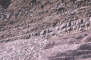
The Pennsylvanian Pottsville Formation is a mapped bedrock unit in Pennsylvania, western Maryland, West Virginia, Ohio, and Alabama. It is a major ridge-former in the Ridge-and-Valley Appalachians of the eastern United States. The Pottsville Formation is conspicuous at many sites along the Allegheny Front, the eastern escarpment of the Allegheny or Appalachian Plateau.
Biosphere reserves in Guatemala include:
Montañas Mayas Chiquibul is a biosphere reserve in the north of Guatemala. It is located in the municipalities of San Luis, Poptún, Dolores, and Melchor de Mencos in the department of El Petén, and covers an area of 1,236 km2 (477 sq mi).

Grutas de Lanquín is a large limestone cave system located 1 kilometre (0.62 mi) west of Lanquín in Alta Verapaz, Guatemala.
Cuevas del Silvino is a limestone cave system in Guatemala. It is located at km 260 on the road connecting Guatemala City to Puerto Barrios, in the municipality of Morales in the department of Izabal.
Las Victorias National Park is located in Alta Verapaz, Guatemala, on the north-western outskirts of the city of Cobán. Formerly a finca acquired in the mid-19th century by the French coffee grower Jules Rossignon, Las Victorias was designated a national park in 1980. The park covers an area of 82 ha, and is managed by the National Forestry Institute (INAB).
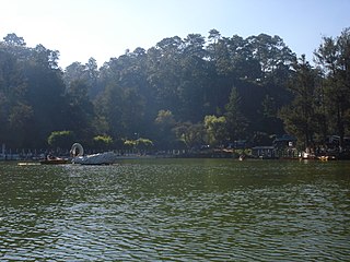
Los Aposentos is a small forested park area with a number of springs and two small lakes. It is located a few kilometers south of the city of Chimaltenango in Guatemala. It was formerly known as "Finca la Alameda" and renamed to Los Aposentos in 1929.
Cerro El Baúl, also known as El Baúl, is a forested lava dome overlooking the valley of Quetzaltenango. It is located about 3 km north of the Almolonga volcano, at the south-eastern edge of the city of Quetzaltenango in Guatemala. And is one of the city's last remaining green areas.
Cerro Miramundo, also known as Montaña de la Soledad, is a hill covered with dry shrubland located a few kilometers south of the city of Zacapa in Guatemala. The hill represents a panoramic point with an impressive view over the surrounding landscape.
Cerro El Reformador is a hill located in El Progreso, Guatemala. The hill is covered with dry shrubland and offers a panoramic point view of the surrounding landscape.
San José la Colonia is located in Alta Verapaz, Guatemala, on the northern outskirts of the city of Cobán. Formerly a nationalized finca, San José la Colonia was designated a national park in 1976. The park covers an area of 54 ha, and is managed by the National Forestry Institute (INAB).
Sipacate-Naranjo National Park is located along the Pacific coast of Escuintla in Guatemala. The park includes mangrove forests, lagoons and sandy beaches and covers an area of 20 km long and 1 km wide, stretching between the coastal towns of Sipacate and El Naranjo.
El Rosario National Park is located in El Petén, Guatemala, on the eastern edge of the town of Sayaxché.. The park is named after laguna El Rosario, a small lake within its boundaries, and was formerly a state owned finca managed by the National Forestry Institute (INAB). In 1980 it was declared a national park. The park covers an area of 11.05 km2, including the El Rosario lake, which has a surface area of 4 ha in the dry season, though it is considerably larger during the rainy season.
Naciones Unidas National Park is a forested park area of 4.91 km2, located 21 km south of Guatemala City, just north of Lake Amatitlán in the municipality of Villa Nueva. It is one of the last remaining nature reserves in the Guatemala City Metropolitan Area.
Punta de Manabique is a small peninsula that separates Amatique Bay from the Gulf of Honduras. It is located on Guatemala's east coast, some 20 km north of Puerto Barrios.

The Chocón Machacas Protected Biotope is a protected nature reserve in eastern Guatemala. It is located in the municipality of Livingston, in a densely forested area covering the lower reaches of the Chocón Machacas River basin and the northern shores of the Río Dulce-Golfete Dulce system.

The Mesaverde Group is a Late Cretaceous stratigraphic group found in areas of Colorado, New Mexico, Utah, and Wyoming, in the Western United States.
