River Cess

Last updated
River Cess
Liberia location map.svg
Red pog.svg
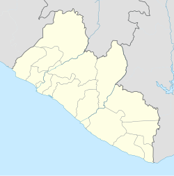
River Cess
Location in Liberia
Coordinates: 5°28′N9°35′W / 5.467°N 9.583°W / 5.467; -9.583
Country Flag of Liberia.svg Liberia
County Rivercess County
Population
 (2008)
  Total2,578
Climate Af

River Cess is the capital city of Rivercess County, Liberia. As of the 2008 national census, the population stood at 2,578. [1] It received its original name Cestos from Portuguese traders in the early 16th century from the baskets that were produced and sold in the town. Cestos in Portuguese and Spanish means basket.

Related Research Articles

Liberia Country on the Atlantic coast of West Africa

Liberia, officially the Republic of Liberia, is a country on the West African coast. It is bordered by Sierra Leone to its northwest, Guinea to its north, Côte d'Ivoire to its east, and the Atlantic Ocean to its south-southwest. It has a population of around 5 million and covers an area of 111,369 square kilometers (43,000 sq mi). English is the official language, but over 20 indigenous languages are spoken, representing the numerous ethnic groups who make up more than 95% of the population. The country's capital and largest city is Monrovia.

Geography of Liberia

Liberia is a Sub-Saharan nation in West Africa located at 6 °N, 9 °W. It borders the north Atlantic Ocean to the southwest and three other African nations on the other three sides, Sierra Leone to the northwest, Guinea to the northeast and Ivory Coast to the east.

Hermitage, Missouri City in Missouri, United States

Hermitage is a city in Hickory County, Missouri, United States, on the Pomme de Terre River. The population was 467 at the 2010 census. It is the county seat of Hickory County. The John Siddles Williams House on Museum Street in Hermitage, on the National Register of Historic Places since 1980, houses the Hickory County Historical Society Museum and Research Room.

Grand Cape Mount County County of Liberia

Grand Cape Mount is a county in the northwestern portion of the West African nation of Liberia. One of 15 counties that constitute the first-level of administrative division in the nation, it has five districts. Robertsport serves as the capital with the area of the county measuring 5,162 square kilometres (1,993 sq mi). As of the 2008 Census, it had a population of 129,817, making it the eighth most populous county in Liberia. The county is bordered by Gbarpolu County to the northeast and Bomi County to the southeast. The northern part of Grand Cape Mount borders the nation of Sierra Leone, while to the west lies the Atlantic Ocean.

Greenville, Liberia Place in Sinoe County, Liberia

Greenville is the capital of Sinoe County in southeastern Liberia and lies on a lagoon near the Sinoe River and the Atlantic Ocean. It is located about 150 miles southeast of Monrovia. As of the 2008 national census, the population stood at 16,434.

Zwedru Place in Grand Gedeh County, Liberia

Zwedru is the capital of Grand Gedeh County, one of the 15 counties in Liberia. Zwedru is located in Tchien District of Grand Gedeh County, near the Cavalla River in the country's south-eastern region and near the border with Côte d'Ivoire. It is located 350 miles southeast from the capital city of Monrovia. The town is a stronghold of the Krahn tribe.

Butaw District (Buto) is one of 16 districts of Sinoe County, Liberia. As of 2008, the population was 3,892.

Greenville District is one of 16 districts of Sinoe County, Liberia. As of 2008, the population was 16,434, making it the most populous district in the county.

Nueva Carteya city in Córdoba, Spain

Nueva Carteya is a city located in the province of Córdoba, Spain. According to the 2006 census (INE), the city has a population of 5566 inhabitants.

Castropodame Place in Castile and León, Spain

Castropodame is a village and municipality located in the region of El Bierzo. According to the 2010 census (INE), the municipality has a population of 1,812 inhabitants.

Traspinedo Place in Castile and León, Spain

Traspinedo is a municipality located in the province of Valladolid, Castile and León, Spain. According to the 2004 census (INE), the municipality has a population of 905 inhabitants.

Los Reyes is a municipality in the western part of the Mexican state of Michoacán. The municipality has an area of 480.09 square kilometres and is bordered to the north by the municipality of Tangancícuaro, to the east by Charapan, to the southeast by Uruapan, to the south by Peribán, to the southwest by Tocumbo, and to the northwest by Tingüindín. The municipality had a population of 77,000 inhabitants according to the 2009 census. Its municipal seat is the city of Los Reyes de Salgado.The city is also known for exporting avocados and blackberries. Both of these orchids surround the area between Los Reyes and Periban, it is also home of the Lobos Grises de los Reyes a professional soccer team currently playing in the Tercera Division Mexicana at Group IX.

Cestos River

The Cestos River, also known as Nuon or Nipoué river, is a Liberian river that rises in the Nimba Range of Guinea and flows south along the Côte d'Ivoire border, then southwest through tracks of Liberian rain forest to empty into a bay on the Atlantic Ocean where the city River Cess is located. The pygmy hippopotamus is known to inhabit lands along stretches of the river. It forms the northern third of the international boundary between Liberia and Côte d'Ivoire.

Shelawadi is a village in the southern state of Karnataka, India. It is located in the Navalgund taluk of Dharwad district in Karnataka.

Sanquin District 3 is one of 16 districts of Sinoe County, Liberia. As of 2008, the population was 3,174.

Sanquin District 2 is one of 16 districts of Sinoe County, Liberia. As of 2008, the population was 3,405.

Sanquin District 1 is one of 16 districts of Sinoe County, Liberia. As of 2008, the population was 2,118.

Bearwor District is one of 8 districts of Rivercess County, Liberia. As of 2008, the population was 3,854.

Zartlahn District is one of 8 districts of Rivercess County, Liberia. As of 2008, the population was 7,146.

Tchologo Region in Savanes, Ivory Coast

Tchologo Region is one of the 31 regions of Ivory Coast. Since its establishment in 2011, it has been one of three regions in Savanes District. The seat of the region is Ferkessédougou and the region's population in the 2014 census was 467,958.

References

  1. "2008 National Population and Housing Census: Preliminary Results" (PDF). Government of the Republic of Liberia. 2008. Retrieved 2012-03-30.

Coordinates: 5°28′N9°35′W / 5.467°N 9.583°W / 5.467; -9.583