Related Research Articles

Deer Creek is a village in Tazewell and Woodford counties in the U.S. state of Illinois. The population was 704 at the 2010 census. Deer Creek is part of the Peoria, Illinois Metropolitan Statistical Area.
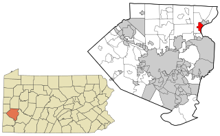
East Deer Township is a township in Allegheny County, Pennsylvania, United States. The population was 1,500 at the 2010 census.

Deer Lake is a town in the western part of the island of Newfoundland in the province of Newfoundland and Labrador, Canada.
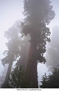
Sequoia National Forest is located in the southern Sierra Nevada mountains of California. The U.S. National Forest is named for the majestic Giant Sequoia trees which populate 38 distinct groves within the boundaries of the forest.

Quatsino Provincial Park is a provincial park in British Columbia, Canada, located on Quatsino Sound on northern Vancouver Island.

White Deer Hole Creek is a 20.5-mile (33.0 km) tributary of the West Branch Susquehanna River in Clinton, Lycoming and Union counties in the U.S. state of Pennsylvania. A part of the Chesapeake Bay drainage basin, the White Deer Hole Creek watershed drains parts of ten townships. The creek flows east in a valley of the Ridge-and-valley Appalachians, through sandstone, limestone, and shale from the Ordovician, Silurian, and Devonian periods.

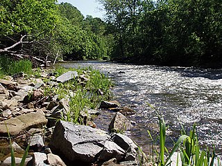
Wills Creek is a tributary of the Muskingum River, 92.2 mi (148.4 km) long, in eastern Ohio in the United States. Via the Muskingum and Ohio Rivers, it is part of the watershed of the Mississippi River. It drains an area of 853 mi² (2,209 km²).
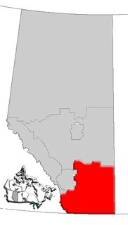
Southern Alberta is a region located in the Canadian province of Alberta. In 2004, the region's population was approximately 272,017. The primary cities are Lethbridge and Medicine Hat. The region is known mostly for agricultural production, but other sectors, such as alternative energy, film production and tourism, are emerging.

The Lil'wat First Nation, a.k.a. the Lil'wat Nation or the Mount Currie Indian Band, is a First Nation band government located in the southern Coast Mountains region of the Interior of the Canadian province of British Columbia. It is a member of the Lillooet Tribal Council, which is the largest grouping of band governments of the St'at'imc or Stl'atl'imx people. Other St'at'imc governments include the smaller In-SHUCK-ch Nation on the lower Lillooet River to the southwest, and the independent N'quatqua First Nation at the near end of Anderson Lake from Mount Currie, which is the main reserve of the Lil'wat First Nation, and also one of the largest Indian reserves by population in Canada.
Deer Creek is a 52.9-mile-long (85.1 km) river in Maryland and Pennsylvania that flows through the scenic areas of Harford County and empties into the Susquehanna River, roughly halfway between the Interstate 95 bridge and Conowingo Dam. Its watershed area is 171 square miles (440 km2). Its watershed area in MD is 145 square miles (380 km2), with 3% impervious surface in 1994. It serves as a divider between the agricultural and urban/suburban areas of Harford County.

Lynchburg is an unincorporated community in east central Harris County, Texas, United States.

The River Inny is a small river in east Cornwall, United Kingdom. It is a tributary of the River Tamar and is about twenty miles (32 km) long from its source near Davidstow on the eastern flank of Bodmin Moor to its confluence with the Tamar at Inny Foot near Dunterton.

North Tamerton is a village and civil parish in east Cornwall, England, UK. The village is situated approximately eight miles (13 km) southeast of Bude and eight miles (13 km) north of Launceston.

Deer Creek Township is one of twenty-four townships in Bates County, Missouri, and is part of the Kansas City metropolitan area within the USA. As of the 2000 census, its population was 2,162.

Artiofabula is a clade made up of the Suina and the Cetruminantia. The clade was found in molecular phylogenetic analyses and contradicted traditional relationships based on morphological analyses.

The Silvermine River is an 8.4-mile-long (13.5 km) river that flows through the towns of Norwalk, Wilton and New Canaan, Connecticut. It is spanned by the 1899 Perry Avenue Bridge in the Silvermine neighborhood, and by the Silvermine River Bridge that carries the Merritt Parkway. It is a tributary of the Norwalk River which it joins at the north end of Deering Pond.
The English River Dene Nation is a Dene First Nation band government in Patuanak, Saskatchewan, Canada. Their reserve is in the northern section of this Canadian province. Its territories are in the boreal forest of the Canadian Shield. This First Nation is a member of the Meadow Lake Tribal Council (MLTC).
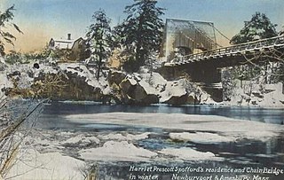
Deer Island is a small island with only 1-2 residences, located in the Merrimack River in Amesbury, Massachusetts. The island connects to mainland Amesbury by way of the Derek S. Hines Memorial Bridge, and to neighboring Newburyport via Chain Bridge.

Deer Creek is a census-designated place in Gila County in the U.S. state of Arizona. Deer Creek is located almost directly between the community of Tonto Basin and the town of Payson near Arizona State Route 87. The population as of the 2010 U.S. Census was 216.

Hudson Bay Regional Park is a regional park in the Canadian province of Saskatchewan. It is located on the south side of the town of Hudson Bay in the RM of Hudson Bay No. 394 along the shores of the Red Deer River. The park is the site of a North West Company fur trading fort called Fort Red Deer River that was built in 1790. About 14 kilometres downstream, near Erwood, was a Hudson's Bay Company trading post that was built in 1757.
References
- ↑ Eilert Ekwall (1928). English River Names. OUP. p. 118.