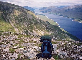
Loch Ericht is a freshwater loch on the border between the former Perthshire, now Perth and Kinross and the former Inverness-shire, now Highlands Council areas of Scotland. It has a north-east to south-west orientation. The village of Dalwhinnie lies at the north east end of the loch. Loch Ericht is the tenth largest freshwater lake in Scotland and has a good reputation for its trout fishing and Ferox trout.

The Allt Graad or River Glass is a river in Easter Ross, Highland, Scotland. It is named on Ordnance Survey maps variously as Allt Graad and River Glass. It has also been known as the "Allt Grande", and the archaic Anglicization, "Aultgraad".

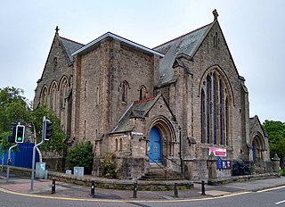
Crown is an area situated beside the city centre of Inverness, the capital city of the Scottish Highlands. In general, the area's housing dates back to the Victorian or Edwardian era.

Loch Laggan is a freshwater loch situated approximately 6+1⁄2 mi (10.5 km) west of Dalwhinnie in the Scottish Highlands. The loch has an irregular shape, runs nearly northeast to southwest and is approximately 7 mi (11 km) in length. It has an average depth of 68 ft (21 m) and is 174 ft (53 m) at its deepest. The eastern end of the loch features the largest freshwater beach in Britain. Since 1934 Loch Laggan has been part of the Lochaber hydro-electric scheme. At the northeast end of the loch is the hamlet of Kinloch Laggan.

Garbh Uisge is a river of approximately 7 km in the Trossachs of Scotland just north-west Callander. It is the outflow of Loch Lubnaig and joins with Eas Gobhain west of Callander to form the River Teith. The name of the river, Garbh Uisge, is Gaelic for "Rough Water", reflecting the nature of the river. The river is often informally called the River Leny due to the Falls of Leny, where the river crosses the Highland Boundary Fault, and because it flows through the Pass of Leny.

Loch Ness is a large freshwater loch in the Scottish Highlands extending for approximately 37 kilometres southwest of Inverness. It takes its name from the River Ness, which flows from the northern end. Loch Ness is best known for alleged sightings of the cryptozoological Loch Ness Monster, also known affectionately as "Nessie". It is one of a series of interconnected, murky bodies of water in Scotland; its water visibility is exceptionally low due to a high peat content in the surrounding soil. The southern end connects to Loch Oich by the River Oich and a section of the Caledonian Canal. The northern end connects to Loch Dochfour via the River Ness, which then ultimately leads to the North Sea via the Moray Firth.

The River Truim is a right bank tributary of the River Spey in the Scottish Highlands. Its headwaters meet to the north of the Pass of Drumochter and flow northwards as the Truim past the dam at the northern end of Loch Ericht and through the village of Dalwhinnie, highest village in the Scottish Highlands. The distillery at Dalwhinnie producing Dalwhinnie Single Malt is also the highest in Scotland. The waters of its most significant tributary, the Allt Cuaich, are diverted in part along an aqueduct to Loch Ericht. The river continues north-northeastwards down Glen Truim, over the Falls of Truim and on to meet the Spey 2.5 miles (4 km) southwest of Newtonmore. It is closely followed for almost its entire length by both the A9 road and the mainline railway from Perth to Inverness.

Glen Cannich is a long glen in the Northwest Highlands of Scotland and through which runs the River Cannich. Emerging from the reservoir of Loch Mullardoch, the river flows east to merge with the River Affric at the village of Cannich, their combined waters forming the River Glass.

Harlosh Island is one of four islands to be found in Skye's Loch Bracadale. Harlosh Island is one mile from the coast of the Duirinish Peninsula and four miles from the coast of the Minginish peninsula. At low tide it is only about 100 metres (330 ft) from Harlosh Point on mainland Skye.

Bearreraig Waterfall is a waterfall of Scotland.

Victoria Falls is a waterfall on the southern side of Loch Maree in Wester Ross in the north-west of Scotland. It is on the Abhainn Garbhaig, a short river that flows from Loch Garbhaig to Loch Maree. The falls are within Slattadale Forest, owned by the Forestry Commission.

The River Tarff is a river in Inverness-shire in the Scottish Highlands. It rises between the hills of Gairbeinn and Geal Charn and flows northwards then southwestwards and finally north-northwestwards into the Great Glen where it enters Loch Ness at Fort Augustus. The middle and lower reaches of the river are confined within the gorge of Glen Tarff. Its headwaters have been dammed to form the Glendoe Reservoir which forms the upper water storage basin for the Glendoe Hydro Scheme which began operation in 2009.

The River Druie is a right bank tributary of the River Spey in northeast Scotland. The Druie tributary, Am Beanaidh, emerges from Loch Einich and flows north through Gleann Einich. To its east, the Allt Drùidh flows northeastwards out of the Lairig Ghru. At their confluence in Rothiemurchus Forest some 4 miles (6 km) southeast of Aviemore, the Druie is born. Their combined waters flow as the River Druie beneath the Cairngorm Club Footbridge and on to meet the waters of the River Luineag immediately above the bridge carrying the B970 road over the river at Coylumbridge. The Druie flows a further 1.5 miles (2.5 km) past Inverdruie to meet the Spey at the southern end of Aviemore. The Luineag emerges from Loch Morlich within the Glenmore Forest Park and receives all the drainage from the northern slopes of Cairn Gorm.

The River Tromie is a right bank tributary of the River Spey in northeast Scotland. It emerges from the northern end of Loch an t-Seilich within the Gaick Forest and flows northwards, then northwestwards down through Glen Tromie to Bhran Cottage where it turns to the north-northeast. It is bridged by the B970 road at Tromie Bridge near Drumguish and flows a further 1.25 miles (2 km) northwest to meet the Spey near Lynchat.

Loch Mhòr is a loch in the traditional county of Inverness-shire in the Scottish Highlands. It occupies much of the wide floor of Stratherrick which runs roughly parallel to Loch Ness, around 3 mi (4.8 km) to its southeast. A generally shallow body of water 179 m (587 ft) above Loch Ness, Loch Mhòr achieves a depth in excess of 20 m (66 ft) towards its southern end.

The Black Water is a river in the Highlands of Scotland. It begins at the confluence of the Glascarnoch River with the Abhainn Srath a' Bhàthaich, near where it is crossed by the Black Bridge, carrying the A835 road. It flows in a south-easterly direction past the village of Garve, then passing through Loch Garve and Loch na Cròic, and around Eilean nan Daraich. It flows over Rogie Falls, then past Contin, around Contin Island, before flowing into the River Conon near Moy Bridge.

Loch Affric is a freshwater loch within Glen Affric, in the Highland council area of Scotland. It lies about 25 miles (40 km) southwest of Beauly. The loch sits in a national nature reserve known for being home to a number of rare species and the loch itself is popular for trout fishing. An annual duathlon is held on the banks of the loch in May and the loch has been widely used as the backdrop in films.

The Scavaig River or River Coruisk is a river on the Isle of Skye, in Scotland. It is located amongst the Cuillin, and flows from Loch Coruisk to meet the sea at Loch na Cuilce, an inlet of Loch Scavaig.


