
The River Wharfe is a river in Yorkshire, England originating within the Yorkshire Dales National Park. For much of its middle course it is the county boundary between West Yorkshire and North Yorkshire. Its valley is known as Wharfedale.
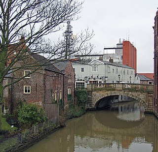
The River Foss is in North Yorkshire, England. It is a tributary of the River Ouse. It rises in the Foss Crooks Woods near Oulston Reservoir close to the village of Yearsley and runs south through the Vale of York to the Ouse in the centre of York. The name most likely comes from the Latin word Fossa, meaning ditch. It is mentioned in the Domesday Book. The York district was settled by Norwegian and Danish people, so parts of the place names could be old Norse. Referring to the etymological dictionary "Etymologisk ordbog", ISBN 82-905-2016-6 deals with the common Danish and Norwegian languages – roots of words and the original meaning. The old Norse word Fos (waterfall) means impetuous. The River Foss was dammed, and even though the elevation to the River Ouse is small, a waterfall was formed. This may have led to the name Fos which became Foss.

The Snoqualmie River is a 45-mile (72 km) long river in King County and Snohomish County in the U.S. state of Washington. The river's three main tributaries are the North, Middle, and South Forks, which drain the west side of the Cascade Mountains near the town of North Bend and join near the town of Snoqualmie just above the Snoqualmie Falls. After the falls the river flows north through rich farmland and the towns of Fall City, Carnation, and Duvall before meeting the Skykomish River to form the Snohomish River near Monroe. The Snohomish River empties into Puget Sound at Everett. Other tributaries of the Snoqualmie River include the Taylor River and the Pratt River, both of which enter the Middle Fork, the Tolt River, which joins at Carnation, and the Raging River at Fall City.

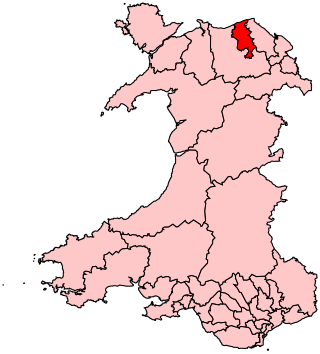
Denbighshire is a county in the north-east of Wales. It borders the Irish Sea to the north, Flintshire to the east, Wrexham to the southeast, Powys to the south, and Gwynedd and Conwy to the west. Rhyl is the largest town, and Ruthin is the administrative centre. Its borders differ from the historic county of the same name.
Flintshire, also known as the County of Flint, is one of Wales' thirteen historic counties, and a former administrative county. It mostly lies on the north-east coast of Wales.

The River Clwyd is a river in Wales that rises in the Clocaenog Forest 5 mi (8 km) northwest of Corwen. Its total length is 35 mi (56 km).
The Vale of Clwyd is a constituency of the House of Commons of the UK Parliament created in 1997 and represented since 2019 by James Davies of the Conservative Party. As with all extant seats its electorate elect one Member of Parliament (MP) by the first past the post system at least every five years.
The Vale of Clwyd is a tract of low-lying ground in the county of Denbighshire in north-east Wales. The Vale extends south-southwestwards from the coast of the Irish Sea for some 20 miles forming a triangle of low ground bounded on its eastern side by the well-defined scarp of the Clwydian Range and to the west by numerous low hills. The River Clwyd which rises within Clocaenog Forest, southwest of Denbigh, runs the full length of the vale. It is joined by the two major left bank tributaries of the River Clywedog and River Elwy and the smaller right bank tributary of the River Wheeler.

The Clwydian Range is a series of hills in the north-east of Wales that runs from Llandegla in the south to Prestatyn in the north; the highest point is 554 m (1,818 ft) Moel Famau. The range forms the north-western part of the Clwydian Range and Dee Valley Area of Outstanding Natural Beauty.

The River Elwy is a river in Wales forming a tributary to the River Clwyd. Though the source of the river may be on the northern flank of Moel Seisiog, south-east of Llanrwst, the river only receives the name Elwy at the village of Llangernyw, where three rivers meet.
The Vale of Clwyd and Conwy Football League was a football league formed in 2011 following the split of the Clwyd Football League, which itself was formed in 1974 as an amalgamation of the Dyserth and the Halkyn Mountain League. The Premier Division was in the fifth level of the Welsh football league system in North Wales. The league folded in 2020 due to a reorganisation of the Welsh football league pyramid, with many teams joining the North Wales Coast East Football League.

Dyserth is a village, community and electoral ward in Denbighshire, Wales. Its population at the 2011 United Kingdom census was 2,269 and was estimated by the Office for National Statistics as 2,271 in 2019. It lies within the historic county boundaries of Flintshire. Features include quarrying remains, waterfalls and the mountain Moel Hiraddug. Its railway line, once part of the London and North Western Railway, finally closed in 1973 and is now a footpath.
The Dyserth branch line was a short standard-gauge mineral railway between the northern end of the Clwydian Range at Dyserth and the North Wales Coast Line at Prestatyn. The line was constructed by the London and North Western Railway in 1869; it was built to carry quarried stone and coal. The rise of tourism led to the introduction of a passenger service in 1905. There were stations at Dyserth and Meliden, and basic halts were built at other stopping places. Competition from road transport led to the passenger service being withdrawn in 1930. With the eventual demise of all the mineral industries around Dyserth the entire line was closed in September 1973.

Saltney Town Football Club is a football club within the town of Saltney, on the border between England and Wales. They play in the Ardal Leagues North West, which is at tier three of the Welsh football pyramid.

The River Gele is a river in the North Wales and a tributary of the River Clwyd. The town of Abergele takes its name from the river. The spelling is a dialectal spelling of the Welsh word gelau. The river gives its name to an electoral ward, called Gele, which includes the southern half of Abergele town.

Nant-y-Ffrith refers to a stream and the wooded valley through which it flows on the border between Flintshire and Wrexham County Borough in Wales. The stream begins in moorland to the east of Llandegla. It passes Bwlchgwyn village before entering a rather steep-sided, rocky valley. It passes under the viaduct of a disused railway line before joining the River Cegidog at Ffrith.

Dyserth Waterfall is a waterfall in Dyserth, North Wales. The River Ffyddion, a tributary of the River Clwyd, falls down a 70-foot ledge creating the waterfall. In the 1880s, mining in the area caused it to dry up, however when the mining stopped, the waterfall resumed its full flow.
St Asaph City Football Club is a Welsh football team based in St Asaph, Denbighshire, Wales. They play in the Ardal NW, which is in the third tier of the Welsh football league system.
The Clwyd Football League was a football league formed in 1974 as an amalgamation of the Dyserth League and the Halkyn Mountain League. The top division was at different periods at the second, third and fourth levels of the Welsh football league system in North Wales. The league ran until 2011 when a split led to the formation of the Clwyd East Football League comprising Flintshire teams under the North East Wales Football Association and the Vale of Clwyd and Conwy Football League, made up of Denbighshire, Conwy county and Vale of Conwy sides, under the North Wales Coast Football Association.
