
The River Wharfe is a river in Yorkshire, England. For much of its length it is the county boundary between West Yorkshire and North Yorkshire.
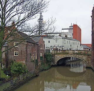
The River Foss is in North Yorkshire, England. It is a tributary of the River Ouse. It rises in the Foss Crooks Woods near Oulston Reservoir close to the village of Yearsley and runs south through the Vale of York to the Ouse in the centre of York. The name most likely comes from the Latin word Fossa, meaning ditch. It is mentioned in the Domesday Book. The York district was settled by Norwegian and Danish people, so parts of the place names could be old Norse. Referring to the etymological dictionary "Etymologisk ordbog", ISBN 82-905-2016-6 dealing with the common Danish and Norwegian languages – roots of words and the original meaning. The old Norse word Fos (waterfall) meaning impetuous. The River Foss was dammed, and even though the elevation to the River Ouse is small, a waterfall was formed. This may have led to the name Fos which became Foss.

The River Swale in Yorkshire, England, is a major tributary of the River Ure, which becomes the River Ouse, that empties into the North Sea via the Humber Estuary. The river gives its name to Swaledale, the valley through which it flows.

The Afon Rheidol is a river in Ceredigion, Wales, 19 miles (31 km) in length. The source is Plynlimon, the largest watershed in Wales with a catchment area covering 73 square miles (189 km2). Receiving an average annual rainfall of 40 inches (1015 mm) it is the source of both the Wye and the Severn.
The Afon Ogwen is a river in north-west Wales draining from some of the greatest peaks in Snowdonia before discharging to the sea on the eastern side of Bangor, Gwynedd.

The Waterfall Way is a road in New South Wales, Australia. It runs east-west from the Pacific Highway to the New England Highway at Armidale. The route passes through some of New South Wales' most scenic countryside and has become well known as its best and Australia's third most beautiful tourist drive. Seven national parks, of which three are listed as World Heritage Areas by UNESCO and form part of the Gondwana Rainforests of Australia, are located on or close to the route. Dorrigo National Park encompasses the waterfalls that give the route its name. It also provides one of the few road links between coastal and inland New South Wales, and is therefore more heavily trafficked than its condition might otherwise suggest.

The Clwydian Range is a series of hills in north east Wales that runs from Llandegla in the south to Prestatyn in the north, with the highest point being the popular Moel Famau. The range forms part of the Clwydian Range and Dee Valley Area of Outstanding Natural Beauty.

The River Geirionydd is a river in Snowdonia, North Wales. It is a tributary of the River Crafnant, which flows over the Fairy Falls waterfall in Trefriw, and thence on into the River Conwy, which is the main river of the Conwy valley.

Afon Porth-llwyd is a river in Snowdonia in north-west Wales. It flows from Llyn Eigiau on the south-eastern edge of the Carneddau range to join the river Conwy.

Dyserth is a village, community and electoral ward in Denbighshire, Wales. Its population at the 2011 United Kingdom census was 2,269, and estimated to be 2306 in 2018. It lies within the historic county boundaries of Flintshire. Its main features are extensive quarrying remains, waterfalls and a mountain. Its railway line, formerly part of the London and North Western Railway, closed in 1930 and is now a footpath.

Melincourt Falls is an 80 feet (24 m) high waterfall on Melin Court Brook, a left-bank tributary of the River Neath / Afon Nedd, located 1-mile (1.6 km) south of Resolven in the county borough of Neath Port Talbot, south Wales. It is formed where the brook plunges over a resistant band of 'Lower Pennant Sandstone' in a 13 acre / 5 hectare nature reserve managed by the Wildlife Trust of South and West Wales. The falls have been drawing visitors for at least two centuries – they are certainly known to have inspired J. M. W. Turner to paint them in 1794. The falls are considered by some to constitute a part of Waterfall Country though the bulk of these falls are a few miles further northeast at the head of the Vale of Neath.
The Vale of Neath, one of the South Wales Valleys, encompasses the upper reaches of the River Neath in southwest Wales. In addition to the River Neath, it is traversed by the Neath Canal and the A465 dual carriageway.

The Grey Mare's Tail is a waterfall on the very edge of the Snowdonia National Park near Gwydir Castle in the county of Conwy, north Wales. It lies just off the B5106 road between the town of Llanrwst and the large village of Trefriw. The Welsh name, Rhaeadr y Parc Mawr, derives from the fact that the falls are fed by a large stream that has its source in the Gwydir Forest, and flows through the old Parc Mine, about a mile to the southeast. The name 'Grey Mare's Tail' was given to it by Lady Willoughby of Gwydir Castle, possibly "in compliment to Lord Byron and the Staubbach"

Conwy Falls is a waterfall on the River Conwy at Bro Garmon in Conwy County Borough in Wales. The falls and surrounding area are a Site of Special Scientific Interest. The nearby cafe, adjacent to the A5, is an interesting example of the work of the Welsh architect Clough Williams-Ellis, of Portmeirion fame.
Dyserth branch line was a short standard-gauge mineral railway between the northern end of the Clwydian Range at Dyserth and the North Wales Coast Line at Prestatyn. The line, which was opened by the London and North Western Railway in 1869, was built to carry quarried stone and coal. The rise of tourism led to the introduction of a passenger service in 1905. Basic halts were introduced along the line. However, competition from road transport led the passenger service being withdrawn in 1930. With the eventual demise of all the mineral industries around Dyserth the entire line was closed in September 1973.

The Afon Aber is a small river in Gwynedd that enters Liverpool Bay on the coast of North Wales at Abergwyngregyn, 53.242°N 4.027°W. It rises in the Carneddau mountains on the northern watersheds of Drum, Foel Fras and Garnedd Uchaf and the eastern watersheds of Drosgl and Moel Wnion. It is principally noted for the spectacular waterfall of one its principal tributaries, the Aber Falls, where it leaves the hills and descends in a single drop to the valley floor. The river, joined by the other main tributary, the Afon Anafon, then flows through a densely wooded valley which is now a nature reserve before entering the sea just north of Abergwyngregyn.
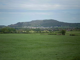
Moel Hiraddug also known as Y Foel is a hill fort and hill in the Clwydian Range of north-east Wales. The northern part of the hill has been eaten away by limestone quarrying. An Iron Age hillfort crowns the hill, called Moel Hiraddug. Its ridge runs North-South and it lies above the village of Dyserth. The views from the top are extensive and include Snowdonia. It is 265 metres above sea level.

Nant-y-Ffrith refers to a stream and the wooded valley through which it flows on the border between Flintshire and Wrexham County Borough in Wales. The stream begins in moorland to the east of Llandegla. It passes Bwlchgwyn village before entering a rather steep-sided, rocky valley. It passes under the viaduct of a disused railway line before joining the River Cegidog at Ffrith.

Dyserth Castle is a castle site in Denbighshire in the country of Wales. It is a scheduled monument protected ancient borough on a ridge north of the village of Dyserth. It was the last castle of the British fortified defences on the Clwydian hill range in the Middle Ages. The nearby village of Dyserth got its name from the castle.

The River Ffyddion is a tributary of the River Clwyd in North Wales. It is this river that forms Dyserth Waterfall.
