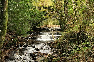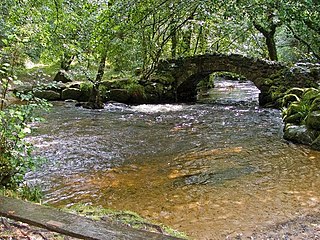
The River Sig is a 2.4 mile long river on Dartmoor in the county of Devon, England. It is a tributary to the River Lemon which it meets at Sigford.

The River Sig is a 2.4 mile long river on Dartmoor in the county of Devon, England. It is a tributary to the River Lemon which it meets at Sigford.

The river starts from marshland just to the south of Saddle Tor and the B3387 road on moorland, near Bag Tor Mire. [1] [2]
It then flows south east, leaving the moor into forest before the Langworthy Brook joins from the right bank. It passes to the west of the village of Sigford before flowing into the Lemon, and therefore, indirectly flowing into the Teign. The River Sig and the River Lemon spring within 5,000 feet of one another.

Childe's Tomb is a granite cross on Dartmoor, Devon, England. Although not in its original form, it is more elaborate than most of the crosses on Dartmoor, being raised upon a constructed base, and it is known that a kistvaen is underneath.

Dartmoor is an upland area in southern Devon, England. The moorland and surrounding land has been protected by National Park status since 1951. Dartmoor National Park covers 954 km2 (368 sq mi).

The Walkham is a river whose source is on Dartmoor, Devon, England. It rises in the wide gap between Roos Tor and Great Mis Tor and flows almost due south for approximately 3 miles (4.8 km) leaving the tors and thus National Park behind then south-west for 1 mile (1.6 km) past Woodtown. The river then reaches a village, Horrabridge, with a small compact network of streets mainly on the south or left bank. It receives most of its tributaries which are unnamed headwaters along its south-flowing inception, draining the near side of two series of six tors (peaks) to the west ending in Pew Tor at 320 metres and likewise to the east ending in Leeden Tor at 389 metres. In absolute distance, 2 miles (3.2 km) west of the village and the same south of the small well-preserved town of Tavistock by a footbridge on the West Devon Way the Walkham joins the Tavy which discharges into the Tamar Estuary north of the Plymouth conurbation after a fast descent around wide hillsides, a few miles south.

Fox Tor is a relatively minor tor on Dartmoor in the county of Devon, England.

Belstone is a small village and civil parish in the West Devon District of Devon, England. Lying on the northern side of Dartmoor, the western boundary of the parish is mostly formed by the East Okement River and the eastern by the River Taw; its highest point is Belstone Tor in the south, at 1,508 feet. The parish is surrounded, clockwise from the north, by the parishes of Sticklepath, South Tawton, Dartmoor Forest and Okehampton Hamlets. In 2001 its population was 257, relatively unchanged from the 1901 figure of 236.

Bickington is a village and civil parish in the Teignbridge district of Devon, England, on the east edge of the Dartmoor National Park. At the 2001 census it had a population of 311. The village is about five miles west of Newton Abbot, on the River Lemon. The church is 15th century; its lychgate has a room over it.

South Dartmoor Community College (SDCC) is a co-educational academy school located in Ashburton, Devon, England. The number of students on roll is 1,650. The school has a sixth form centre and has become a Specialist Sports College with Training School Status that is strongly linked with Ashmoor Hockey Club. It has 5 Tors from Dartmoor as its school houses and is split into 2 different populations, X and Y. The Tors are as listed, Hay Tor, Bel Tor, Fox Tor, Rippon Tor and Hound Tor.

Ashburn is a river in the Dartmoor moors in Devon in south-west England, flowing through the Ashburton valley to the River Dart.

The River Bovey rises on the eastern side of Dartmoor in Devon, England, and is the largest tributary to the River Teign. The river has two main source streams, both rising within a mile of each other, either side of the B3212 road between Moretonhampstead and Postbridge, before joining at Jurston.

The East Webburn is a stream in the Dartmoor moors in Devon in south-west England. It rises on the western side of the moors flowing off the west side of Hameldown ridge. Its source is less than 1 kilometre south west of Grimspound Bronze Age settlement. It flows south past Widecombe-in-the-Moor and joins the West Webburn River. These combined streams then join the River Dart close to the village of Holne.

The River Lemon is a 9.9 mile river in the county of Devon in southwest England. It is a tributary of the River Teign, starting on Dartmoor by Haytor, and ending in Newton Abbot. It rises on the south-east side of Dartmoor near Haytor, joins with the River Sig and the Langworthy Brook at Sigford, then passes the village of Bickington. Lower down, it is joined by the Kestor Brook and it then flows through the woods in Bradley Valley, past the manor house of Bradley, and through the town of Newton Abbot where it flows through a 440-yard-long tunnel below the town centre. Just below the town, the river joins the River Teign at 50.517°N 3.607°W, near the head of its estuary.

The Lyd is a river rising at Lyd Head in the Dartmoor national park in Devon in South West England and flowing into the River Tamar beyond Lifton. It runs through Lydford Gorge, the deepest gorge in South West England.

The River Swincombe is a tributary of the West Dart River that flows through Dartmoor national park in Devon, south-west England. It rises south-east of Princetown, and flows 2 km south-east to Foxtor Mires, where it turns north-east to meet the West Dart near Hexworthy. The first 2 km are known as the Strane River. Some maps show that the source starts north of Nakers Hill and heads north west to the east of Foxtor Mires where it meets the Strane River which is its own river.

The West Okement is a river in north Dartmoor in Devon in south-west England. It rises at West Okement Head near Cranmere Pool and flows in a generally NW direction past Black-a-Tor Copse and into Meldon Reservoir. After exiting the reservoir it flows in a generally northeast direction towards Okehampton, where it joins the East Okement River to form the River Okement. Its total length is roughly 16 kilometres (10 mi).

The West Webburn is a stream on Dartmoor in Devon in south-west England. It rises on the eastern side of the moors flowing off the east side of Hameldown Ridge. Its source is extremely close to the Grimspound Bronze Age settlement, and it was probably the main source of water for the settlement. It flows south, going past Widecombe-in-the-Moor, and joins the East Webburn River at Lizwell Meet in Oakmoor Wood. These combined streams then join the River Dart at Buckland Bridge in Holne Chase.

The Redlake Tramway was a railway built to carry supplies and workers between Bittaford and the clay workings at Redlake, near the centre of the southern part of Dartmoor, Devon, England. It was built in 1911 to a 3 ft narrow gauge, and ran for a circuitous 8.3 miles (13.4 km).

Sigford is a small hamlet in the Parish of Ilsington, on the eastern edge of Dartmoor, Devon, England. It is situated at the confluence of three rivers, although the name of the settlement refers to just one of these, the River Sig. The other two rivers are the Lemon and Langworthy Brook.

North Bovey is a village and civil parish situated on the south-eastern side of Dartmoor National Park, Devon, England, about 11 miles WSW of the city of Exeter and 1.5 miles SSW of Moretonhampstead. The village lies above the eastern bank of the River Bovey from which it takes its name. In 2001 the population of the parish was 274, compared to 418 in 1901 and 519 in 1801.

Becky Falls, originally known as Becka Falls, is a tourist attraction in Dartmoor, England, centered on a waterfall of around 20 metres down a boulder-strewn bed. In addition to the waterfall as the centrepiece, there is a woodland park with features such as a children's zoo, woodland trail, and crafts.
Rippon Tor is a striking tor on eastern Dartmoor, in England, that stands at 473 metres (1,552 ft) above sea level. It has three cairns, of which are some of Dartmoor's largest, a triangulation pillar, and several rock piles that overlook the northern high moors near Fernworthy Forest and Great Mis Tor. Field boundaries surround the tor.
Coordinates: 50°32′58″N3°43′32″W / 50.5495°N 3.7255°W