Hopkins Township is a civil township of Allegan County in the U.S. state of Michigan. The population was 2,601 at the 2010 census. The township is named after Stephen Hopkins, a signer of the Declaration of Independence.

Jay is a town in Essex County, New York, United States. The population was 2,506 at the 2010 census. The town is named after John Jay, governor of New York when the town was formed.

Teignbridge is a local government district in Devon, England. Its council is based in Newton Abbot.

Ilsington is a village and civil parish situated on the eastern edge of Dartmoor, Devon, England. It is one of the largest parishes in the county, and includes the villages of Ilsington, Haytor Vale, Liverton and South Knighton. The parish is surrounded, clockwise from the north, by the parishes of Bovey Tracey, Teigngrace, Newton Abbot, Ogwell, Bickington, Ashburton, Widecombe-in-the-Moor and Manaton. In 2001 the population of the parish was 2,444, greatly increased from the 886 residents recorded in 1901. The parish is represented in parliament by Mel Stride, as part of the Central Devon constituency.

Puddletown is a village and civil parish in Dorset, England. It is situated by the River Piddle, from which it derives its name, about 4.5 miles (7 km) northeast of the county town Dorchester. Its earlier name Piddletown fell out of favour, probably because of connotations of the word "piddle". The name Puddletown was officially sanctioned in the late 1950s. Puddletown's civil parish covers 2,908 hectares and extends to the River Frome to the south. In 2013 the estimated population of the civil parish was 1450.

The Androscoggin River is a river in the U.S. states of Maine and New Hampshire, in northern New England. It is 178 miles (286 km) long and joins the Kennebec River at Merrymeeting Bay in Maine before its water empties into the Gulf of Maine on the Atlantic Ocean. Its drainage basin is 3,530 square miles (9,100 km2) in area. The name "Androscoggin" comes from the Eastern Abenaki term /aləssíkɑntəkw/ or /alsíkɑntəkw/, meaning "river of cliff rock shelters" ; or perhaps from Penobscot /aləsstkɑtəkʷ/, meaning "river of rock shelters". The Anglicization of the Abenaki term is likely an analogical contamination with the colonial governor Edmund Andros.

South Dartmoor Community College (SDCC) is a co-educational academy school located in Ashburton, Devon, England. The number of students on roll is 1,650. The school has a sixth form centre and has become a Specialist Sports College with Training School Status that is strongly linked with Ashmoor Hockey Club. It has 5 Tors from Dartmoor as its school houses and is split into 2 different populations, X and Y. The Tors are as listed, Hay Tor, Bel Tor, Fox Tor, Rippon Tor and Hound Tor.
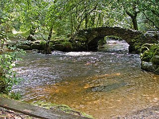
The River Bovey rises on the eastern side of Dartmoor in Devon, England, and is the largest tributary to the River Teign. The river has two main source streams, both rising within a mile of each other, either side of the B3212 road between Moretonhampstead and Postbridge, before joining at Jurston.

The River Lemon is a 9.9 mile river in the county of Devon in southwest England. It is a tributary of the River Teign, starting on Dartmoor by Haytor, and ending in Newton Abbot. It rises on the south-east side of Dartmoor near Haytor, joins with the River Sig and the Langworthy Brook at Sigford, then passes the village of Bickington. Lower down, it is joined by the Kestor Brook and it then flows through the woods in Bradley Valley, past the manor house of Bradley, and through the town of Newton Abbot where it flows through a 440-yard-long tunnel below the town centre. Just below the town, the river joins the River Teign at 50.517°N 3.607°W, near the head of its estuary.
Exbourne is a village and civil parish in the English county of Devon. The Anglo-Saxon origin of the name is gæces burn - Cuckoo Stream. It occupies a hillside location between the River Okement and the Hole Brook, about 5 miles north of Okehampton in West Devon, and height above sea level ranges between 280 Ft. and 484 Ft. It lies in a primarily agricultural location and the local parish council represents both Exbourne and nearby Jacobstowe. The population of the ward which represents Exbourne and all surrounding villages was 1,695 at the 2011 census.

Oak Island is one of the Apostle Islands, in northern Wisconsin, in Lake Superior, and is part of the Apostle Islands National Lakeshore.
Weyer is a hamlet in the town of Hamburg in Erie County, New York, United States.

Saint-Quentin is a civil parish in Restigouche County, New Brunswick, Canada.
Tonquin Pass, 1948 m (6393 ft), is a mountain pass in the Canadian Rockies, linking Tonquin Valley in Jasper National Park, Alberta, to Mount Robson Provincial Park and adjoining areas of British Columbia. It is at the headwaters of Tonquin Creek, which flows into British Columbia. Located on the interprovincial boundary, it is on the Continental Divide.
Kuke is a village in Saaremaa Parish, Saare County in western Estonia.

Teigngrace is a civil parish centred on a hamlet that lies about two miles north of the town of Newton Abbot in Devon, England. According to the 2001 census, its population was 235, compared to 190 a century earlier. The western boundary of the parish mostly runs along the A382 road; its short northern boundary along the A38; and its eastern partly along the rivers Bovey and Teign. It comes to a point at its southern extremity, near Newton Abbot Racecourse. The parish is surrounded, clockwise from the north, by the parishes of Bovey Tracey, Kingsteignton, Newton Abbot and a small part of Ilsington.

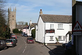
West Buckfastleigh is a small civil parish on the eastern border of Dartmoor in Devon, England. Situated within the parish are the village of Scorriton and the hamlets of Michelcombe and Combe.
Cyclone Creek is a stream in the U.S. state of South Dakota.

The River Sig is a 2.4 mile long river on Dartmoor in the county of Devon, England. It is a tributary to the River Lemon which it meets at Sigford.

Mearley Brook is a minor river in Lancashire, England. It is approximately 4.5 miles (7.2 km) long and has a catchment area of 8.79 square miles (22.77 km2).
