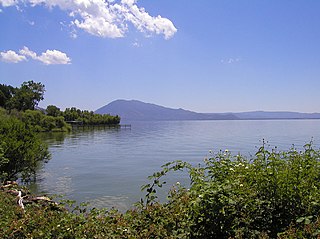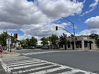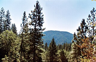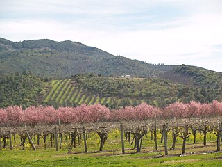
Lake County is a county located in the north central portion of the U.S. state of California. As of the 2020 census, the population was 68,163. The county seat is Lakeport. The county takes its name from Clear Lake, the dominant geographic feature in the county and the largest non-extinct natural lake wholly within California.

Clearlake is a city in Lake County, California. Clearlake is 4.5 miles (7.2 km) north-northwest of Lower Lake, at an elevation of 1,417 feet (432 m). As of the 2020 census, the city had a total population of 16,685, up from 15,250 in the 2010 census. It takes its name from Clear Lake.

Kelseyville is a unincorporated community in Lake County, California, located six miles southeast of Lakeport, at an elevation of 1,384 feet. For statistical purposes, the United States Census Bureau has defined that community as a census-designated place (CDP). Its population was 3,382 according to the 2020 United States census.

Lower Lake is a census-designated place (CDP) in the southern Clear Lake region of Lake County, in northern California. Lower Lake is also an Indian rancheria of the Koi Nation people.

Middletown is a census-designated place (CDP) in Lake County, California, United States. Its population was 725 at the 2020 census down from 1,323 at the 2010 census, which was up slightly from 1,020 at the 2000 census. Middletown was given its name because it is halfway between Lower Lake and Calistoga, which is 17 miles (27 km) to the south. The town was severely damaged by the 2015 Valley Fire.

Upper Lake is a census-designated place (CDP) in Lake County, California, United States. Upper Lake is located 8 miles (13 km) north of Lakeport, at an elevation of 1,345 feet (410 m). The population was 1,052 at the 2010 census, up from 989 at the 2000 census. The Habematolel Pomo of Upper Lake are headquartered here.
California's 6th congressional district is a congressional district in the U.S. state of California. It is represented by Democrat Ami Bera.
New Jersey's 4th congressional district is a congressional district that stretches along the New Jersey Shore. It has been represented by Republican Chris Smith since 1981, the second-longest currently serving member of the US House of Representatives and the longest serving member of Congress from New Jersey in history.

Mount Konocti is a volcano in Lake County, California on the south shore of Clear Lake. At 4,305 feet (1,312 m), it is the second highest peak in the Clear Lake Volcanic Field, which consists of numerous volcanic domes and cones ranging from 10,000 to 2.1 million years old. Although it is often described as extinct, it is actually classified by the USGS as High Threat Potential. Clear Lake Volcanic Field's alert level is currently classified as Normal.
California's 8th congressional district is a congressional district in the U.S. state of California. As of 2023, Democrat John Garamendi represents the district. Currently, the 8th district includes parts of the Bay Area counties of Contra Costa County and Solano County, including the cities of Vallejo, Fairfield, Richmond and parts of Martinez.
California's 4th congressional district is a U.S. congressional district in California. The district is located in the northwestern part of the state, and includes all of Lake County and Napa County, most of Yolo County, and parts of Solano County and Sonoma County. Major cities in the district include Davis, Woodland, Napa, Vacaville, and most of Santa Rosa. The new 4th district is solidly Democratic, and is represented by Mike Thompson.

Cobb Mountain is the tallest mountain in the Mayacamas Mountains of California.

Lake County wine designates wine made from grapes grown mostly in Lake County, California. The region is located north of Napa County and east of Mendocino County. Although each region within Lake County has unique viticultural attributes, many are influenced by Clear Lake, the largest inland body of water in California.
Buckingham Park is an unincorporated community in Lake County, California. It is located on the south shore of Clear Lake, on the peninsula just south of The Narrows and 4.8 mi (7.7 km) northeast of Kelseyville, 9 miles (14 km) east-southeast of Lakeport, at an elevation of 1,414 feet. The community was established as an "exclusive subdivision" of lakeside properties in 1930.

Kelseyville Riviera is a planned community in Lake County, California. In 2021, its name was changed from Clearlake Riviera by its homeowners association. The population was 3,410 at the 2020 census.
Riviera West is a planned and unincorporated community in Lake County, California, lying within the Soda Bay census-designated place boundaries. It is located on the northern slope of Mount Konocti, east of the Riviera Heights subdivision.

Pieta is an archaic placename, former crossroads, and former railroad depot in Mendocino County, California. It is located near the mouth of Pieta Creek 5 miles (8 km) southeast of Hopland, at an elevation of 476 feet.
Konocti Harbor is a resort and former music venue in Kelseyville, California. It is situated at the base of Mount Konocti on the south shore of Clear Lake, the largest freshwater lake interior to California. Its amenities include a spa, a restaurant, a marina, and two Olympic-size swimming pools.
Andrew Kelsey, or Andy Kelsey, was an early American pioneer of California with his brothers Samuel and Benjamin Kelsey. Originally from Kentucky, he arrived in Alta California with the Bartleson–Bidwell Party in 1841, ventured into Oregon with his brothers, and participated in the Bear Flag Revolt. He eventually settled in the Clear Lake area in modern-day Lake County, California after acquiring livestock from Californio Salvador Vallejo. He and his business partner Charles Stone effectively enslaved local Pomo and Wappo bands and, along with Benjamin Kelsey, subjected them to starvation, torture, rapes and murders. Andrew Kelsey and Charles Stone were killed in 1849 during an Indian uprising triggered by their mistreatment of the indigenous population. Kelsey's name is attached to the town of Kelseyville in Lake County.

The Valley Fire was a wildfire during the 2015 California wildfire season that started on September 12 in Lake County, California. It began shortly after 1:00 pm near Cobb with multiple reports of a small brush fire near the intersection of High Valley and Bottlerock Roads. It quickly spread and by 6:30 PM PDT, it had burned more than 10,000 acres (40 km2). By Sunday, the thirteenth of September, the fire had reached 50,000 acres (202 km2) and had destroyed much of Cobb, Middletown, Whispering Pines, and parts in the south end of Hidden Valley Lake. The fire ultimately spread to 76,067 acres (308 km2), killed four people and destroyed nearly 2,000 buildings, before it was fully contained on October 15, 2015, causing at least $921 million in insured property damage. At the time, the fire was the third-most destructive fire in California history, based on the total structures burned, but the Camp Fire (2018) and the North Complex fire in 2020 exceeded that total.


