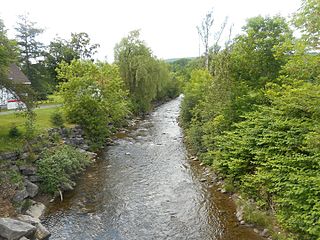
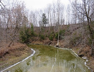
The Rivière Trompeuse is a tributary of the rivière aux Écorces, flowing in the unorganized territory of Lac-Jacques-Cartier, in the La Côte-de-Beaupré Regional County Municipality, in the administrative region of Capitale-Nationale, in the province of Quebec, in Canada. The course of the Trompeuse River crosses the northwestern part of the Laurentides Wildlife Reserve.

The Rivière aux Pins is a watercourse flowing in several municipalities of La Jacques-Cartier Regional County Municipality, in the administrative region of Capitale-Nationale, in Quebec, in Canada. The municipalities crossed by this 32.7 kilometres (20.3 mi) river, are Saint-Gabriel-de-Valcartier (18.9 km), Shannon (11,0 km) and Fossambault-sur-le-Lac (2.8 km).
The Petite rivière aux Pins is a tributary of the Rivière aux Pins, flowing entirely in the territory of Saint-Gabriel-de-Valcartier, in the La Jacques-Cartier Regional County Municipality, in the administrative region of Capitale-Nationale, in Quebec, in Canada.

The rivière aux Chiens flows south, on the north shore of the Saint Lawrence river, in the municipalities of Beaupré and Château-Richer, in the La Côte-de-Beaupré Regional County Municipality, in the administrative region of Capitale-Nationale, in the province from Quebec, to Canada. It empties into the St. Lawrence River at Beaupré.
The Rivière du Premier Rang is a tributary of the west bank of the Jean-Noël River flowing on the north bank of the Saint Lawrence River, in the municipalities of Saint-Hilarion and Les Éboulements, in the MRC of Charlevoix Regional County Municipality, in the administrative region of Capitale-Nationale, in the province of Quebec, in Canada.
The Rivière des Boudreault is a tributary of the northwest shore of the St. Lawrence River, in the municipality of Les Éboulements, in the Charlevoix Regional County Municipality, in the administrative region of Capitale-Nationale, in the province of Quebec, in Canada.
Le Gros Bras is a tributary of the eastern bank of the lower part of the rivière du Gouffre, flowing in the unorganized territory of Lac-Pikauba and the municipality of Saint-Urbain, in the Charlevoix Regional County Municipality, in the administrative region of Capitale-Nationale, in the province of Quebec, in Canada. The upper part of this watercourse begins in Grands-Jardins National Park.
The Rivière des Monts is a tributary of the southwest bank of the lower part of the watercourse Le Gros Bras, flowing in the non organized from Lac-Pikauba and the municipality of Saint-Urbain, in the Charlevoix Regional County Municipality, in the administrative region of Capitale-Nationale, in the province of Quebec, in Canada.
The Sabrevois River is a tributary of the south shore of the St. Lawrence River, flowing in the city of Boucherville, in the administrative region of Montérégie, southwest of province of Quebec, in Canada.
The rivière Saint-Charles is a tributary of the south shore of the Saint Lawrence River, flowing in the city of Varennes, in the Marguerite-D'Youville Regional County Municipality, in the administrative region of Montérégie, southwest of province of Quebec, to Canada.
The Écossais River is a tributary of the Yamaska River. It flows in the administrative region of Montérégie, on the South Shore of the Saint Lawrence River, in Quebec, Canada. Its course towards the north-east successively crosses the municipalities of:

The North Eaton River is a tributary of the Eaton River, which flows into the Saint-Francois River which in turn flows to the south bank of the Saint Lawrence River. The North Eaton River flows through the municipalities of La Patrie, Newport and Cookshire-Eaton, in the Le Haut-Saint-François Regional County Municipality (MRC), in the administrative region of Estrie, in Quebec, in Canada.

The Moe River is a watercourse flowing in the administrative region of Estrie to Quebec, Canada. It is a tributary of the rivière aux Saumons which successively flows into the Massawippi River, into the Saint-François River, therefore a sub-tributary of the Saint Lawrence River.

The David River is a tributary of the East shore of the Yamaska River. It flows north-east on the South Shore of the St. Lawrence River, in Quebec, Canada, in the municipalities of:

The Sauvage River is a tributary of the Felton River which flows into the Baie Sauvage to the south of Grand lac Saint François which constitutes the head lake of the Saint-François River.
The Petite rivière Muskrat is a tributary of Grand lac Saint François which constitutes the head lake of the Saint-François River. The course of the "Petite rivière Muskrat" crosses the territory of the municipality of Adstock, in the Les Appalaches Regional County Municipality, in the administrative region of Chaudière-Appalaches, on the South Shore of the St. Lawrence River, in Quebec, Canada.
The rivière aux Ormes is a tributary of the east bank of the Huron River which constitutes a tributary of the south shore of the St. Lawrence River.
The Aulneuse River is a tributary of the south shore of the St. Lawrence River. This river flows through the municipalities of Saint-Apollinaire and the town of Lévis, in the administrative region of Chaudière-Appalaches, in Quebec, in Canada.
The Cugnet river is a tributary of the Beaurivage River which is a tributary of the west bank of the Chaudière River. It flows in the municipality of Saint-Lambert-de-Lauzon of the Lotbinière Regional County Municipality and in the Saint-Étienne-de-Lauzon of the city of Lévis, in the administrative region of Chaudière-Appalaches, in Quebec, in Canada.

The rivière de la Grande Coudée is a tributary of the west bank of the Chaudière River which flows northward to empty onto the south bank of the St. Lawrence River. It flows in the municipalities of Saint-Hilaire-de-Dorset, Saint-Gédéon-de-Beauce and Saint-Martin, in the Beauce-Sartigan Regional County Municipality, in the administrative region of Chaudière-Appalaches, in Quebec, in Canada.


