Ringforts, ring forts or ring fortresses are circular fortified settlements that were mostly built during the Bronze Age up to about the year 1000. They are found in Northern Europe, especially in Ireland. There are also many in South Wales and in Cornwall, where they are called rounds. Ringforts come in many sizes and may be made of stone or earth. Earthen ringforts would have been marked by a circular rampart, often with a stakewall. Both stone and earthen ringforts would generally have had at least one building inside.

Rathdowney or Rathdowny is a town in southwest County Laois, Ireland. It lies some 32 km southwest of Portlaoise in the Irish Midlands, at the point where the R433 regional road from Abbeyleix to Templemore is crossed by the R435 from Borris-in-Ossory to Johnstown. The R433 provides access for Rathdowney to the Dublin-Cork M8 motorway, while the R435 links the town to the Dublin-Limerick M7. As of the 2016 census, the population of Rathdowney was 1,271.

Ratoath is a village in County Meath, Ireland. A branch of the Broad Meadow Water flows through the town. The R125 and R155 roads meet in the village. At the 2016 census, there were 9,533 people living in Ratoath.

The Grianan of Aileach, sometimes anglicised as Greenan Ely or Greenan Fort, is a hillfort atop the 244 metres (801 ft) high Greenan Mountain at Inishowen in County Donegal, Ireland. The main structure is a stone ringfort, thought to have been built by the Northern Uí Néill, in the sixth or seventh century CE; although there is evidence that the site had been in use before the fort was built. It has been identified as the seat of the Kingdom of Ailech and one of the royal sites of Gaelic Ireland. The wall is about 4.5 metres (15 ft) thick and 5 metres (16 ft) high. Inside it has three terraces, which are linked by steps, and two long passages within it. Originally, there would have been buildings inside the ringfort. Just outside it are the remains of a well and a tumulus.

Rosegreen is a village County Tipperary, Ireland. It is about 6.4 miles south of Cashel on the Cashel to Clonmel road. As of the 2016 census the population was 171. The village is home to the Ballydoyle Stables, which is the horseracing training establishment of Vincent O'Brien. Rosegreen is in the barony of Middle Third.
Raheen is a townland and village in County Wexford, Ireland. It lies 27 km from Wexford, 11 km from New Ross, and 23 km from Enniscorthy.

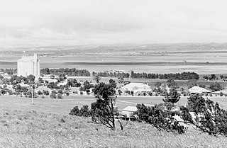
Robertstown is a town in South Australia. The town is located 23 kilometres (14 mi) north of Eudunda, in the Regional Council of Goyder. At the 2006 census, Robertstown and the surrounding area had a population of 318. Robertstown is named for the John Roberts, the first postmaster in the area, who laid out the town in 1871. It was previously known as Emu Flats and Roberts Town.
Brickeens is a very small townland in County Longford, Ireland. It is about five kilometres north of Keenagh and eight kilometres south of Longford town. Brickeens townland has an area of approximately 146 acres (0.2 sq mi), and had a population of 21 people as of the 2011 census. Evidence of ancient settlement in the townland include two ringforts.
Rath is a hamlet in the south west area of County Offaly, Ireland. The hamlet is located midway between the towns of Birr and Kilcormac on a northeast-southwest country road. It is located in the parish of Eglish and Drumcullen which is in the Roman Catholic Diocese of Meath. The hamlet has a number of local amenities for the local population including a church, a national school, a local community centre and a local shop. Drumcullen GAA is the local GAA club and is located about half a kilometre to the south of the hamlet.

Rathborney, sometimes Rathbourney, is a civil parish in the Barony of Burren in County Clare, Ireland.

Longstone Rath is a ringfort (rath) and National Monument located in County Tipperary, Ireland.
Mullaghreelan Rath is a ringfort (rath) and National Monument located in County Kildare, Ireland.
Ardmulchan Fort is a ringfort (rath) and National Monument located in County Meath, Ireland.
Realtogue Fort is a ringfort (rath) and National Monument located in County Meath, Ireland.

Danestown Fort is a ringfort (rath) and National Monument located in County Meath, Ireland.
Errigal Ringfort, also called Fort William, is a ringfort (rath) and National Monument located in County Cavan, Ireland.
Raharney Ringfort is a ringfort located in County Westmeath, Ireland and a National Monument.

Ballyallaban ringfort or sometimes An Rath is an earthen ringfort south of Ballyvaughan in the Burren area, in County Clare, Ireland. It is a National Monument.

Rathtoe, also spelled Rathoe, is a village and townland in County Carlow, Ireland. The village is located in the civil parish of Gilbertstown, between Tullow and Ballon, County Carlow. The Burren River flows through the area. Rathtoe is a census town, and had a population of 304 as of the 2016 census.


