
The South Orkney Islands are a group of islands in the Southern Ocean, about 604 km (375 mi) north-east of the tip of the Antarctic Peninsula and 844 km (524 mi) south-west of South Georgia Island. They have a total area of about 620 km2 (240 sq mi). The islands are claimed both by Britain, and by Argentina as part of Argentine Antarctica. Under the 1959 Antarctic Treaty, sovereignty claims are held in abeyance.
Andreaea Plateau is a small plateau with an average elevation of 180 metres (590 ft), located southwest of Robin Peak, Signy Island, in the South Orkney Islands. The feature is notable for the largest known stand in the Antarctic of the black-brown moss Andreaea.
Coldblow Col is a snow-covered col at 300 metres (1,000 ft) elevation, between Echo Mountain and the Cragsman Peaks on Coronation Island, in the South Orkney Islands. It was surveyed in 1950 by the Falkland Islands Dependencies Survey (FIDS). The name derives from the fact that a FIDS party had their tent blown down in a gale when camped on this col in September 1948.
Condor Peninsula is a mountainous, ice-covered peninsula, 30 nautical miles long and 10 to 15 nautical miles wide, between Odom Inlet and Hilton Inlet on the east coast of Palmer Land, Antarctica.
Conroy Point is a headland midway along the northwest side of Moe Island in the South Orkney Islands. It was named by the UK Antarctic Place-Names Committee after James W.H. Conroy, ornithologist on Signy Island, 1967–68.
Jensen Ridge is a curving ridge running eastward from Foca Point toward Jane Col on Signy Island in the South Orkney Islands. It was named in 1991 by the UK Antarctic Place-Names Committee after Captain Gullik Jensen, of the whaling ship Strombus from Tønsberg, Norway, who made the last whaling expedition to Signy Island in 1935–36.
Fyr Channel is a channel 0.2 nautical miles (0.4 km) wide between the southwest end of Signy Island and Moe Island, in the South Orkney Islands. The name "Fyr Strait" appears on a manuscript chart drawn by Captain Petter Sorlle in 1912, and corrected by Hans Borge in 1913, but the generic term channel is approved because of the small size of this feature. The Corral Whaling Co. of Bergen, a subsidiary of Messrs. Christensen and Co., Corral, Chile, operated the steam whaler Fyr in the South Orkney Islands in 1912–13.
Paternoster Valley is a valley extending southwestward from Stygian Cove in northern Signy Island. So named by United Kingdom Antarctic Place-Names Committee (UK-APC) from the occurrence of three small paternoster lakes, at different levels in the valley.
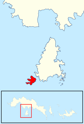
Moe Island is an island 2 km (1.2 mi) long in the South Orkney Islands off Antarctica, separated from the south-west end of Signy Island by Fyr Channel. It was charted by Captain Petter Sørlle in 1912–13, and named after M. Thoralf Moe of Sandefjord, Norway, a contemporary whaling captain who worked in this area. The northernmost point of the island is Spaull Point, named by United Kingdom Antarctic Place-Names Committee (UK-APC) after Vaughan W. Spaull, British Antarctic Survey (BAS) biologist on Signy Island, 1969.

The Flensing Islands are a group of small islands lying 1 nautical mile (2 km) west of Foca Point on the west side of Signy Island, in the South Orkney Islands. The islands were named "Flenserne" on a chart of 1912–13 by Norwegian whaling captain Petter Sorlle. The name Flensing Islands, suggested by the earlier Norwegian name, was used by Discovery Investigations personnel on the Discovery II who surveyed the group in 1933. Flensing is the process of stripping skin and blubber from whales.
Moraine Valley is a valley filled with morainic debris, 0.75 nautical miles (1.4 km) long, which drains north into Elephant Flats on the east side of Signy Island, in the South Orkney Islands off Antarctica. In summer a stream, fed by the ice slopes at its south end, runs in this valley. It was named by the Falkland Islands Dependencies Survey following their survey of 1947.
The Moss Braes are west-facing slopes situated west of Robin Peak on Signy Island, in the South Orkney Islands off Antarctica. They were named by the UK Antarctic Place-Names Committee in 1990 from the extensive moss banks on the dissected rocky slopes.
Maling Peak is a mountain 430 metres (1,400 ft) high and is the southernmost of two conspicuous peaks 0.5 nautical miles (1 km) northwest of Cape Vik on the south coast of Coronation Island in the South Orkney Islands, Antarctica. It was roughly surveyed in 1933 by Discovery Investigations personnel and was named by the UK Antarctic Place-Names Committee for Derek H. Maling, a Falkland Islands Dependencies Survey meteorologist at Signy Island in 1948 and 1949, who made a survey triangulation of Signy Island and the south coast of Coronation Island.
Sandefjord Peaks is a set of three conical peaks, the highest 635 m, marking the southwest end of Pomona Plateau at the west end of Coronation Island, in the South Orkney Islands. The southernmost of these peaks was named Sandefjord Peak after nearby Sandefjord Bay by DI personnel in 1933. The collective name, Sandefjord Peaks, was recommended by the United Kingdom Antarctic Place-Names Committee (UK-APC) following a survey of the peaks by the Falkland Islands Dependencies Survey (FIDS) in 1950. They were first climbed in September 1969 by John Edwards, Martin Pinder, Dave Rinning and Eliot Wright after 11 days man-hauling a sledge across from Signy Island
Skua Terrace is a terrace in the northwest part of Signy Island, South Orkney Islands, extending north-south from the vicinity of Spindrift Rocks to the vicinity of Express Cove. Named in 1980 by the United Kingdom Antarctic Place-Names Committee (UK-APC) from the numerous pairs of brown skuas nesting in the area.
Mount Sladen is a conspicuous pyramid-shaped mountain, 890 m, standing 1.5 nautical miles (2.8 km) northeast of Saunders Point in eastern Coronation Island, in the South Orkney Islands. Surveyed by the Falkland Islands Dependencies Survey (FIDS) in 1948–49. Named by the United Kingdom Antarctic Place-Names Committee (UK-APC) for Dr. William J.L. Sladen of the FIDS, medical officer and biologist at Hope Bay in 1948, and at Signy Island in 1950. During the 1960s and 1970s, Dr. Sladen was chief United States Antarctic Research Program (USARP) investigator concerned with studies of penguins at Cape Crozier, Ross Island.
Snipe Peak is a peak, 225 m, which is the main peak on Moe Island, situated close southwest of Signy Island in the South Orkney Islands. Surveyed in 1933 by DI personnel. The name, proposed by G. Robin of Falkland Islands Dependencies Survey (FIDS) following his survey in 1947, commemorates the first visit to Signy Island, in February 1948, of HMS Snipe.
Spindrift Col is a col between hills in north-central Signy Island, 0.5 nautical miles (0.9 km) southeast of Spindrift Rocks. Named by United Kingdom Antarctic Place-Names Committee (UK-APC) in association with Spindrift Rocks.
Limestone Valley is a valley extending northwest from Cemetery Bay, Signy Island, in the South Orkney Islands. The valley leads directly to Jane Col and serves as a route to the west coast of the island. It was so named by the UK Antarctic Place-Names Committee because of an exposure of limestone in the cliff above the valley.
Three Lakes Valley is a low valley containing three freshwater lakes, extending from the vicinity of Elephant Flats northward to Stygian Cove on Signy Island, in the South Orkney Islands. The three lakes, from north to south, are Heywood Lake, Knob Lake, and Pumphouse Lake. The valley was surveyed and given this descriptive name by the Falkland Islands Dependencies Survey (FIDS) in 1947.