The Finger Lakes are a group of eleven long, narrow, roughly north–south lakes located south of Lake Ontario in an area called the Finger Lakes region in New York, in the United States. This region straddles the northern and transitional edge, known as the Finger Lakes Uplands and Gorges ecoregion, of the Northern Allegheny Plateau and the Ontario Lowlands ecoregion of the Great Lakes Lowlands.

Cattaraugus County is a county in Western New York, with one side bordering Pennsylvania. As of the United States 2020 census, the population was 77,042. The county seat is Little Valley. The county was created in 1808 and later organized in 1817.
Great Valley is a town in Cattaraugus County, New York, United States. The population was 1,997 at the 2020 census. The town is named after its local geographical setting, a relative comparison of two tributaries of the Allegheny River.

Little Valley is a town in Cattaraugus County, New York, United States. The population was 1,672 at the 2020 census. The town is named after its local geographical setting, a relative comparison of two tributaries of the Allegheny River.

Allegany State Park is a state park in western New York State, located in Cattaraugus County just north of the Allegheny National Forest in Pennsylvania. The park is divided into two sections: The Red House Area and the Quaker Run Area. It lies within the Allegheny Highlands forests ecoregion.

New York State Route 17 (NY 17) is a major state highway that extends for 397 miles (638.91 km) through the Southern Tier and Downstate regions of New York in the United States. It begins at the Pennsylvania state line in Mina and follows the Southern Tier Expressway east through Corning to Binghamton and the Quickway from Binghamton east to Woodbury, where it turns south to follow the Orange Turnpike to the New Jersey state line near Suffern, where it connects to New Jersey Route 17. From the Pennsylvania border to the village of Waverly and from Binghamton to Windsor, NY 17 is concurrent with Interstate 86 (I-86). Eventually, the entire east–west portion of NY 17 from the Pennsylvania border to Woodbury will become I-86 as projects to upgrade the route to Interstate Highway standards are completed.

The Catskill Park is in the Catskill Mountains in New York in the United States. It consists of 700,000 acres of land inside a Blue Line in four counties: Delaware, Greene, Sullivan, and Ulster. As of 2005, 287,500 acres (116,300 ha) or 41 percent of the land within, is owned by the state as part of the Forest Preserve; it is managed by the Department of Environmental Conservation (DEC). Another 5% is owned by New York City to protect four of the city's reservoirs in the region that lie partially within the park and their respective watersheds.

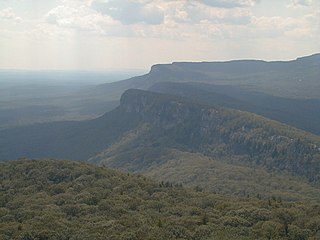
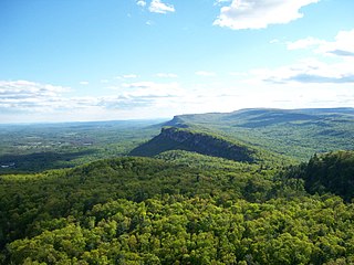
The Mohonk Preserve is a nature preserve in the Shawangunk Ridge, 90 miles (140 km) north of New York City in Ulster County, New York. The preserve has over 8,000 acres (32 km2) of cliffs, forests, fields, ponds and streams, with over 70 miles (110 km) of carriage roads and 40 miles (64 km) of trails for hiking, cycling, trail running, cross-country skiing, snowshoeing, and horseback riding. It is also a major destination for rock climbers, hosting 50,000 climbers each year who enjoy more than 1,000 climbing routes.

The Shawangunk Ridge, also known as the Shawangunk Mountains or The Gunks, is a ridge of bedrock in Ulster County, Sullivan County and Orange County in the state of New York, extending from the northernmost point of the border with New Jersey to the Catskills. The Shawangunk Ridge is a continuation of the long, easternmost section of the Appalachian Mountains; the ridge is known as Kittatinny Mountain in New Jersey, and as Blue Mountain as it continues through Pennsylvania. This ridge constitutes the western border of the Great Appalachian Valley.

New York State Route 104 (NY 104) is a 182.41-mile-long (293.56 km) east–west state highway in Upstate New York in the United States. It spans six counties and enters the vicinity of four cities—Niagara Falls, Lockport, Rochester, and Oswego—as it follows a routing largely parallel to the southern shoreline of Lake Ontario, along a ridge of the old shoreline of Glacial Lake Iroquois. The western terminus of NY 104 is an intersection with NY 384 in Niagara Falls, Niagara County, while its eastern terminus is a junction with NY 13 in the town of Williamstown, Oswego County. The portion of NY 104 between Rochester and the village of Webster east of the city is a limited-access highway known as the Keeler Street Expressway west of NY 590 and the Irondequoit–Wayne County Expressway east of NY 590; from Williamson to Oswego, NY 104 is a super two highway.

New York State Route 353 (NY 353) is a north–south state highway located within Cattaraugus County, New York, in the United States. It extends for 23.97 miles (38.58 km) from an intersection with NY 417 in the city of Salamanca to a junction with U.S. Route 62 (US 62) in the hamlet of Dayton. In between, the route traverses isolated and undeveloped areas of the county, save for the villages of Little Valley and Cattaraugus. In the latter, NY 353 intersects and briefly overlaps with NY 242.

New York State Route 242 (NY 242) is a state highway that runs across Cattaraugus County, New York, in the United States. Although signed as an east–west route, it takes a more northeast–southwest course across the county from NY 394 near the hamlet of Randolph in the town of Coldspring to NY 16 in Machias. The western end between Randolph and Little Valley was the western half of the short-lived New York State Route 17H. The eastern half of NY 17H was the southern end of NY 353 from Little Valley to Salamanca.
The High Peaks Wilderness Area, the largest Forest Preserve unit in the U.S. state of New York, is located in three counties and six towns in the Adirondack Park: Harrietstown in Franklin County, North Elba, Keene, North Hudson and Newcomb in Essex County and Long Lake in Hamilton County.

U.S. Route 219 (US 219) is a part of the U.S. Highway System that runs from Rich Creek, Virginia, to West Seneca, New York. In the U.S. state of New York, US 219 extends 67.63 miles (108.84 km) from the Pennsylvania state line at Carrollton to an interchange with the New York State Thruway at exit 55 in West Seneca, southeast of downtown Buffalo. In Cattaraugus County, the area surrounding US 219 is predominantly rural. However, in northern Cattaraugus County, US 219 becomes an expressway leading through Erie County and into the heart of Buffalo. The route serves the villages of Ellicottville and Springville, where it meets New York State Route 242 (NY 242) and NY 39, respectively, and indirectly serves Hamburg via NY 391.

Reinstein Woods Nature Preserve is located near the city of Buffalo in the Town of Cheektowaga in Erie County, New York, USA. Reinstein Woods Nature Preserve is a 292-acre (118 ha) forested complex that also includes wetlands and ponds, located within a developed suburban area. The nature preserve also features an environmental education center.

Halcott Mountain is one of the Catskill Mountains of the U.S. state of New York. It is mostly located in Greene County, with some of its lower slopes in Delaware and Ulster counties. Its exact summit elevation has not been officially determined, but the highest contour line on the mountain is 3,520 feet (1,070 m). It is one of the peaks on the divide between the Delaware and Hudson watersheds.

Deep Notch, sometimes West Kill Notch, or Echo Notch, is a mountain pass in Lexington, New York, United States. It divides two Catskill peaks, both subpeaks of high peaks of the range. The narrow groove between the steep, high slopes on either side is traversed by state highway NY 42 and the Shandaken Tunnel, part of the New York City water supply system. It has been called "striking" and "a marvel of grandeur and beauty".
Svend O. Heiberg Memorial Forest is a 3,800-acre (1,500-hectare) research forest located in parts of Onondaga and Cortland counties, and within the towns of Truxton, Preble, Fabius, and Tully in New York State. The forest is named after Svend O. Heiberg, former Associate Dean of Graduate Studies at the New York State College of Forestry at Syracuse University, in Syracuse, New York.
McCarty Hill is a mountain in the Southern Tier of New York. It is located in Cattaraugus County, mostly in Little Valley and Great Valley, with portions in Ellicottville and Mansfield. In 1940, an 82-foot-6-inch-tall (25.15 m) steel fire lookout tower was built on the mountain. The tower ceased fire lookout operations and then officially closed in early 1989. In 1993, the tower was dismantled and removed and replaced with a free-standing communications tower.

Rock Rift Fire Observation Tower, also known as the Rock Rift Fire Tower, is a historic fire observation station located in the Town of Tompkins, Delaware County, New York. The tower stands at the summit of Tower Mountain at an elevation of 2,376 ft (724 m) and rises above the Cannonsville Reservoir, part of New York City’s extensive water supply system. It was built in 1934 and listed on the National Register of Historic Places # 100003231 in 2018. The Rock Rift Fire Tower is also listed on the National Historic Lookout Register of the Forest Fire Lookout Association. Its listing numbers are US 1183, NY 41. The tower was transferred to the Town of Tompkins from New York State Department of Environmental Conservation in 2017. The land that the tower rests on is owned by New York City as part of their West of Hudson Watershed. The tower was decommissioned from active use in 1989.


